Old Maps of Winterset, Ohio for Academic Research
Study the evolution of Winterset with 14 high-resolution historic maps. Whether you're teaching, researching, or modeling changes in land use, these maps provide essential visual documentation of urban, environmental, and geographic change.
- Analyze long-term change: Track patterns in development, transportation, and natural features.
- Ideal for environmental or urban studies: Support academic projects with primary historical map data.
- Use in the classroom or lab: Educators and researchers rely on these maps to bring historical context to life.
These maps are a powerful tool for teaching, research, and visualizing how Winterset has changed over the decades.
Winterset, OH maps
(14)- 1909 Map of Antrim
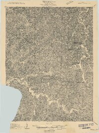 1909 Antrim1909 Print · USGSEastern Ohio at the turn of the century reveals a landscape of ridge-top farms and valley settlements centered around Antrim and Londonderry. Genealogists can trace family footprints across township lines to sites like Allen Chapel, Moccasin School, and Sewellsville.2 unique versions available
 - 1911 Map of Antrim
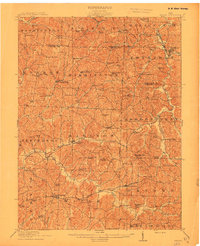 1911 Antrim1911 Print · USGSGuernsey County and parts of Harrison and Tuscarawas Counties appear here just after the first decade of the century, when the rural landscape was dotted with family-named schools and crossroads. Genealogists can trace the exact locations of vanished local landmarks like Moccasin School, Wesley Church, and the dual-named Winterset P.O. Winchester.3 unique versions available
 - 1951 Map of Canton
 1951 Canton1951 Print · USGSThe industrial heartland of Ohio and Pennsylvania reached its mid-century peak during this era of heavy rail and river transit. Genealogists and historians can trace the development of steel towns like Aliquippa and Weirton alongside the Ohio River and major lines of the Pennsylvania RR.
 - 1953 Map of Canton
 1953 Canton1953 Print · USGSThe industrial heartland of Ohio and Pennsylvania is captured at its mid-century peak in this detailed regional survey. Genealogists and historians can trace the vast rail networks of the Pennsylvania RR and find local landmarks like Nimisila Reservoir and Tappan Reservoir.
 - 1957 Map of Canton, 1971 Print
 1957 Canton1971 Print · USGSThe industrial heartland of eastern Ohio and western Pennsylvania comes alive in this mid-century survey of the Ohio River Valley. Trace the heritage of rail and river commerce through Pittsburgh, the massive steel towns along the Ohio River, and major junctions on the Pennsylvania RR.3 unique versions available
 - 1962 Map of Canton
 1962 Canton1962 Print · USGSThe industrial heartland of Eastern Ohio and Western Pennsylvania thrives in the early sixties as steel mills and rail lines dominate the river valleys. Genealogists and historians can trace local landmarks like McKinley National Memorial, Malone College, and industrial sites such as Republic Steel Corp.2 unique versions available
 - 1962 Map of Old Washington, 1963 Print
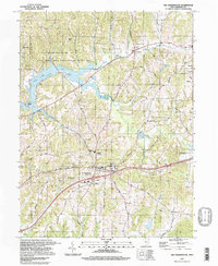
 1962 Old Washington1963 Print · USGSGuernsey County's rural landscape is captured here in the early sixties, as a massive PROPOSED highway begins to redraw the local geography. Researchers can find long-standing community landmarks like the Fairground, Winterset Cem, and the village of Old Washington.3 unique versions available
 - 1993 Map of Old Washington
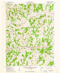
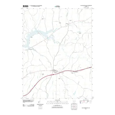
 1993 Old Washington1993 Print · USGSGuernsey County's rolling hills are shown in the early nineties, centered on the village of Old Washington and the newly developed corridors of Interstate 70. Genealogists and local historians can trace rural family sites near Winterset Cem, Madison Sch, and the old Zane Road.
 - 1994 Map of Old Washington, 1998 Print
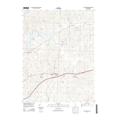
 1994 Old Washington1998 Print · USGSThe Guernsey County hills in the 1990s show a landscape of public recreation and rural industry near Old Washington. Researchers can trace old family lines through Winterset Cem, find the Brothers Aviation Landing Strip, or locate several Drill Hole sites.
 - 2010 Map of Old Washington, 2010 Print
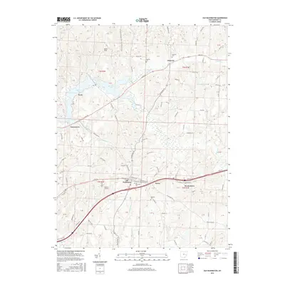
 2010 Old Washington2010 Print · USGSCovers Winterset, including Old Washington, Elizabethtown, and other nearby areas
 - 2013 Map of Old Washington, 2013 Print
 2013 Old Washington2013 Print · USGSCovers Winterset, including Old Washington, Elizabethtown, and other nearby areas
 - 2016 Map of Old Washington, 2016 Print
 2016 Old Washington2016 Print · USGSCovers Winterset, including Old Washington, Elizabethtown, and other nearby areas
 - 2019 Map of Old Washington, 2019 Print
 2019 Old Washington2019 Print · USGSCovers Winterset, including Old Washington, Elizabethtown, and other nearby areas
 - 2023 Map of Old Washington, 2023 Print
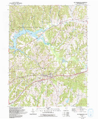
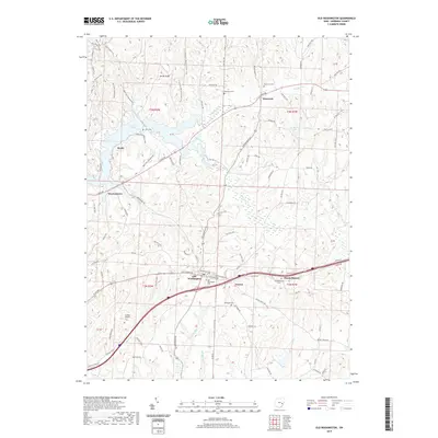
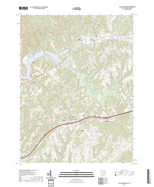 2023 Old Washington2023 Print · USGSGuernsey County's rolling landscape is captured here in the early twenty-first century, centered on the historic crossroads of Old Washington. Researchers can locate several lineage-rich burial grounds including Elizabeth Cem and McQuade Cem while tracing the varied shoreline of Salt Fork Lake.
End of results
Showing maps 1-14 of 14
Top cities near Winterset
- Cambridge historical maps
- Barnesville historical maps
- Newcomerstown historical maps
- Byesville historical maps
- Center historical maps
- Rush historical maps
See more
Frequently asked questions
- What are the different types of historical maps available for Winterset?
- What is the oldest map of Winterset?
- Where can I purchase historical maps of Winterset for my home or office?
- Where can I download high-res historical maps of Winterset?
- Are there historical topographic maps available for Winterset?
- Is there historical aerial imagery available for Winterset?
- Where are historical maps of Winterset sourced from?