Old Maps of English Woods, Cincinnati for Academic Research
Study the evolution of English Woods with 11 high-resolution historic maps. Whether you're teaching, researching, or modeling changes in land use, these maps provide essential visual documentation of urban, environmental, and geographic change.
- Analyze long-term change: Track patterns in development, transportation, and natural features.
- Ideal for environmental or urban studies: Support academic projects with primary historical map data.
- Use in the classroom or lab: Educators and researchers rely on these maps to bring historical context to life.
These maps are a powerful tool for teaching, research, and visualizing how English Woods has changed over the decades.
English Woods, Cincinnati maps
(11)- 1914 Map of West Cincinnati
 1914 West Cincinnati1914 Print · USGSCincinnati and the Ohio River valley appear here in a period of intense industrial growth and suburban expansion just before the First World War. Researchers can trace the dense rail networks of the Chesapeake and Ohio or locate early institutions like the Ohio Military Institute and Spring Grove Cemetery.4 unique versions available
 - 1953 Map of Cincinnati West, 1955 Print
 1953 Cincinnati West1955 Print · USGSThe western hills and industrial valleys of Cincinnati are captured here in the early fifties as neighborhoods expanded toward the county line. Researchers can locate specialized sites like the Clovernook Blind Home, trace rail lines through Ivorydale, or find family names at Wesleyan Cem.
 - 1953 Map of Cincinnati, 1965 Print
 1953 Cincinnati1965 Print · USGSThe Ohio River valley and the industrial heartland of Indiana and Ohio are captured here during the mid-century peak of rail and river commerce. Genealogists and historians can trace connections between Cincinnati and outlying military sites like Camp Atterbury and Bakalar AFB.3 unique versions available
 - 1957 Map of Cincinnati
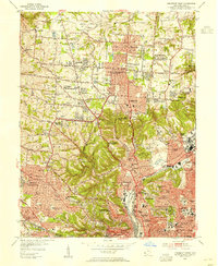
 1957 Cincinnati1957 Print · USGSThe Ohio River valley and its surrounding highlands thrived during the mid-fifties industrial peak, centered on the bustling Cincinnati and Dayton metropolitan hubs. Researchers can trace the extensive rail networks and military sites like Wright-Patterson AFB and Camp Atterbury.
 - 1961 Map of Cincinnati West, 1963 Print
 1961 Cincinnati West1963 Print · USGSGreater Cincinnati was rapidly expanding into northern Hamilton County in the early sixties as new subdivisions began to fill the valleys. Genealogists and historians can locate numerous landmarks like Arlington Memorial Gardens Cemetery, St Josephs Orphanage, and the grounds of McAuley High Sch.6 unique versions available
 - 1986 Map of Cincinnati
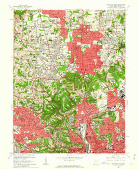
 1986 Cincinnati1986 Print · USGSGreater Cincinnati and its tri-state surrounds are captured here in the mid-eighties as suburban growth reached into the neighboring hills and river valleys. Researchers can trace the development of transit hubs like Greater Cincinnati International Airport and historic sites such as Spring Grove Cemetery.3 unique versions available
 - 2010 Map of Cincinnati West, 2010 Print
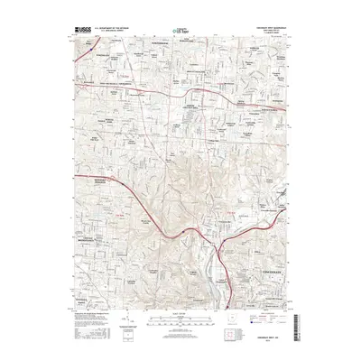
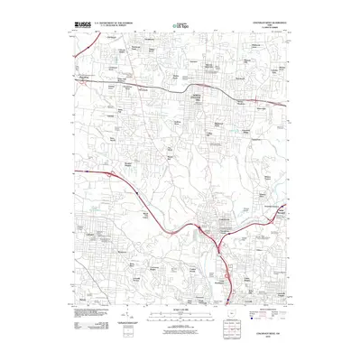 2010 Cincinnati West2010 Print · USGSCovers English Woods, including Cincinnati, North College Hill, and other nearby areas
 - 2013 Map of Cincinnati West, 2013 Print
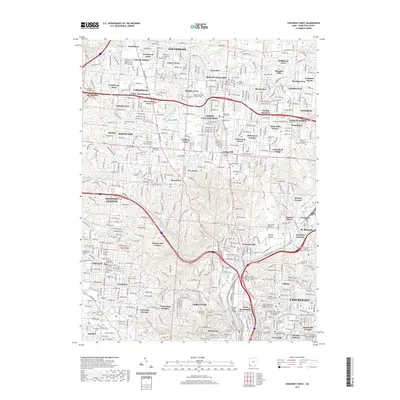
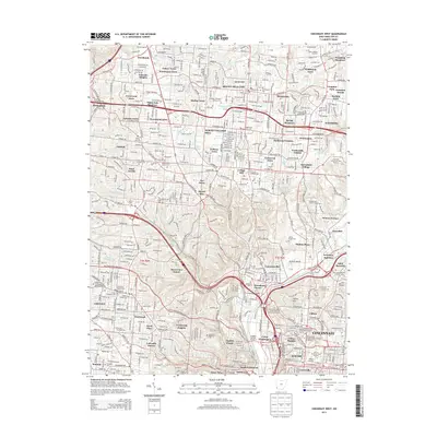 2013 Cincinnati West2013 Print · USGSCovers English Woods, including Cincinnati, North College Hill, and other nearby areas
 - 2016 Map of Cincinnati West, 2016 Print
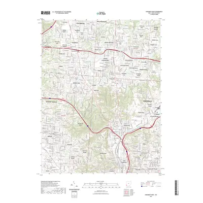
 2016 Cincinnati West2016 Print · USGSCovers English Woods, including Cincinnati, North College Hill, and other nearby areas
 - 2019 Map of Cincinnati West, 2019 Print
 2019 Cincinnati West2019 Print · USGSCovers English Woods, including Cincinnati, North College Hill, and other nearby areas
 - 2023 Map of Cincinnati West, 2023 Print
 2023 Cincinnati West2023 Print · USGSCincinnati and its northern suburbs are shown here in the 2020s, revealing a dense urban landscape of hospitals, universities, and parks. Genealogists can trace family plots at Spring Grove Cem and Arboretum or find landmarks like the University of Cincinnati.
End of results
Showing maps 1-11 of 11
Frequently asked questions
- What are the different types of historical maps available for English Woods?
- What is the oldest map of English Woods?
- Where can I purchase historical maps of English Woods for my home or office?
- Where can I download high-res historical maps of English Woods?
- Are there historical topographic maps available for English Woods?
- Is there historical aerial imagery available for English Woods?
- Where are historical maps of English Woods sourced from?