Old Maps of Arlington, Ohio
Explore 12 old maps of Arlington, spanning from 1905 to today. These high-resolution historic maps reveal how streets, neighborhoods, landmarks, and natural features evolved over time — perfect for genealogy, metal detecting, research, and local history exploration.
What you can do with these maps:
- See how Arlington changed over time: Compare historical maps to modern-day views to trace roads, homesites, rail lines & more.
- View detailed metadata: Each map includes creators, publishers, year, scale, and archive source.
- Overlay maps with satellite & LiDAR: Visualize the past alongside modern tools to explore terrain & human change.
- Trusted historical sources: Maps sourced from the USGS, Library of Congress, and other archives.
- Access maps your way: View online, download high-res files, or order prints for personal or research use.
Start exploring old maps of Arlington to uncover forgotten places, hidden landmarks, and the deep history beneath your feet.
Arlington, OH maps
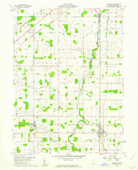
(12)- 1905 Map of Arlington, 1961 Print
 1905 Arlington1961 Print · USGSNorthwest Ohio at the turn of the century was a landscape of dense rail junctions and drainage-fed farmlands. You can trace the intersecting lines of the Northern Ohio RR and Ohio Central Lines at Arlington, or locate rural landmarks like Mt Moriah Church and the Treece School.
 - 1907 Map of Arlington
 1907 Arlington1907 Print · USGSNorthwestern Ohio's fertile landscape is captured here during the peak of its rail-and-river economy. Genealogists can trace family roots through local landmarks like North Washington PO, Jones School, and the Mt Olivet Church.2 unique versions available
 - 1950 Map of Marion
 1950 Marion1950 Print · USGSCentral Ohio was a powerhouse of rail and river industry at the mid-century point, serving as a vital corridor between the Great Lakes and the Ohio River valley. Genealogists and rail historians can trace the paths of the Erie RR and Nickel Plate Road through towns like Bucyrus, Galion, and Upper Sandusky.
 - 1960 Map of Arlington, 1961 Print
 1960 Arlington1961 Print · USGSSouthern Hancock County appears at the dawn of the 1960s as a thriving agricultural and energy-producing landscape. Researchers can trace the legacy of small-town Ohio through family cemeteries like Hartman Cem and the rail-side growth of Jenera and Arlington.4 unique versions available
 - 1962 Map of Marion
 1962 Marion1962 Print · USGSCentral Ohio during the post-war era showcases a dense network of railroad towns and emerging interstate highways. Genealogists can trace family roots in smaller settlements like Houcktown and Marseilles or locate landmarks near Indian Lake.
 - 1966 Map of Marion, 1968 Print
 1966 Marion1968 Print · USGSCentral Ohio in the mid-sixties is captured during a period of rapid highway expansion and industrial connectivity. Genealogists and historians can trace rail-and-river networks through towns like Marion, Urbana, and Mount Vernon, or locate landmarks such as Malabar Farm and Black Hand Rock.3 unique versions available
 - 1986 Map of Marion
 1986 Marion1986 Print · USGSNorthwest Ohio's agricultural and rail heartland is captured here in the mid-1980s, centered on the expansion of Marion and Kenton. Genealogists can trace family footprints near Bluffton College, old rail stops like Dola, and landmarks such as Indian Lake State Park.2 unique versions available
 - 2010 Map of Arlington, 2010 Print
 2010 Arlington2010 Print · USGSCovers Arlington, including Findlay, Jenera, and other nearby areas
 - 2013 Map of Arlington, 2013 Print
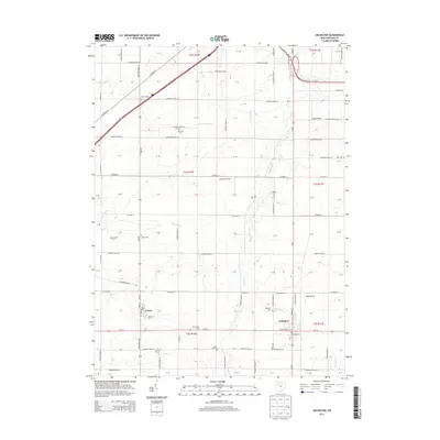 2013 Arlington2013 Print · USGSCovers Arlington, including Findlay, Jenera, and other nearby areas
 - 2016 Map of Arlington, 2016 Print
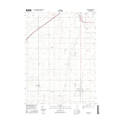 2016 Arlington2016 Print · USGSCovers Arlington, including Findlay, Jenera, and other nearby areas
 - 2019 Map of Arlington, 2019 Print
 2019 Arlington2019 Print · USGSCovers Arlington, including Findlay, Jenera, and other nearby areas
 - 2023 Map of Arlington, 2023 Print
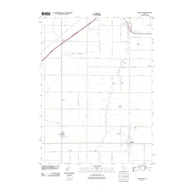
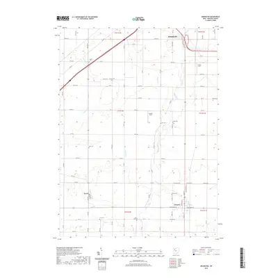
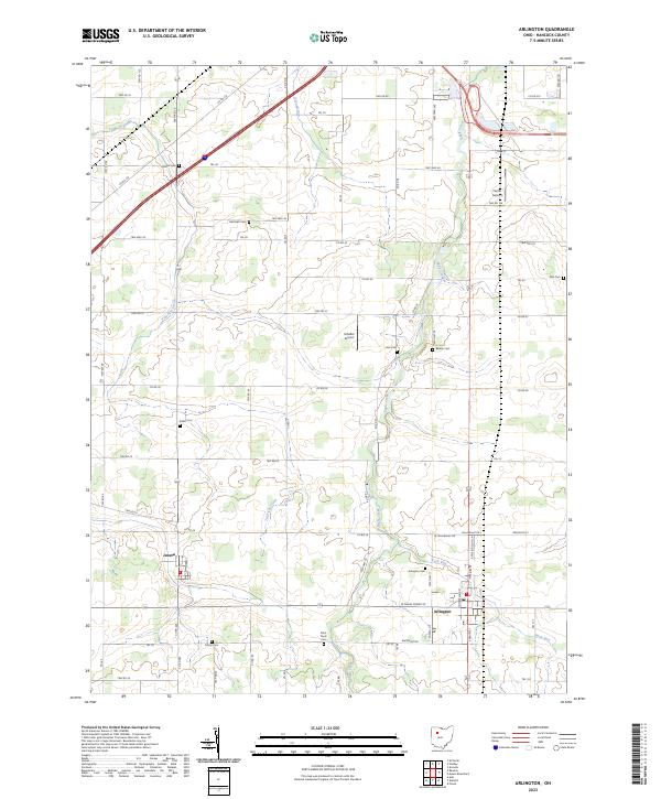 2023 Arlington2023 Print · USGSHancock County farmland is mapped here in the early twenty-first century, centered on the village of Arlington. Genealogists can locate several local burial grounds, including Trinity Cem, Saint Pauls Cem, and Bishop Cem along Eagle Creek.
End of results
Showing maps 1-12 of 12
Top cities near Arlington
- Findlay historical maps
- Ada historical maps
- Bluffton historical maps
- McComb historical maps
- Blanchard historical maps
- Forest historical maps
See more
Top neighborhoods of Arlington
Frequently asked questions
- What are the different types of historical maps available for Arlington?
- What is the oldest map of Arlington?
- Where can I purchase historical maps of Arlington for my home or office?
- Where can I download high-res historical maps of Arlington?
- Are there historical topographic maps available for Arlington?
- Is there historical aerial imagery available for Arlington?
- Where are historical maps of Arlington sourced from?