Old Maps of Hardin County, Ohio for Hiking & Exploration
Hike through history with 104 historic maps of Hardin County. Explore old trails, ghost towns, and forgotten backroads — perfect for outdoor adventurers and local explorers.
- Rediscover forgotten places: Map out old mining camps, roads, and footpaths that no longer exist on modern maps.
- Layer with modern tools: Combine with LiDAR or satellite views to plan hikes through historical terrain.
- Made for exploration: Popular among hikers, overlanders, and local history lovers.
Use these maps to find adventure and explore the hidden past of Hardin County.
Hardin County, OH maps
(104)- 1905 Map of Arlington, 1961 Print
 1905 Arlington1961 Print · USGSNorthwest Ohio at the turn of the century was a landscape of dense rail junctions and drainage-fed farmlands. You can trace the intersecting lines of the Northern Ohio RR and Ohio Central Lines at Arlington, or locate rural landmarks like Mt Moriah Church and the Treece School.
 - 1907 Map of Bluffton
 1907 Bluffton1907 Print · USGSNorthwestern Ohio at the height of the steam and electric rail era shows a landscape of growing college towns and productive farmland. Trace the intersection of the Ohio Northern RR and Lake Erie and Western RR, or find vanished community hubs like Lafayette Herring PO and the Hillsville School.3 unique versions available
 - 1907 Map of Arlington
 1907 Arlington1907 Print · USGSNorthwestern Ohio's fertile landscape is captured here during the peak of its rail-and-river economy. Genealogists can trace family roots through local landmarks like North Washington PO, Jones School, and the Mt Olivet Church.2 unique versions available
 - 1907 Map of Upper Sandusky, 1943 Print
 1907 Upper Sandusky1943 Print · USGSWyandot County at the dawn of the twentieth century was a landscape of thriving rail junctions and dispersed rural school districts. Genealogists and local historians can trace the exact locations of family landmarks like Grace Chapel, the Indian Mill, and numerous rural schools from Moody School to Hendricks School 24.
 - 1913 Map of Alger
 1913 Alger1913 Print · USGSWestern Ohio's agricultural heartland is documented here just before the Great War, showing a landscape shaped by drainage ditches and rail lines. Locate family landmarks like the Bee Hive School, Mt Zion Church, and the vanished stops along the Chicago & Erie Railroad.2 unique versions available
 - 1915 Map of Alger
 1915 Alger1915 Print · USGSNorthwest Ohio's agricultural and rail heartland is captured here just before the First World War. Genealogists can locate family homesteads near dozens of early rural schoolhouses like Kingsley School and trace the paths of the ERIE RR and LAKEVIEW ELECTRIC ROAD.4 unique versions available
 - 1915 Map of Kenton, 1942 Print
 1915 Kenton1942 Print · USGSHardin County at the dawn of the motorized age shows a landscape deeply connected by competing rail lines and rural school districts. Genealogists and historians can trace family roots at dozens of named schoolhouses like Henpeck and Brush College, or locate vanished stops along the Toledo and Ohio Central Railroad.
 - 1915 Map of La Rue, 1944 Print
 1915 La Rue1944 Print · USGSRailroad hubs and rural school districts define the landscape of Marion and Wyandot Counties in the years before the Great War. Genealogists can trace family roots through numerous local landmarks like York Street School, the village of La Rue, and the Scioto Military Land.
 - 1943 Map of Alger
 1943 Alger1943 Print · USGSDuring the early 1940s, this pocket of Ohio was a landscape of rail-fed villages and drainage ditches. Trace family roots across a grid of rural schools like Sugarfree Sch, follow the Erie RR through Alger, or explore the shores of Indian Lake.
 - 1944 Map of Kenton
 1944 Kenton1944 Print · USGSHardin County was a thriving agricultural and railroad hub in the 1940s, centered on the busy junction at Kenton. Researchers can locate dozens of country schools like Brush College and trace the legacy of the Virginia Military Land near Silver Creek.
 - 1950 Map of Marion
 1950 Marion1950 Print · USGSCentral Ohio was a powerhouse of rail and river industry at the mid-century point, serving as a vital corridor between the Great Lakes and the Ohio River valley. Genealogists and rail historians can trace the paths of the Erie RR and Nickel Plate Road through towns like Bucyrus, Galion, and Upper Sandusky.
 - 1960 Map of Roundhead, 1962 Print
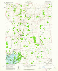 1960 Roundhead1962 Print · USGSThe northern shores of Indian Lake were coming into their own as a recreation destination in the early sixties. Researchers can trace the legacy of family farms and vanished crossroads through McArthur Cem, the tracks of the New York Central, and the village of Roundhead.3 unique versions available
 - 1960 Map of Marseilles, 1962 Print
 1960 Marseilles1962 Print · USGSThe rural borderlands of Wyandot and Hardin counties are mapped here in the early sixties, centered on the riverside village of Marseilles. Genealogists can trace family names through numerous rural sites like Stansbery Cem, York Street Ch, and the Old Indian Treaty Bdy.4 unique versions available
 - 1960 Map of Silver Creek, 1962 Print
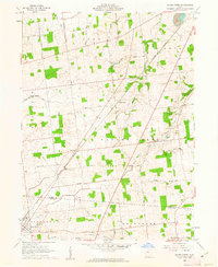 1960 Silver Creek1962 Print · USGSHardin and Logan Counties are captured in the early sixties as rural townships and rail-connected villages define the landscape. Researchers can trace family history through local sites like Sloan-Yelverton Cem, the New York Central rail line, and the village of Belle Center.2 unique versions available
 - 1961 Map of Foraker, 1962 Print
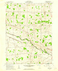 1961 Foraker1962 Print · USGSHardin County in the early sixties reveals a landscape shaped by the historical boundary of the Virginia Military District. Genealogists and historians can trace family-named sites like Smith Cem and landmarks such as the Friendship Grange Hall and Foraker.2 unique versions available
 - 1961 Map of Alger, 1962 Print
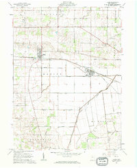 1961 Alger1962 Print · USGSNorthwestern Hardin County thrived as a rail and drainage hub in the early sixties. Genealogists can trace family names at Carman Cem and Preston Cem or locate old community centers like Quickstep Ch and the village of McGuffey.2 unique versions available
 - 1961 Map of Waynesfield, 1962 Print
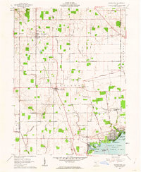 1961 Waynesfield1962 Print · USGSAuglaize County farming life and the northern recreation shores of Indian Lake are captured here during the early sixties. Researchers can trace historic property divisions along the Old Indian Treaty Boundary and locate family burial sites like Willow Branch Cem or the village of New Hampshire.3 unique versions available
 - 1961 Map of Mt Victory, 1962 Print
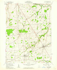 1961 Mt Victory1962 Print · USGSNorthern Ohio agriculture and rail life converge in the early sixties near the Hardin and Logan county line. Genealogists can trace family names and local landmarks like Ridgeway Cem, the Amish Sch, and the New York Central rail line.2 unique versions available
 - 1961 Map of Forest, 1962 Print
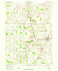 1961 Forest1962 Print · USGSHardin County agriculture and rail industry intersect in the early sixties at the junction of two major lines. Researchers can trace family history through the numerous rural burial sites and churches like Earlywine Cem, Union Chapel, and Patterson Cem.2 unique versions available
 - 1961 Map of Dunkirk, 1962 Print
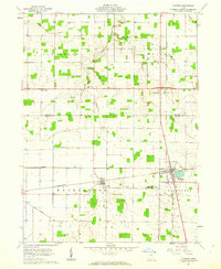 1961 Dunkirk1962 Print · USGSIn the early 1960s, the border of Hancock and Hardin counties functioned as a busy rail crossroads and agricultural center. Local historians can trace the junction of the Pennsylvania and New York Central railroads at Dunkirk, alongside rural anchors like Hardin Northern Sch and Dola.2 unique versions available
 - 1961 Map of Ada, 1962 Print
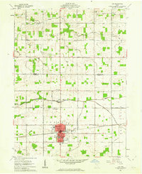 1961 Ada1962 Print · USGSThe village of Ada and the campus of Ohio Northern University appear here in the early sixties as a center of education and rail transport. Researchers can trace family plots at McClure Cem and Thompson Cem or locate old rural landmarks like Liberty Chapel.2 unique versions available
 - 1961 Map of La Rue, 1962 Print
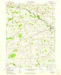 1961 La Rue1962 Print · USGSIn the early 1960s, this pocket of Marion and Hardin counties was a crossroads of the Erie-Lackawanna and New York Central railroads. Genealogists can locate numerous family burial grounds including Bonner Cem and Virden Cem, or trace the path of the Scioto River through La Rue.2 unique versions available
 - 1961 Map of Beaverdam, 1963 Print
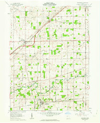 1961 Beaverdam1963 Print · USGSBeaverdam and Lafayette serve as local hubs in this 1960s survey of western Ohio's rail and river country. Researchers can trace rural lineages through numerous sites like Gratz Cem, Woodland Cem, and Liberty Chapel along the Ottawa River.3 unique versions available
 - 1961 Map of Kenton, 1963 Print
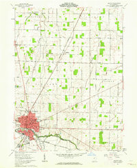 1961 Kenton1963 Print · USGSHardin County during the early 1960s serves as a vital rail and river crossing for the Ohio heartland. Genealogists and local historians can trace family-named roads and rural institutions like St Marys Cem, Hardin Sch, and the Grant (Grants Sta) rail stop.3 unique versions available
 - 1961 Map of Harrod, 1963 Print
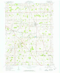 1961 Harrod1963 Print · USGSThe rural landscape of Allen and Auglaize Counties in the early sixties centers on the ERIE LACKAWANNA rail line and the Auglaize River. Genealogists can trace family footprints across dozens of local sites, including Harrod, West Newton, and Salem Cem.2 unique versions available
Showing maps 1-25 of 104
Top cities of Hardin County
Frequently asked questions
- What are the different types of historical maps available for Hardin County?
- What is the oldest map of Hardin County?
- Where can I purchase historical maps of Hardin County for my home or office?
- Where can I download high-res historical maps of Hardin County?
- Are there historical topographic maps available for Hardin County?
- Is there historical aerial imagery available for Hardin County?
- Where are historical maps of Hardin County sourced from?