2020s Maps of Henry County, Ohio
Explore 10 historic maps of Henry County from the 2020s. These maps offer a rare glimpse into what life looked like during the 2020s — showing old roads, neighborhoods, homes, and landmarks that have changed or disappeared over time.
Whether you're researching your family's past, planning a metal detecting trip, or studying how Henry County's landscape evolved across the 2020s, these high-resolution maps are a powerful tool for exploring the history of this region.
- Focus on a specific era: All maps on this page are from the 2020s, giving you a focused view of this time period.
- See what’s changed: Compare century-old streets, trails, and buildings to today's modern landscape using overlays and satellite layers.
- Research with precision: Use these maps for genealogy, historical research, land use analysis, or educational projects.
- View, download, or print: Maps are fully viewable online in high resolution, and can be downloaded or printed for your own records.
Start exploring Henry County's history through authentic maps from the 2020s. This is your window into the past.
Henry County, OH maps
(10)- 2023 Map of Napoleon West, 2023 Print
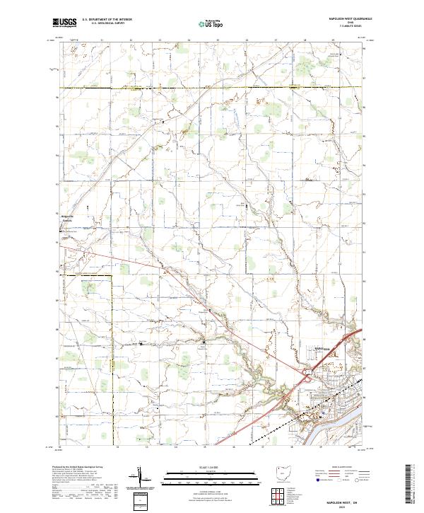 2023 Napoleon West2023 Print · USGSHenry County is showcased in this modern survey of the agricultural heartland near the Maumee River. Genealogists can trace family roots through numerous rural landmarks like Zion Lutheran Cem, Union Chapel Cem, and the village of Ridgeville Corners.
 - 2023 Map of Florida, 2023 Print
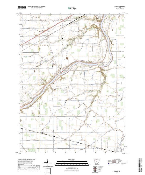 2023 Florida2023 Print · USGSThe riverfront communities and agricultural townships of Henry County are documented here in the early twenty-first century. Family historians can trace ancestral roots through numerous local burial grounds like Florida Cem, Brey Cem, and Parry Cem.
 - 2023 Map of Deshler, 2023 Print
 2023 Deshler2023 Print · USGSNorthwestern Ohio's agricultural landscape is documented here in the early twenty-first century, showing the village of Deshler and its surrounding townships. Genealogists and local researchers can locate Woodlawn Cem and Belmore, while tracing the paths of Brush Creek and Hammer Creek.
 - 2023 Map of Hamler, 2023 Print
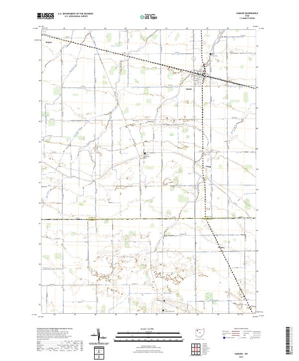 2023 Hamler2023 Print · USGSThe crossroads and drainage ditches of Henry and Putnam counties appear in high detail during the early 2020s. Genealogists and historians can trace family plots at Saint Pauls Cem and Old South Center Cem or locate the quiet corners of Gallup and Prentiss.
 - 2023 Map of New Bavaria, 2023 Print
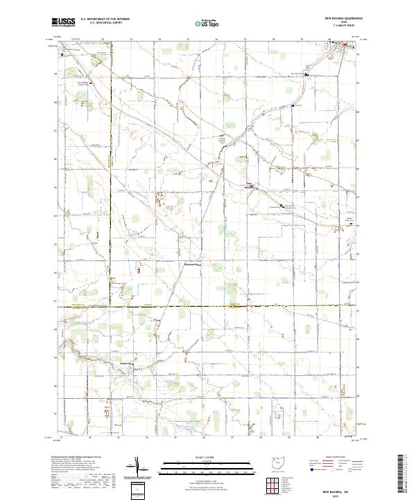 2023 New Bavaria2023 Print · USGSIn the northwestern Ohio countryside, this modern survey documents the ancestral German settlements of Henry and Defiance counties. Researchers can trace family history through a remarkable number of local burial sites, including Saint Marys Cem, Emanuels Cem, and Sacred Heart Cem.
 - 2023 Map of McClure, 2023 Print
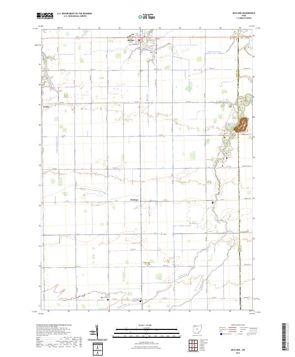 2023 McClure2023 Print · USGSNorthern Ohio farming country is shown here in the 2020s, centered on the historic village of McClure. Researchers can trace local burial sites like Saint Johns Lutheran Cem and Angel Cem along the winding banks of Beaver Creek.
 - 2023 Map of Colton, 2023 Print
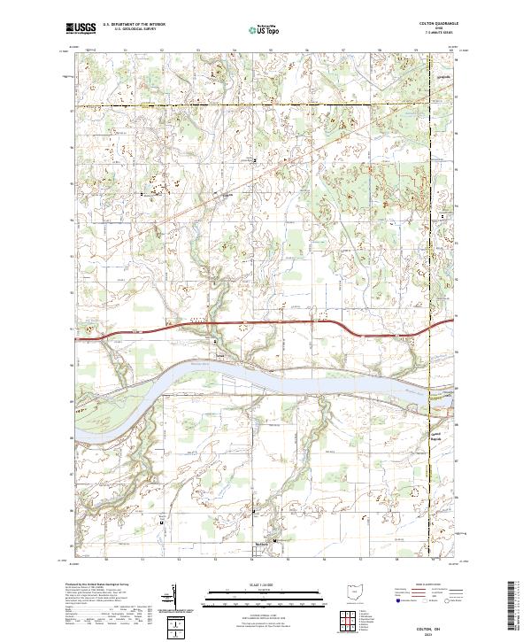 2023 Colton2023 Print · USGSThe Maumee River valley in Northwest Ohio comes alive in this survey, showing the historic river towns and the expansive drainage network of the former Black Swamp. Genealogists and hikers can trace the North Country National Scenic Trl or locate family plots at Heath Colton Cem and Mount Pleasant Cem.
 - 2023 Map of Napoleon East, 2023 Print
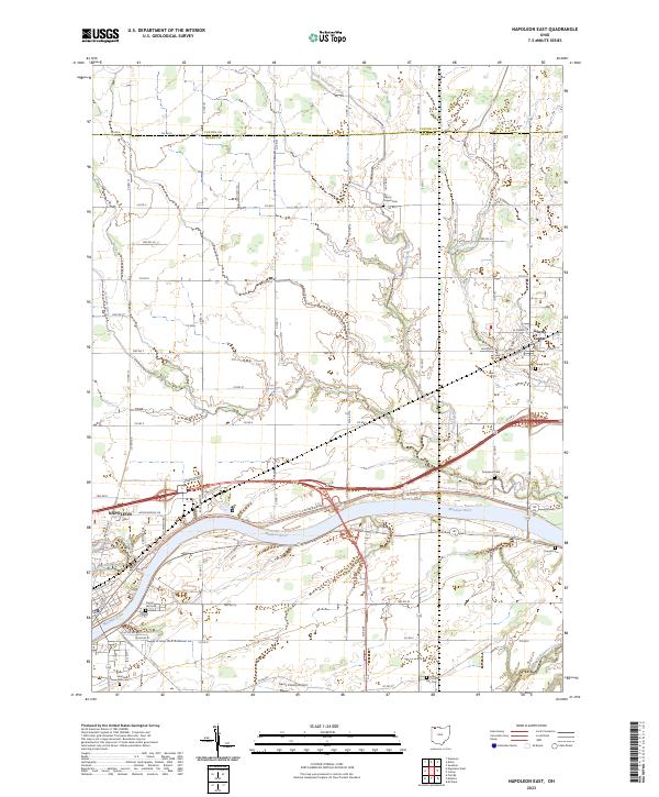 2023 Napoleon East2023 Print · USGSHenry County and the Maumee River valley are shown in contemporary detail as the landscape balances its agricultural roots with modern development. Researchers can trace family sites at Damascus Cem and Young Cem or follow the path of North Turkeyfoot Creek through Liberty Center.
 - 2023 Map of Ridgeville Corners, 2023 Print
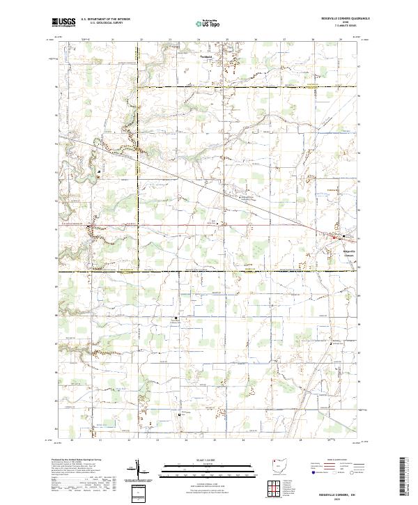 2023 Ridgeville Corners2023 Print · USGSThis part of Northwest Ohio is captured in the early 2020s as a landscape of intersection between four counties and a network of traditional farmsteads. Genealogists can trace several local burying grounds like Bethlehem Lutheran Cem and Domersville Cem near Ridgeville Corners.
 - 2023 Map of Malinta, 2023 Print
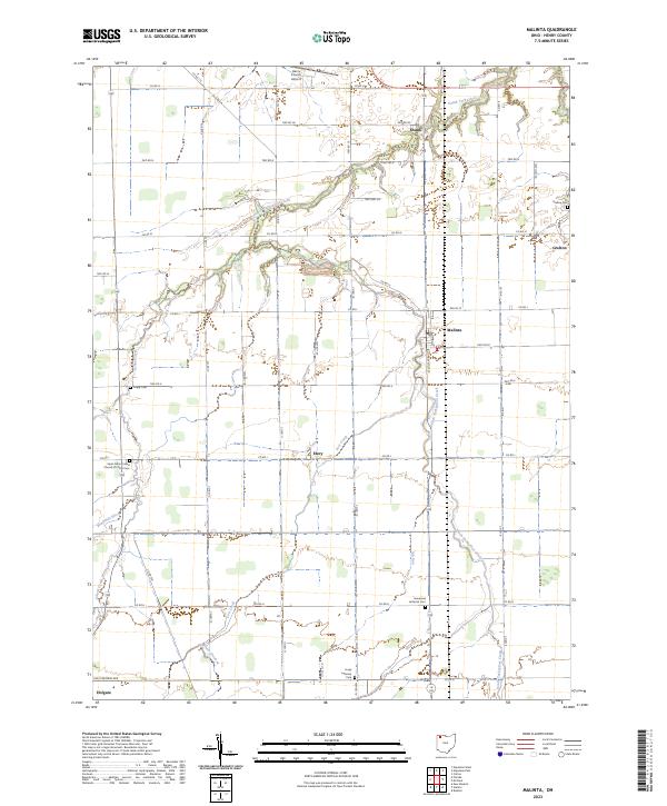 2023 Malinta2023 Print · USGSHenry County remains a quintessential Northwest Ohio landscape of crossroads hamlets and family farmsteads in the twenty-first century. Genealogists and local historians can trace rural roots at sites like Grelton Cem or follow the waters of South Turkeyfoot Creek through Malinta.
End of results
Showing maps 1-10 of 10
Top cities of Henry County
Frequently asked questions
- What are the different types of historical maps available for Henry County?
- What is the oldest map of Henry County?
- Where can I purchase historical maps of Henry County for my home or office?
- Where can I download high-res historical maps of Henry County?
- Are there historical topographic maps available for Henry County?
- Is there historical aerial imagery available for Henry County?
- Where are historical maps of Henry County sourced from?