2020s Maps of Liberty Center, Liberty Township
Explore 2 historic maps of Liberty Center from the 2020s. These maps offer a rare glimpse into what life looked like during the 2020s — showing old roads, neighborhoods, homes, and landmarks that have changed or disappeared over time.
Whether you're researching your family's past, planning a metal detecting trip, or studying how Liberty Center's landscape evolved across the 2020s, these high-resolution maps are a powerful tool for exploring the history of this region.
- Focus on a specific era: All maps on this page are from the 2020s, giving you a focused view of this time period.
- See what’s changed: Compare century-old streets, trails, and buildings to today's modern landscape using overlays and satellite layers.
- Research with precision: Use these maps for genealogy, historical research, land use analysis, or educational projects.
- View, download, or print: Maps are fully viewable online in high resolution, and can be downloaded or printed for your own records.
Start exploring Liberty Center's history through authentic maps from the 2020s. This is your window into the past.
Liberty Center, Liberty Township maps
(2)- 2023 Map of Colton, 2023 Print
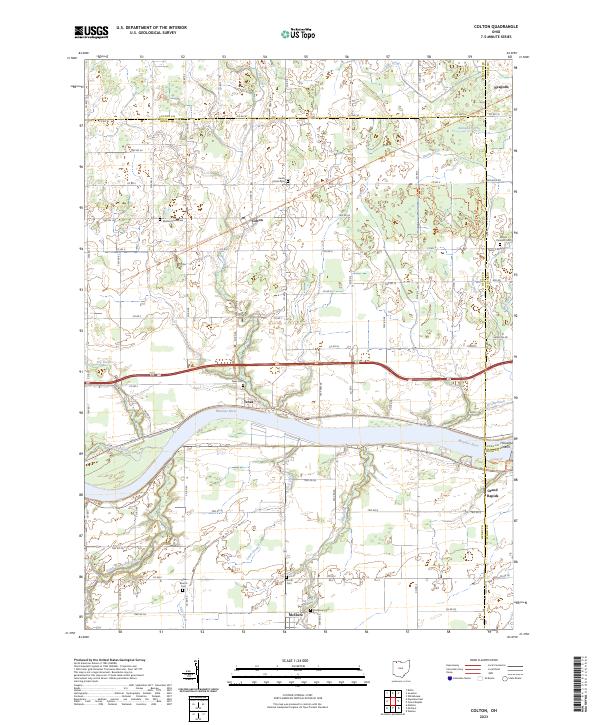 2023 Colton2023 Print · USGSThe Maumee River valley in Northwest Ohio comes alive in this survey, showing the historic river towns and the expansive drainage network of the former Black Swamp. Genealogists and hikers can trace the North Country National Scenic Trl or locate family plots at Heath Colton Cem and Mount Pleasant Cem.
 - 2023 Map of Napoleon East, 2023 Print
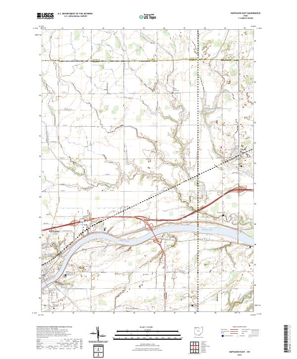 2023 Napoleon East2023 Print · USGSHenry County and the Maumee River valley are shown in contemporary detail as the landscape balances its agricultural roots with modern development. Researchers can trace family sites at Damascus Cem and Young Cem or follow the path of North Turkeyfoot Creek through Liberty Center.
End of results
Showing maps 1-2 of 2
Top cities near Liberty Center
- Napoleon historical maps
- Wauseon historical maps
- Providence historical maps
- Swanton historical maps
- Whitehouse historical maps
- Delta historical maps
See more
Frequently asked questions
- What are the different types of historical maps available for Liberty Center?
- What is the oldest map of Liberty Center?
- Where can I purchase historical maps of Liberty Center for my home or office?
- Where can I download high-res historical maps of Liberty Center?
- Are there historical topographic maps available for Liberty Center?
- Is there historical aerial imagery available for Liberty Center?
- Where are historical maps of Liberty Center sourced from?