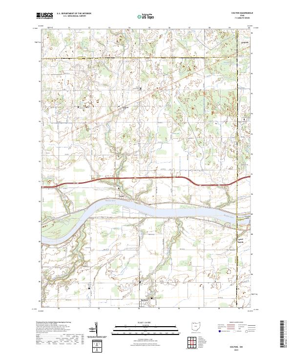
2023 Map of Colton
USGS Topo · Published 2023About this map
The Maumee River serves as the central geographic axis for this region of Northwest Ohio, defining the boundaries between Henry, Lucas, and Wood Counties. Along its banks, the settlement of Texas and the village of Grand Rapids reflect the river-oriented development of the area, while inland towns like Colton, McClure, and Neapolis mark the transition into the productive agricultural landscape. The terrain is crisscrossed by an extensive network of drainage ditches such as Aumend Ditch and Harris Ditch, essential for managing the flat plains once part of the Great Black Swamp.
Find a feature on this map
86 named features on this map. Tap any name to fly to it.
Don’t see what you’re looking for? This feature index may not catch every label — zoom into the map to look around manually.
Map Details
Editions of this 2023 Colton Map
This is the sole edition of this map. No revisions or reprints were ever made.
Other maps of this area

1908 · Napoleon
USGS Topo · 1:62,500

1909 · Mc Clure
USGS Topo · 1:62,500

1911 · Wauseon
USGS Topo · 1:62,500

1911 · Swanton
USGS Topo · 1:62,500

1913 · Wauseon
USGS Topo · 1:62,500

1914 · Swanton
USGS Topo · 1:62,500

1935 · Grand Rapids
USGS Topo · 1:24,000

1935 · Whitehouse
USGS Topo · 1:24,000
1940 · Whitehouse
USGS Topo · 1:31,680

1940 · Grand Rapids
USGS Topo · 1:31,680