
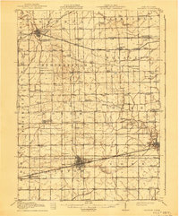
1913 Map of Wauseon
USGS Topo · Published 1913About this map
Wauseon serves as the central hub for this early twentieth-century survey, revealing a landscape defined by the intersection of major rail lines and a dense network of rural school districts. The Lake Shore and Michigan Southern RR and the Wabash RR cut through the southern townships, while the Toledo and Western Electric Railway connects northern settlements like Morenci and Lyons. This era shows the transition from post office-centric communities like Tedrow PO to more established railroad towns.
Find a feature on this map
84 named features on this map. Tap any name to fly to it.
Don’t see what you’re looking for? This feature index may not catch every label — zoom into the map to look around manually.
Map Details
Editions of this 1913 Wauseon Map
2 editions found
Other maps of this area

1907 · Defiance
USGS Topo · 1:62,500

1908 · Napoleon
USGS Topo · 1:62,500

1909 · Mc Clure
USGS Topo · 1:62,500

1909 · Defiance
USGS Topo · 1:62,500

1911 · Wauseon
USGS Topo · 1:62,500

1911 · Swanton
USGS Topo · 1:62,500

1913 · Alvordton
USGS Topo · 1:62,500

1914 · Swanton
USGS Topo · 1:62,500

1939 · Blissfield
USGS Topo · 1:62,500

1941 · Blissfield
USGS Topo · 1:62,500