
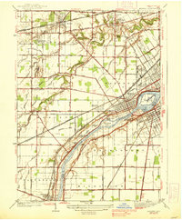
1935 Map of Grand Rapids
USGS Topo · Published 1935About this map
The Maumee River corridor south of Toledo Welfare Farm reveals a complex 1930s landscape of hydraulic engineering and river-based industry. Near the settlement of Grand Rapids, the presence of the Lucas Wood Co Canal (Abandoned) and a Filled Mill suggests a shift away from earlier water-powered milling toward more modern infrastructure, like the Edison Co Transmission Line. The river is dotted with numerous islands, including Missionary Island and Indian Island, while the Ottawa Twelvemile Reservation reflects the layered history of land use in Wood County.
Find a feature on this map
81 named features on this map. Tap any name to fly to it.
Don’t see what you’re looking for? This feature index may not catch every label — zoom into the map to look around manually.
Map Details
Editions of this 1935 Grand Rapids Map
This is the sole edition of this map. No revisions or reprints were ever made.
Other maps of this area

1900 · Toledo
USGS Topo · 1:62,500

1901 · Bowling Green
USGS Topo · 1:62,500

1903 · Bowling Green
USGS Topo · 1:62,500

1909 · Mc Clure
USGS Topo · 1:62,500

1911 · Swanton
USGS Topo · 1:62,500

1914 · Swanton
USGS Topo · 1:62,500

1935 · Whitehouse
USGS Topo · 1:24,000

1935 · Maumee
USGS Topo · 1:24,000
1938 · Maumee
USGS Topo · 1:31,680
1938 · Tontogany
USGS Topo · 1:31,680