Old Maps of Waterville, Ohio
Explore 47 old maps of Waterville, spanning from 1900 to today. These high-resolution historic maps reveal how streets, neighborhoods, landmarks, and natural features evolved over time — perfect for genealogy, metal detecting, research, and local history exploration.
What you can do with these maps:
- See how Waterville changed over time: Compare historical maps to modern-day views to trace roads, homesites, rail lines & more.
- View detailed metadata: Each map includes creators, publishers, year, scale, and archive source.
- Overlay maps with satellite & LiDAR: Visualize the past alongside modern tools to explore terrain & human change.
- Trusted historical sources: Maps sourced from the USGS, Library of Congress, and other archives.
- Access maps your way: View online, download high-res files, or order prints for personal or research use.
Start exploring old maps of Waterville to uncover forgotten places, hidden landmarks, and the deep history beneath your feet.
Waterville, OH maps
(47)- 1900 Map of Toledo, 1932 Print
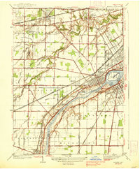
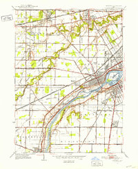
 1900 Toledo1932 Print · USGSToledo and the lower Maumee River valley are shown at the height of the railroad era, as the city expanded into an industrial powerhouse. Researchers can trace early infrastructure like the Michigan Division Canal and locate historic sites like the Toledo Insane Asylum or the Oil Wells near Lime City.
 - 1901 Map of Bowling Green, 1958 Print
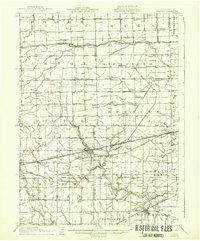
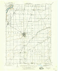 1901 Bowling Green1958 Print · USGSWood County at the turn of the century is a hub of steam and rail traffic centered on the growing seat of Bowling Green. Researchers can trace old family sites and rural settlements like Hull Prairie, Tontogany, and Jerry City across a landscape of early railroad lines.
 - 1903 Map of Bowling Green
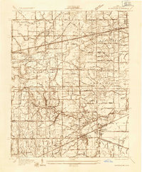
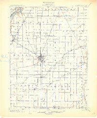 1903 Bowling Green1903 Print · USGSWood County at the turn of the century is a dense web of steam railroads and electric interurban lines connecting agricultural hubs. Researchers can trace the path of the Miami and Erie Canal or locate small settlements like Sugar Ridge, Tontogany, and Jerry City.3 unique versions available
 - 1909 Map of Mc Clure, 1936 Print
 1909 Mc Clure1936 Print · USGSNorthwest Ohio's agricultural and transit heartland is captured here at the start of the twentieth century. Genealogists and rail historians can trace the paths of the Wabash RR and the Electric Detroit and Toledo Line as they connected towns like Mc Clure and Weston.2 unique versions available
 - 1911 Map of Swanton, 1956 Print
 1911 Swanton1956 Print · USGSNorthwest Ohio and the Michigan border are captured here just before the era of major highway expansion. Genealogists can trace early twentieth-century property locations near Metamora, Raab Corners, and numerous rural schoolhouses like Frogpond School.
 - 1914 Map of Swanton, 1937 Print
 1914 Swanton1937 Print · USGSThe Ohio-Michigan borderlands come alive in this era of peak rail transit and rural schoolhouse density. Genealogists and historians can trace family roots through numerous local landmarks like Metamora, Richfield Center, and uniquely named sites such as Huckleberry School or Frogpond School.
 - 1935 Map of Grand Rapids
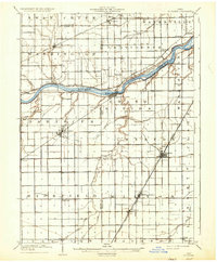
 1935 Grand Rapids1935 Print · USGSLucas and Wood counties during the mid-1930s display a landscape defined by the winding Maumee River and its industrial history. Genealogists and historians can trace the foundations of local communities at St Patrick Cem, Nazareth Hall, and the Lucas Wood Co Canal.
 - 1935 Map of Whitehouse
 1935 Whitehouse1935 Print · USGSWestern Lucas County was a landscape of intricate drainage ditches and rail corridors in the mid-1930s. Researchers can trace the path of the Toledo and Indiana (Electric) line or locate family sites at Weckerly Cemetery and Roberts Chapel.
 - 1935 Map of Maumee
 1935 Maumee1935 Print · USGSThe Maumee River valley is shown in the mid-1930s, just as electric railways and state highways began to reshape the old river towns. Genealogists and researchers can locate Springfield Chapel, trace the Cincinnati and Lake Erie line, or find the Hulls Crossing Mill.
 - 1938 Map of Maumee
 1938 Maumee1938 Print · USGSThe riverfront communities of Northwest Ohio thrive during the mid-1930s as rail and road networks begin to overtake the old canal system. Researchers can trace the legacy of the Miami and Erie Canal and explore historical sites like Fort Meigs and Fallen Timber State Park.2 unique versions available
 - 1938 Map of Tontogany
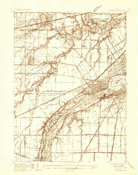
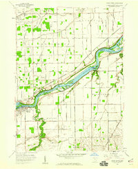
 1938 Tontogany1938 Print · USGSThe Maumee River corridor in the late thirties is captured here at a major rail and road junction. Local historians can trace the early industrial footprint of Waterville and the Waterville Quarry, or locate river landmarks like Roche de Boeuf.2 unique versions available
 - 1940 Map of Whitehouse
 1940 Whitehouse1940 Print · USGSLucas County and the village of Whitehouse are shown here in the mid-1930s as a vital railroad crossroads. Researchers can trace the layout of early schools and cemeteries like Bordner Sch and the Whitehouse Cem, or locate the historic Airway Beacon.2 unique versions available
 - 1940 Map of Grand Rapids
 1940 Grand Rapids1940 Print · USGSThe riverfront and rail lines of Wood and Lucas Counties are captured here in the years before WWII. Genealogists and historians can trace the Napoleon Canal, locate Salem Ch, and follow the Twelvemile Reservation Boundary near Grand Rapids.2 unique versions available
 - 1951 Map of Maumee, 1952 Print
 1951 Maumee1952 Print · USGSIn the early 1950s, the Maumee River valley was a corridor of burgeoning industry and deep frontier history. Researchers can trace military sites like Fort Meigs and Fort Miami, alongside local landmarks such as Turkey Foot Rock and Springfield Chapel.2 unique versions available
 - 1951 Map of Whitehouse, 1952 Print
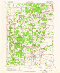
 1951 Whitehouse1952 Print · USGSLucas County during the early fifties reveals a landscape of organized agriculture and rail-side hamlets. Genealogists and local historians can trace family land near Whitehouse, locate the Whitehouse Cemetery, and see the early layout of Monclova and Crissey.
 - 1952 Map of Tontogany, 1953 Print
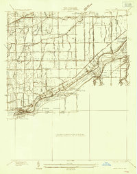
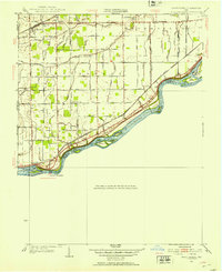
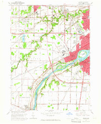
 1952 Tontogany1953 Print · USGSThe riverfront town of Waterville is captured here in the early fifties, situated along a prominent stretch of the Maumee. Local historians can trace the paths of the New York Chicago and St Louis railroad and landmarks like Roche de Boeuf and Missionary Island.
 - 1952 Map of Grand Rapids, 1953 Print
 1952 Grand Rapids1953 Print · USGSThe Maumee River valley comes alive in the early 1950s, showing a landscape shaped by river transport and deep-rooted agricultural townships. Researchers can find precise locations for Neapolis, Providence Church, and the unique Toledo Welfare Farm.
 - 1956 Map of Toledo, 1968 Print
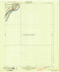
 1956 Toledo1968 Print · USGSNorthwest Ohio and the Lake Erie shoreline are shown in detail during the late fifties, showcasing a landscape of heavy industry, railroads, and island communities. Genealogists and historians can trace rail networks like the Chesapeake & Ohio RR or locate landmarks such as the Erie Proving Ground and Kelleys Island.4 unique versions available
 - 1958 Map of Grand Rapids, 1960 Print
 1958 Grand Rapids1960 Print · USGSThe river and rail corridor of Wood County is shown here in the late fifties, dominated by the islands of the Maumee River. Family historians can trace local roots through the Beaver Creek Cem, Providence Ch, and the outlying County Farm.3 unique versions available
 - 1958 Map of Bowling Green North, 1960 Print
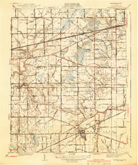
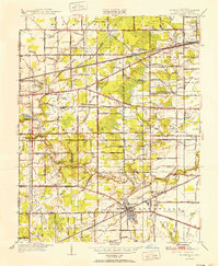
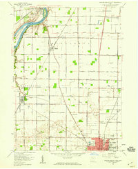 1958 Bowling Green North1960 Print · USGSWood County in the late fifties shows a landscape of river-bend settlements and expanding academic grounds. Researchers can trace the mid-century footprint of Bowling Green State University or locate family sites near Tontogany Cem and Haskins.6 unique versions available
 - 1961 Map of Toledo
 1961 Toledo1961 Print · USGSThe western basin of Lake Erie and the industrial heart of Northern Ohio are captured here during the post-war era. Researchers can trace historical rail lines like the New York Central or locate landmarks like the Erie Ordnance Depot and Pelee Island.
 - 1964 Map of Maumee, 1965 Print
 1964 Maumee1965 Print · USGSGreater Toledo and the riverfront communities of Maumee and Perrysburg are captured here during a period of mid-century suburban and industrial expansion. Trace the region's frontier roots at Fallen Timbers State Memorial or follow the historic rail paths of the Baltimore and Ohio Railroad.3 unique versions available
 - 1964 Map of Whitehouse, 1966 Print
 1964 Whitehouse1966 Print · USGSLucas County in the mid-sixties shows a landscape of traditional settlements like Whitehouse and Monclova increasingly defined by modern infrastructure. Researchers can trace the layout of Toledo Express Airport and find local landmarks like Love Lands Ch and the Roth Cem.2 unique versions available
 - 1986 Map of Toledo
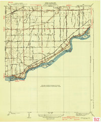
 1986 Toledo1986 Print · USGSGreater Toledo and the Lake Erie shoreline are captured here in the mid-eighties, showcasing a massive network of industrial waterways and rail lines. You can trace the path of the Maumee River past Rossford or explore the conservation lands at Ottawa National Wildlife Refuge.2 unique versions available
 - 1986 Map of Findlay
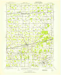
 1986 Findlay1986 Print · USGSNorthwest Ohio's industrial and agricultural heartland is documented here in the mid-1980s, centered on the major hubs of Findlay, Fostoria, and Tiffin. Researchers can trace the intersections of the BALTIMORE AND OHIO railroad and family sites near Greenlawn Cem or Sagar Ridge.2 unique versions available
Showing maps 1-25 of 47
Top cities near Waterville
- Toledo historical maps
- Bowling Green historical maps
- Perrysburg historical maps
- Sylvania historical maps
- Maumee historical maps
- Monclova historical maps
See more
Top neighborhoods of Waterville
Frequently asked questions
- What are the different types of historical maps available for Waterville?
- What is the oldest map of Waterville?
- Where can I purchase historical maps of Waterville for my home or office?
- Where can I download high-res historical maps of Waterville?
- Are there historical topographic maps available for Waterville?
- Is there historical aerial imagery available for Waterville?
- Where are historical maps of Waterville sourced from?