1950s Maps of Waterville, Ohio
Explore 7 historic maps of Waterville from the 1950s. These maps offer a rare glimpse into what life looked like during the 1950s — showing old roads, neighborhoods, homes, and landmarks that have changed or disappeared over time.
Whether you're researching your family's past, planning a metal detecting trip, or studying how Waterville's landscape evolved across the 1950s, these high-resolution maps are a powerful tool for exploring the history of this region.
- Focus on a specific era: All maps on this page are from the 1950s, giving you a focused view of this time period.
- See what’s changed: Compare century-old streets, trails, and buildings to today's modern landscape using overlays and satellite layers.
- Research with precision: Use these maps for genealogy, historical research, land use analysis, or educational projects.
- View, download, or print: Maps are fully viewable online in high resolution, and can be downloaded or printed for your own records.
Start exploring Waterville's history through authentic maps from the 1950s. This is your window into the past.
Waterville, OH maps
(7)- 1951 Map of Maumee, 1952 Print
 1951 Maumee1952 Print · USGSIn the early 1950s, the Maumee River valley was a corridor of burgeoning industry and deep frontier history. Researchers can trace military sites like Fort Meigs and Fort Miami, alongside local landmarks such as Turkey Foot Rock and Springfield Chapel.2 unique versions available
 - 1951 Map of Whitehouse, 1952 Print
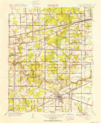 1951 Whitehouse1952 Print · USGSLucas County during the early fifties reveals a landscape of organized agriculture and rail-side hamlets. Genealogists and local historians can trace family land near Whitehouse, locate the Whitehouse Cemetery, and see the early layout of Monclova and Crissey.
 - 1952 Map of Tontogany, 1953 Print
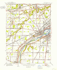
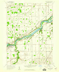
 1952 Tontogany1953 Print · USGSThe riverfront town of Waterville is captured here in the early fifties, situated along a prominent stretch of the Maumee. Local historians can trace the paths of the New York Chicago and St Louis railroad and landmarks like Roche de Boeuf and Missionary Island.
 - 1952 Map of Grand Rapids, 1953 Print
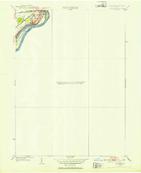
 1952 Grand Rapids1953 Print · USGSThe Maumee River valley comes alive in the early 1950s, showing a landscape shaped by river transport and deep-rooted agricultural townships. Researchers can find precise locations for Neapolis, Providence Church, and the unique Toledo Welfare Farm.
 - 1956 Map of Toledo, 1968 Print
 1956 Toledo1968 Print · USGSNorthwest Ohio and the Lake Erie shoreline are shown in detail during the late fifties, showcasing a landscape of heavy industry, railroads, and island communities. Genealogists and historians can trace rail networks like the Chesapeake & Ohio RR or locate landmarks such as the Erie Proving Ground and Kelleys Island.4 unique versions available
 - 1958 Map of Grand Rapids, 1960 Print
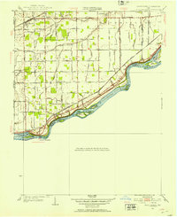
 1958 Grand Rapids1960 Print · USGSThe river and rail corridor of Wood County is shown here in the late fifties, dominated by the islands of the Maumee River. Family historians can trace local roots through the Beaver Creek Cem, Providence Ch, and the outlying County Farm.3 unique versions available
 - 1958 Map of Bowling Green North, 1960 Print
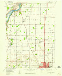 1958 Bowling Green North1960 Print · USGSWood County in the late fifties shows a landscape of river-bend settlements and expanding academic grounds. Researchers can trace the mid-century footprint of Bowling Green State University or locate family sites near Tontogany Cem and Haskins.6 unique versions available
End of results
Showing maps 1-7 of 7
Top cities near Waterville
- Toledo historical maps
- Bowling Green historical maps
- Perrysburg historical maps
- Sylvania historical maps
- Maumee historical maps
- Monclova historical maps
See more
Top neighborhoods of Waterville
Frequently asked questions
- What are the different types of historical maps available for Waterville?
- What is the oldest map of Waterville?
- Where can I purchase historical maps of Waterville for my home or office?
- Where can I download high-res historical maps of Waterville?
- Are there historical topographic maps available for Waterville?
- Is there historical aerial imagery available for Waterville?
- Where are historical maps of Waterville sourced from?