
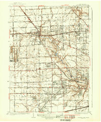
1935 Map of Whitehouse
USGS Topo · Published 1935About this map
The village of Whitehouse serves as the focal point of this 1935 survey, situated at the junction of the Wabash Railroad and the Bucher Transmission Line. The landscape is defined by an extensive and intricate network of drainage systems, such as Van Fleet Ditch and Weckerly Ditch 21, which supported the agricultural development of western Lucas County. To the north, the Toledo and Indiana (Electric) railway parallels the Chicago Pike, illustrating the era's reliance on both electric interurban lines and developing highways. Local life is documented through landmarks like Roberts Chapel, the Mennonite Ch and cemetery, and several rural schools including Bokoner Sch and Gruboak Sch. The presence of the Valley Wood Golf Club and Metropolitan Park near East Swanton suggests the emergence of recreational spaces alongside the established farming and transit corridors during the mid-1930s.
Find a feature on this map
66 named features on this map. Tap any name to fly to it.
Don’t see what you’re looking for? This feature index may not catch every label — zoom into the map to look around manually.
Map Details
Editions of this 1935 Whitehouse Map
This is the sole edition of this map. No revisions or reprints were ever made.
Other maps of this area

1900 · Toledo
USGS Topo · 1:62,500

1901 · Bowling Green
USGS Topo · 1:62,500

1903 · Bowling Green
USGS Topo · 1:62,500

1909 · Mc Clure
USGS Topo · 1:62,500

1911 · Swanton
USGS Topo · 1:62,500

1914 · Swanton
USGS Topo · 1:62,500

1935 · Grand Rapids
USGS Topo · 1:24,000

1935 · Maumee
USGS Topo · 1:24,000

1935 · Berkey
USGS Topo · 1:24,000
1937 · Sylvania
USGS Topo · 1:31,680