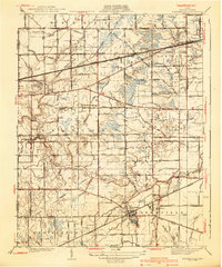
1940 Map of Whitehouse
USGS Topo · Published 1940About this map
Whitehouse serves as the primary hub in this mid-1930s landscape, positioned where several transportation lines converge. The map documents a transition in transit technology, showing the tracks of the Wabash RR and New York Central RR alongside the interurban Toledo and Indiana RR. This era's navigation infrastructure is marked by an Airway Beacon west of the Metropolitan Park, indicating the growing importance of regional flight paths.
Find a feature on this map
70 named features on this map. Tap any name to fly to it.
Don’t see what you’re looking for? This feature index may not catch every label — zoom into the map to look around manually.
Map Details
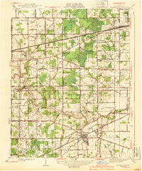
Editions of this 1940 Whitehouse Map
2 editions found
Other maps of this area

1900 · Toledo
USGS Topo · 1:62,500

1901 · Bowling Green
USGS Topo · 1:62,500

1903 · Bowling Green
USGS Topo · 1:62,500

1909 · Mc Clure
USGS Topo · 1:62,500

1911 · Swanton
USGS Topo · 1:62,500

1914 · Swanton
USGS Topo · 1:62,500

1935 · Grand Rapids
USGS Topo · 1:24,000

1935 · Whitehouse
USGS Topo · 1:24,000

1935 · Maumee
USGS Topo · 1:24,000

1935 · Berkey
USGS Topo · 1:24,000