Old Maps of Hillsboro, Ohio for Genealogy
Trace your family roots with 19 historic maps of Hillsboro. These high-res maps reveal old neighborhoods, homesites, landmarks, and streets — helping you uncover where your ancestors lived and how the area evolved over time.
- Explore historic neighborhoods: Identify where your relatives may have lived in the 1800s or 1900s.
- Compare maps over time: Trace the changes in streets, buildings, and landmarks for multi-generational research.
- Perfect for genealogy & ancestry research: Used by family historians and researchers to map out lineage and migration.
These maps are an incredible resource for exploring your personal connection to Hillsboro's past.
Hillsboro, OH maps
(19)- 1917 Map of Hillsboro, 1941 Print
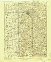 1917 Hillsboro1941 Print · USGSHighland County during the First World War era was a bustling network of electric rail lines and one-room schoolhouses. Genealogists can locate family landmarks like the Highland County Infirmary or schools such as Kansas College School and Brier College School.2 unique versions available
 - 1944 Map of Hillsboro
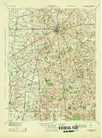 1944 Hillsboro1944 Print · USGSHighland County is documented here during the mid-forties, showing the vital rail junction at Hillsboro and a dense network of rural schools. Trace ancestral roots through localized landmarks like Brier College Sch, Mowrystown, and Millers Chapel Ch.
 - 1947 Map of Columbus, 1948 Print
 1947 Columbus1948 Print · USGSCentral Ohio in the late 1940s is captured in this survey, showing the post-war transition of its rail hubs and military airfield expansions. Genealogists and historians can trace the paths of the Ohio Canal, the Pennsylvania RR lines, and the Camp Sherman Military Reservation.
 - 1960 Map of New Market, 1962 Print
 1960 New Market1962 Print · USGSHighland County’s rolling farmland and scattered crossroad hamlets are captured here just after the mid-century. Researchers can trace ancestral sites at Old Dutch Cem and South Liberty Ch, or follow the path of the Baltimore and Ohio through Fairview.3 unique versions available
 - 1961 Map of Columbus
 1961 Columbus1961 Print · USGSCentral and Southern Ohio are captured here in the early sixties, as the region's industrial rail hubs and military bases reached their peak. Genealogists and historians can trace the transition from urban Columbus to rural townships along the Scioto River, locating Lockbourne USAF and old junctions like Washington Court House.
 - 1961 Map of Hillsboro, 1963 Print
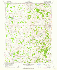
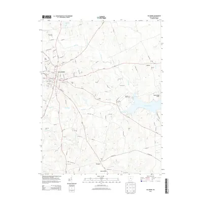
 1961 Hillsboro1963 Print · USGSHillsboro and its rural Highland County surroundings are captured in the early sixties, showing the city's growth alongside the newly established Rocky Fork Lake. Researchers can trace local lineage through sites like St Marys Cem, Prospect Ch, and the outlying settlement of Berrysville.4 unique versions available
 - 1962 Map of Columbus
 1962 Columbus1962 Print · USGSCentral Ohio during the early sixties reveals a transition from the industrial corridors of Columbus to the forested ridges of the south. Genealogists and historians can trace the rail networks of the Baltimore & Ohio RR and find local landmarks like Washington Court House and Camp Sherman Military Reservation.
 - 1967 Map of Columbus, 1969 Print
 1967 Columbus1969 Print · USGSCentral Ohio during the late sixties serves as a vital corridor of rail and aviation, from the industrial streets of Springfield to the hangar lines of Lockbourne Air Force Base. Genealogists and researchers can trace the growth of towns like Circleville and London or locate rural landmarks such as St Paul church and the London Correctional Institution.2 unique versions available
 - 1986 Map of Hillsboro
 1986 Hillsboro1986 Print · USGSThe rural landscapes of Highland and Clinton counties appear in the mid-eighties as a busy corridor of railroads and regional airports. Genealogists and historians can trace old community centers like Reesville and Starbucktown alongside significant landmarks like Wilmington College and Fort Hill State Memorial.2 unique versions available
 - 2010 Map of Hillsboro, 2010 Print
 2010 Hillsboro2010 Print · USGSCovers Hillsboro, including Prospect, Berrysville, and other nearby areas
 - 2010 Map of New Market, 2010 Print
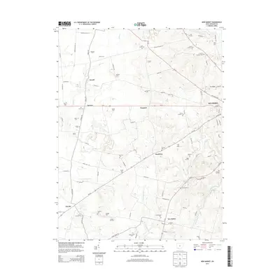
 2010 New Market2010 Print · USGSCovers Hillsboro, including New Market, Hoagland, and other nearby areas
 - 2013 Map of New Market, 2013 Print
 2013 New Market2013 Print · USGSCovers Hillsboro, including New Market, Hoagland, and other nearby areas
 - 2013 Map of Hillsboro, 2013 Print
 2013 Hillsboro2013 Print · USGSCovers Hillsboro, including Prospect, Berrysville, and other nearby areas
 - 2016 Map of New Market, 2016 Print
 2016 New Market2016 Print · USGSCovers Hillsboro, including New Market, Hoagland, and other nearby areas
 - 2016 Map of Hillsboro, 2016 Print
 2016 Hillsboro2016 Print · USGSCovers Hillsboro, including Prospect, Berrysville, and other nearby areas
 - 2019 Map of New Market, 2019 Print
 2019 New Market2019 Print · USGSCovers Hillsboro, including New Market, Hoagland, and other nearby areas
 - 2019 Map of Hillsboro, 2019 Print
 2019 Hillsboro2019 Print · USGSCovers Hillsboro, including Prospect, Berrysville, and other nearby areas
 - 2023 Map of New Market, 2023 Print
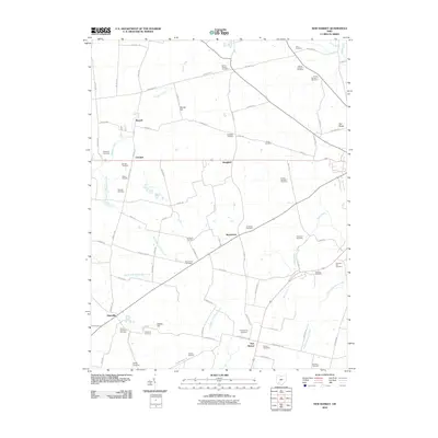
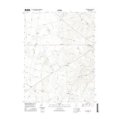
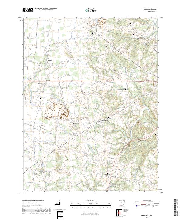 2023 New Market2023 Print · USGSHighland County at the start of the 2020s remains a landscape of quiet crossroads and historic family burial sites. Researchers can trace ancestral locations at Old Dutch Cem, the Hamer Township Cem, and the community of New Market.
 - 2023 Map of Hillsboro, 2023 Print
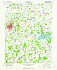
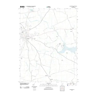
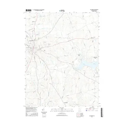
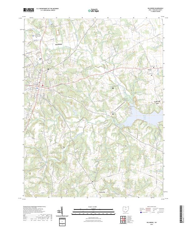 2023 Hillsboro2023 Print · USGSHillsboro and its rural Highland County surroundings are captured in this contemporary survey, showcasing the area's mix of town life and reservoir-fed waterways. Researchers can trace numerous local burial grounds such as New Light Cem and Carlisle Cem near the shores of Rocky Fork Lake.
End of results
Showing maps 1-19 of 19
Top cities near Hillsboro
- Wilmington historical maps
- Greenfield historical maps
- New Market historical maps
- Lynchburg historical maps
- Leesburg historical maps
- New Vienna historical maps
See more
Top neighborhoods of Hillsboro
- East Main Street Historic District historical maps
- Hillsboro Historic Business District historical maps
Frequently asked questions
- What are the different types of historical maps available for Hillsboro?
- What is the oldest map of Hillsboro?
- Where can I purchase historical maps of Hillsboro for my home or office?
- Where can I download high-res historical maps of Hillsboro?
- Are there historical topographic maps available for Hillsboro?
- Is there historical aerial imagery available for Hillsboro?
- Where are historical maps of Hillsboro sourced from?