
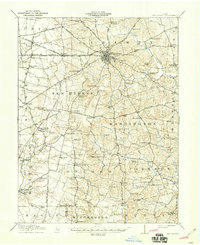
1917 Map of Hillsboro
USGS Topo · Published 1941About this map
Hillsboro serves as the regional hub for Highland County in this early twentieth-century survey, revealing a dense network of rural schools and family-named landmarks. The landscape is defined by the convergence of the Baltimore and Ohio Southwestern Railroad and the Ohio Electric RR, which connect settlements like Fairview and Russell to the larger market. To the south and west, the topography transitions from the open fields of Union and Liberty townships into the more dissected drainage basins of Whiteoak Creek and the Rocky Fork.
Find a feature on this map
102 named features on this map. Tap any name to fly to it.
Don’t see what you’re looking for? This feature index may not catch every label — zoom into the map to look around manually.
Map Details
Editions of this 1917 Hillsboro Map
2 editions found
Other maps of this area

1907 · Blanchester
USGS Topo · 1:62,500

1915 · Bainbridge
USGS Topo · 1:48,000

1916 · Peebles
USGS Topo · 1:62,500

1917 · Bainbridge
USGS Topo · 1:62,500

1917 · Greenfield
USGS Topo · 1:62,500

1917 · Sabina
USGS Topo · 1:62,500

1917 · Sardinia
USGS Topo · 1:62,500

1918 · Peebles
USGS Topo · 1:62,500

1918 · Seaman
USGS Topo · 1:62,500

1928 · Higginsport
USGS Topo · 1:48,000