Old Maps of Knox County, Ohio for Metal Detecting
Plan your next treasure hunt with 138 historic maps of Knox County. Find old homesites, ghost towns, trails, and gathering spots that may be lost to time — perfect for identifying promising metal detecting locations.
- Locate forgotten sites: Uncover places like long-lost settlements, abandoned rail lines, or gathering spots.
- Plan better hunts: Use map overlays combined with LiDAR or satellite views to narrow in on historically rich areas.
- Made for detectorists: Thousands of hobbyists use these maps to discover relics, coins, and hidden history.
Use these historic maps to boost your research and find new opportunities beneath the surface of Knox County.
Knox County, OH maps
(138)- 1909 Map of Newark, 1937 Print
 1909 Newark1937 Print · USGSLicking County at the turn of the century shows a bustling rail hub at the meeting of the forks of the Licking River. Genealogists and researchers can trace family roots through numerous country schools like Poodle School and rural parishes including Newton Chapel.2 unique versions available
 - 1910 Map of Frazeysburg, 1937 Print
 1910 Frazeysburg1937 Print · USGSMuskingum and Licking Counties are captured here during a pivotal era of rail dominance and canal obsolescence. Researchers can locate vanished rural schoolhouses like Pisgah School or trace the early paths of the Ohio Canal near Dresden.2 unique versions available
 - 1912 Map of Loudonville, 1958 Print
 1912 Loudonville1958 Print · USGSBefore modern highways rearranged rural Ohio, this area thrived as a network of rail-side towns and country schoolhouses. Genealogists can trace family footprints at Germany School, the Greenville Treaty Line, and the village of Shreve.
 - 1912 Map of Gambier, 1958 Print
 1912 Gambier1958 Print · USGSKnox County is captured at a fascinating moment when rural hamlets and small colleges thrived alongside expanding rail lines. Genealogists can locate dozens of country schools like Wildcat School and trace ancestors near Monroe Mills or the Democracy P O.2 unique versions available
 - 1912 Map of Perrysville, 1959 Print
 1912 Perrysville1959 Print · USGSRichland and Ashland counties were thriving agricultural and rail hubs during this era of rural development. Genealogists and local historians can trace the specific locations of many vanished schools and landmarks, from Black Swamp School to the prominent Gatton Rock.
 - 1913 Map of Brinkhaven, 1958 Print
 1913 Brinkhaven1958 Print · USGSCoshocton County was a landscape of steep ridges and river valleys just before the First World War. Researchers can locate dozens of country schoolhouses and churches, such as Nigger Run School, Tiverton Center, and Wilson Chapel.
 - 1914 Map of Gambier, 1942 Print
 1914 Gambier1942 Print · USGSKnox County in the early twentieth century is captured here as a thriving network of rail-connected towns and rural school districts. Genealogists can locate family-named landmarks like Pike School and Bedell School or trace the early campus of Kenyon College and the State Tuberculosis Hospital.
 - 1914 Map of Loudonville, 1944 Print
 1914 Loudonville1944 Print · USGSNorth-central Ohio is captured here in the years before the Great War, showing a dense network of hill-country farms and railroad towns. Genealogists can trace family roots through dozens of local landmarks like Germany School, Miley Crossroads, and the historic Greenville Treaty Line.
 - 1915 Map of Brinkhaven, 1925 Print
 1915 Brinkhaven1925 Print · USGSCoshocton and Knox counties come alive in the decade before the Great War, showing a network of river-valley rail towns and upland farmsteads. Genealogists can trace family footprints across dozens of local landmarks like Nigger Run School 23, Mohawk Village, and New Guilford.2 unique versions available
 - 1915 Map of Perrysville, 1944 Print
 1915 Perrysville1944 Print · USGSAshland and Richland counties are captured here just before the First World War, when the landscape was a patchwork of small school districts and river-bottom farms. Genealogists can locate family landmarks such as St James School, the Treaty 1795 Line, and the rural village of Newville.
 - 1915 Map of Shauck, 1946 Print
 1915 Shauck1946 Print · USGSRichland County and its neighbors are captured here just before the First World War, showing a landscape of established rail hubs and rural school districts. Genealogists can locate family homesteads near Johnsville Shauck PO, Steam Corners, or Bellville.
 - 1915 Map of Marengo, 1946 Print
 1915 Marengo1946 Print · USGSMorrow and Delaware counties are shown in detail during the heyday of the steam railroad and the one-room schoolhouse. Genealogists and historians can locate vanished local landmarks like Swamp Angel School, the County Infirmary, and the Treaty Line.
 - 1915 Map of Fredericktown, 1950 Print
 1915 Fredericktown1950 Print · USGSKnox and Morrow Counties are shown here during the height of the steam-rail era. Genealogists can locate dozens of country schoolhouses like Salem and Updike, alongside family landmarks such as Braddock Mound and the County Infirmary.
 - 1943 Map of Shauck
 1943 Shauck1943 Print · USGSNorth Central Ohio is captured here in the mid-1940s, showing a landscape of small agricultural hamlets and a dense network of country schools. Genealogists and researchers can trace local landmarks like Johnsville Shauck P O, Chestnut Chapel, and the Erie RR corridor.
 - 1943 Map of Gambier
 1943 Gambier1943 Print · USGSKnox County during the Second World War shows a landscape of institutional growth and deep-rooted rural communities. Genealogists can trace family footprints across dozens of local schoolhouses like Cherry Hall Sch and historic centers such as Democracy P O or Martinsburg.
 - 1943 Map of Marengo
 1943 Marengo1943 Print · USGSCentral Ohio's agricultural heartland is documented here during the early war years, showing a landscape defined by small-town rail hubs and a dense network of rural schoolhouses. Researchers can trace family history through dozens of named sites like Chestnut Grove Sch, the County Infirmary, and settlements such as Westfield and Fulton.
 - 1943 Map of Fredericktown
 1943 Fredericktown1943 Print · USGSRural Knox County is captured here in the 1940s, showing a landscape of small townships connected by the Baltimore and Ohio RR and local schoolhouse districts. Genealogists can trace family footprints at Woodland Hall Sch, Bethel Ch, and ancient landmarks like Raleigh Mound.
 - 1943 Map of Loudonville
 1943 Loudonville1943 Print · USGSAshland and Holmes counties during the early years of the war show a landscape defined by the PENNSYLVANIA rail line and the Mohican River. Genealogists can locate dozens of country schools like Ball Alley Sch and settlements such as Nashville or Big Prairie.
 - 1944 Map of Perrysville
 1944 Perrysville1944 Print · USGSThe Mohican River valley in the mid-1940s reveals a transition from traditional milling to modern water management with the Pleasant Hill Reservoir. Genealogists can trace family footprints across dozens of country school sites like Knotty Oak Sch and the vanished crossroads of Black Swamp.
 - 1950 Map of Marion
 1950 Marion1950 Print · USGSCentral Ohio was a powerhouse of rail and river industry at the mid-century point, serving as a vital corridor between the Great Lakes and the Ohio River valley. Genealogists and rail historians can trace the paths of the Erie RR and Nickel Plate Road through towns like Bucyrus, Galion, and Upper Sandusky.
 - 1961 Map of Fredericktown, 1962 Print
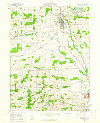 1961 Fredericktown1962 Print · USGSKnox County's rolling farmland and river valleys are captured here in the early sixties, showing the vital link between Fredericktown and the Kokosing River. Researchers can trace ancestral sites at Liberty Chapel Cem or locate ancient landmarks like Braddock Mound.4 unique versions available
 - 1961 Map of Chesterville, 1962 Print
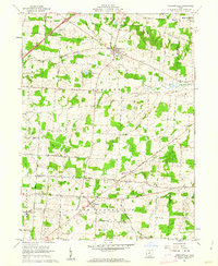 1961 Chesterville1962 Print · USGSMorrow and Knox counties are shown here in the early 1960s, documenting a landscape of rural crossroads and river valleys. Researchers can trace ancestral locations through several family-named junctions like Bowen Corners and old church sites such as Harmony Chapel.2 unique versions available
 - 1961 Map of Mt Vernon, 1962 Print
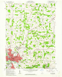 1961 Mt Vernon1962 Print · USGSMid-century Knox County is shown here at a peak of institutional and educational growth, centered on the bustling city of Mt Vernon. You can trace the historic College campus in Gambier, locate family plots at Oak Grove Cem, or find the old Knox-Vernon Speedway.4 unique versions available
 - 1961 Map of Centerburg, 1962 Print
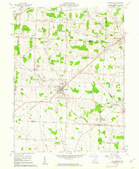 1961 Centerburg1962 Print · USGSKnox County is captured at the start of the 1960s, centered on the strategic rail junction at Centerburg. Genealogists and local historians can trace family plots at Houck Cem and Moreland Cem or locate old community landmarks like Milford Ch and Rich Hill.3 unique versions available
 - 1961 Map of Olive Green, 1962 Print
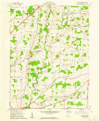 1961 Olive Green1962 Print · USGSCentral Ohio farm country comes to life in the early 1960s, showing a landscape of small crossroads and creek-side settlements. Researchers can trace the path of the Pennsylvania railroad or locate rural landmarks like the Covered Bridge and Pagetown Cem.3 unique versions available
Showing maps 1-25 of 138
Top cities of Knox County
Frequently asked questions
- What are the different types of historical maps available for Knox County?
- What is the oldest map of Knox County?
- Where can I purchase historical maps of Knox County for my home or office?
- Where can I download high-res historical maps of Knox County?
- Are there historical topographic maps available for Knox County?
- Is there historical aerial imagery available for Knox County?
- Where are historical maps of Knox County sourced from?