2020s Maps of Elizabeth Township, Ohio
Explore 6 historic maps of Elizabeth Township from the 2020s. These maps offer a rare glimpse into what life looked like during the 2020s — showing old roads, neighborhoods, homes, and landmarks that have changed or disappeared over time.
Whether you're researching your family's past, planning a metal detecting trip, or studying how Elizabeth Township's landscape evolved across the 2020s, these high-resolution maps are a powerful tool for exploring the history of this region.
- Focus on a specific era: All maps on this page are from the 2020s, giving you a focused view of this time period.
- See what’s changed: Compare century-old streets, trails, and buildings to today's modern landscape using overlays and satellite layers.
- Research with precision: Use these maps for genealogy, historical research, land use analysis, or educational projects.
- View, download, or print: Maps are fully viewable online in high resolution, and can be downloaded or printed for your own records.
Start exploring Elizabeth Township's history through authentic maps from the 2020s. This is your window into the past.
Elizabeth Township, OH maps
(6)- 2022 Map of Greenup, 2022 Print
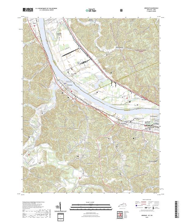 2022 Greenup2022 Print · USGSThe Ohio River borderlands between Kentucky and Ohio are shown here in the 2020s, highlighting a landscape shaped by iron furnaces and river commerce. Researchers can trace family history at Riverview Cem or explore the sites of Ohio Furnace and Junior Furnace.
 - 2023 Map of Sherritts, 2023 Print
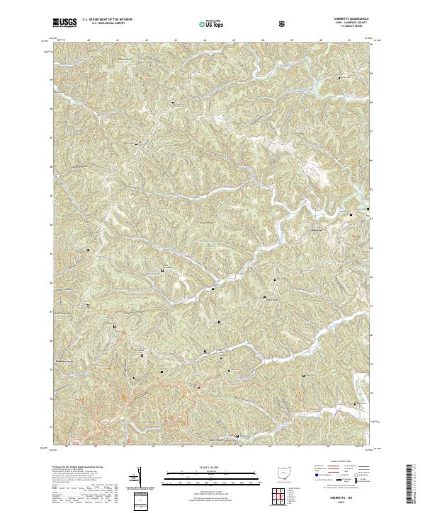 2023 Sherritts2023 Print · USGSLawrence County's high ridges and timbered hollows are shown in detail here during the early twenty-first century. Genealogists can trace family names at Macedonia Cem and Stewart Werner Cem near the small settlement of Sherritts.
 - 2023 Map of Kitts Hill, 2023 Print
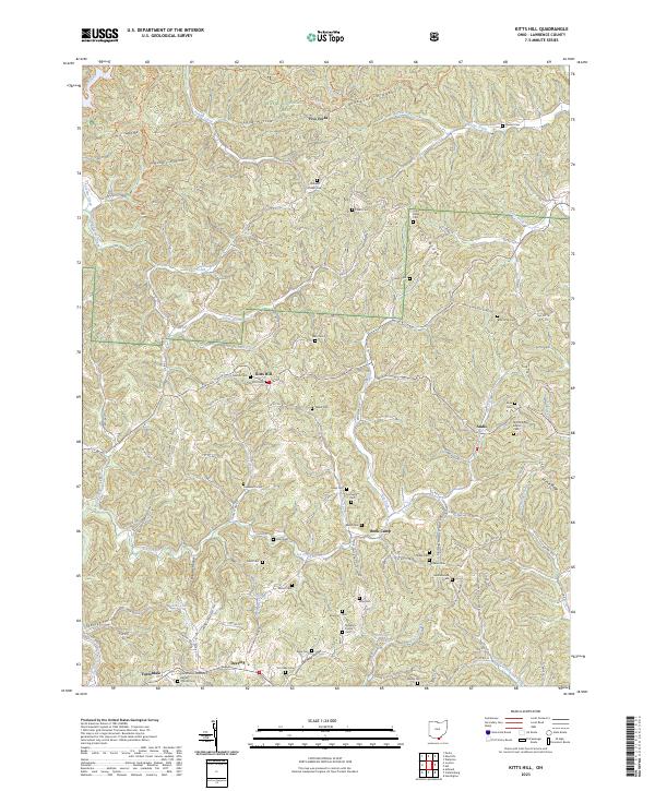 2023 Kitts Hill2023 Print · USGSLawrence County's wooded ridges and creek valleys are documented here in the early twenty-first century. Genealogists can locate dozens of remote family burial sites like Mamre Cem and Bald Knob Cem tucked among landmarks such as Rock Camp.
 - 2023 Map of Wheelersburg, 2023 Print
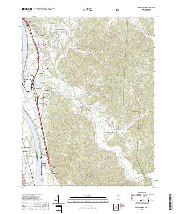 2023 Wheelersburg2023 Print · USGSWheelersburg and the eastern bank of the Ohio River are shown here in recent detail, illustrating the blend of river-bottom industry and ridge-top settlements. Genealogists can trace family names through numerous burial sites like Old Wheelersburg Cem, Old Dutch Cem, and the community of Franklin Furnace.
 - 2023 Map of Pedro, 2023 Print
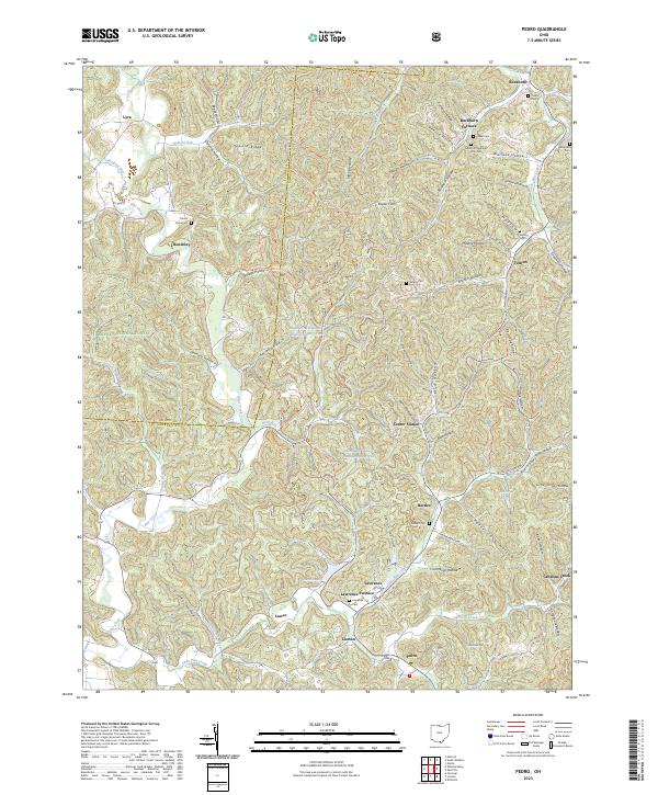 2023 Pedro2023 Print · USGSIron furnaces and forest settlements define this corner of southern Ohio during the modern era. Genealogists and historians can locate legacy sites like Buckhorn Furnace and Lawrence Furnace alongside family markers at Puckett Cem.
 - 2023 Map of Ironton, 2023 Print
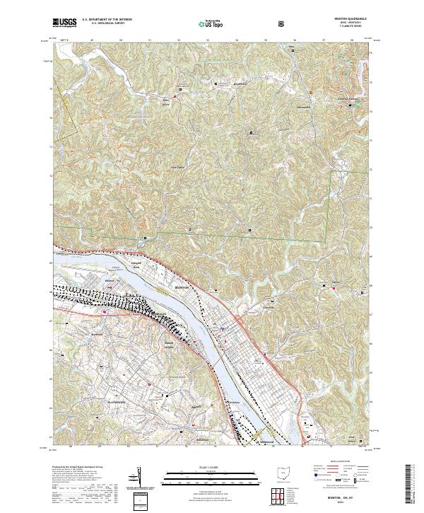 2023 Ironton2023 Print · USGSThe Ohio River valley and its industrial corridor are captured here, from the streets of Ironton to the ridges of the Wayne National Forest. Genealogists can trace family names across Woodland Cem, Vesuvius Cem, and the Lawrence County Courthouse.
End of results
Showing maps 1-6 of 6
Top cities near Elizabeth Township
- Huntington historical maps
- Ashland historical maps
- Portsmouth historical maps
- Ironton historical maps
- Flatwoods historical maps
- South Point historical maps
See more
Top neighborhoods of Elizabeth Township
- Royersville historical maps
- Etna historical maps
- Lawco historical maps
- Lisman historical maps
- Pedro historical maps
- Pine Grove historical maps
See more
Frequently asked questions
- What are the different types of historical maps available for Elizabeth Township?
- What is the oldest map of Elizabeth Township?
- Where can I purchase historical maps of Elizabeth Township for my home or office?
- Where can I download high-res historical maps of Elizabeth Township?
- Are there historical topographic maps available for Elizabeth Township?
- Is there historical aerial imagery available for Elizabeth Township?
- Where are historical maps of Elizabeth Township sourced from?