Old Maps of Richland Township, Ohio for Genealogy
Trace your family roots with 41 historic maps of Richland Township. These high-res maps reveal old neighborhoods, homesites, landmarks, and streets — helping you uncover where your ancestors lived and how the area evolved over time.
- Explore historic neighborhoods: Identify where your relatives may have lived in the 1800s or 1900s.
- Compare maps over time: Trace the changes in streets, buildings, and landmarks for multi-generational research.
- Perfect for genealogy & ancestry research: Used by family historians and researchers to map out lineage and migration.
These maps are an incredible resource for exploring your personal connection to Richland Township's past.
Richland Township, OH maps
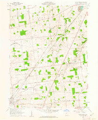
(41)- 1913 Map of Alger
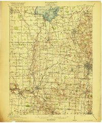
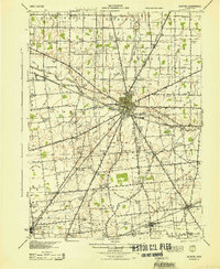
 1913 Alger1913 Print · USGSWestern Ohio's agricultural heartland is documented here just before the Great War, showing a landscape shaped by drainage ditches and rail lines. Locate family landmarks like the Bee Hive School, Mt Zion Church, and the vanished stops along the Chicago & Erie Railroad.2 unique versions available
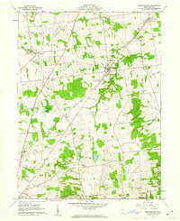
 - 1913 Map of Bellefontaine
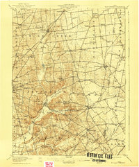
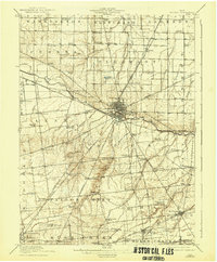
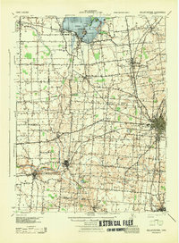
 1913 Bellefontaine1913 Print · USGSLogan County in the decade before the First World War shows a landscape connected by steam and electric rail. Genealogists can locate family landmarks from Santa Fe to Quincy, including the County Infirmary and old sites like Muchinippi Church.2 unique versions available
 - 1913 Map of East Liberty, 1961 Print
 1913 East Liberty1961 Print · USGSLogan and Union counties are shown here just before the First World War, when a dense network of country schools and steam railroads bound the countryside together. Genealogists can trace family footprints at Marl City, Indian Mound School, or the Greenville Treaty Line.
 - 1915 Map of Alger
 1915 Alger1915 Print · USGSNorthwest Ohio's agricultural and rail heartland is captured here just before the First World War. Genealogists can locate family homesteads near dozens of early rural schoolhouses like Kingsley School and trace the paths of the ERIE RR and LAKEVIEW ELECTRIC ROAD.4 unique versions available
 - 1915 Map of Bellefontaine
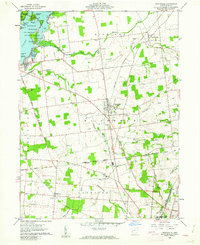
 1915 Bellefontaine1915 Print · USGSLogan County at the start of the twentieth century shows a bustling landscape of rail hubs and lakeside settlements. Genealogists can trace family footprints at Richland New Richland PO or locate landmarks like the County Infirmary and Black Lake School.3 unique versions available
 - 1915 Map of East Liberty, 1941 Print
 1915 East Liberty1941 Print · USGSLogan County at the start of the twentieth century shows a landscape of established rail hubs and numerous rural school districts. Genealogists can trace family roots through landmarks like Zanesfield, Bethany School, and the historic Greenville Treaty Line.
 - 1915 Map of Kenton, 1942 Print
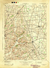
 1915 Kenton1942 Print · USGSHardin County at the dawn of the motorized age shows a landscape deeply connected by competing rail lines and rural school districts. Genealogists and historians can trace family roots at dozens of named schoolhouses like Henpeck and Brush College, or locate vanished stops along the Toledo and Ohio Central Railroad.
 - 1943 Map of Alger
 1943 Alger1943 Print · USGSDuring the early 1940s, this pocket of Ohio was a landscape of rail-fed villages and drainage ditches. Trace family roots across a grid of rural schools like Sugarfree Sch, follow the Erie RR through Alger, or explore the shores of Indian Lake.
 - 1944 Map of East Liberty
 1944 East Liberty1944 Print · USGSThe rail-and-river network of Logan County is at its peak in the 1940s, connecting small farming towns across the Central Ohio landscape. Local researchers can trace family landmarks like Bethany Sch, the Treaty Line, and the high peak at Campbell Hill.
 - 1944 Map of Kenton
 1944 Kenton1944 Print · USGSHardin County was a thriving agricultural and railroad hub in the 1940s, centered on the busy junction at Kenton. Researchers can locate dozens of country schools like Brush College and trace the legacy of the Virginia Military Land near Silver Creek.
 - 1944 Map of Bellefontaine
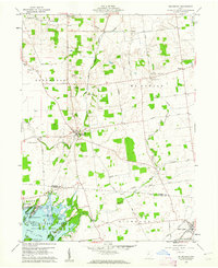
 1944 Bellefontaine1944 Print · USGSLogan County in the 1940s centers on the bustling rail junction of Bellefontaine and the recreational shores of Indian Lake. Genealogists and local historians can locate early landmarks like the County Infirmary and dozens of rural schoolhouses, including McKee Creek Sch and Miller Sch.
 - 1950 Map of Marion
 1950 Marion1950 Print · USGSCentral Ohio was a powerhouse of rail and river industry at the mid-century point, serving as a vital corridor between the Great Lakes and the Ohio River valley. Genealogists and rail historians can trace the paths of the Erie RR and Nickel Plate Road through towns like Bucyrus, Galion, and Upper Sandusky.
 - 1960 Map of Huntsville, 1962 Print
 1960 Huntsville1962 Print · USGSLogan County in the early sixties is defined by the historic Greenville Treaty Line and the recreation waters of Indian Lake State Park. Researchers can trace old family roots through Huntsville Cem and McMorran or follow the New York Central rail line.3 unique versions available
 - 1960 Map of Roundhead, 1962 Print
 1960 Roundhead1962 Print · USGSThe northern shores of Indian Lake were coming into their own as a recreation destination in the early sixties. Researchers can trace the legacy of family farms and vanished crossroads through McArthur Cem, the tracks of the New York Central, and the village of Roundhead.3 unique versions available
 - 1960 Map of Silver Creek, 1962 Print
 1960 Silver Creek1962 Print · USGSHardin and Logan Counties are captured in the early sixties as rural townships and rail-connected villages define the landscape. Researchers can trace family history through local sites like Sloan-Yelverton Cem, the New York Central rail line, and the village of Belle Center.2 unique versions available
 - 1961 Map of Rushsylvania, 1962 Print
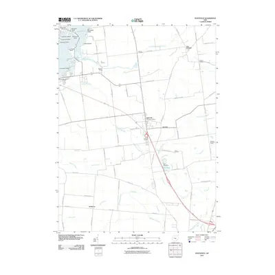
 1961 Rushsylvania1962 Print · USGSLogan County, Ohio, is captured in the early sixties as a landscape of established farmsteads and historic treaty boundaries. Genealogists and historians can locate family plots at McKirahen Cem or trace the early settlements of Marl City and Northwood.3 unique versions available
 - 1962 Map of Marion
 1962 Marion1962 Print · USGSCentral Ohio during the post-war era showcases a dense network of railroad towns and emerging interstate highways. Genealogists can trace family roots in smaller settlements like Houcktown and Marseilles or locate landmarks near Indian Lake.
 - 1966 Map of Marion, 1968 Print
 1966 Marion1968 Print · USGSCentral Ohio in the mid-sixties is captured during a period of rapid highway expansion and industrial connectivity. Genealogists and historians can trace rail-and-river networks through towns like Marion, Urbana, and Mount Vernon, or locate landmarks such as Malabar Farm and Black Hand Rock.3 unique versions available
 - 1986 Map of Bellefontaine
 1986 Bellefontaine1986 Print · USGSWest Central Ohio in the mid-1980s reveals a landscape of growing metropolitan fringes and established rural centers. Researchers can trace historic cemeteries and civic institutions from Oak Grove Cem to the State Reformatory For Women and Cedar Bog State Nature Preserve.
 - 1986 Map of Marion
 1986 Marion1986 Print · USGSNorthwest Ohio's agricultural and rail heartland is captured here in the mid-1980s, centered on the expansion of Marion and Kenton. Genealogists can trace family footprints near Bluffton College, old rail stops like Dola, and landmarks such as Indian Lake State Park.2 unique versions available
 - 1992 Map of Bellefontaine
 1992 Bellefontaine1992 Print · USGSWest-central Ohio in the early nineties reveals a blend of high-plateau geography and growing suburban corridors near the state capital. Genealogists can trace family connections to landmarks like Mount Tabor Church, Oak Grove Cemetery, and the high ground of Campbell Hill.
 - 2010 Map of Rushsylvania, 2010 Print
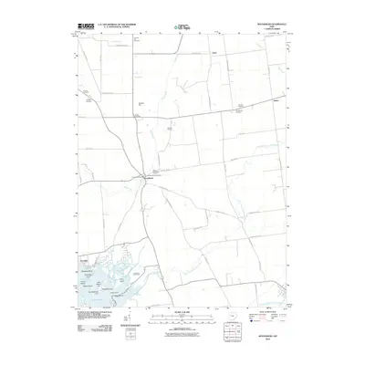
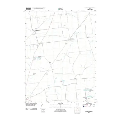 2010 Rushsylvania2010 Print · USGSCovers Richland Township, including Bellefontaine, Rushsylvania, and other nearby areas
 - 2010 Map of Huntsville, 2010 Print
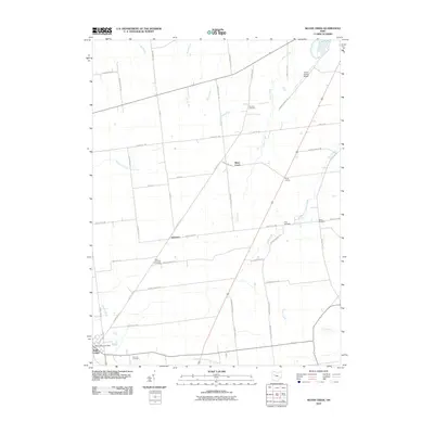
 2010 Huntsville2010 Print · USGSCovers Richland Township, including Bellefontaine, Huntsville, and other nearby areas
 - 2010 Map of Roundhead, 2010 Print
 2010 Roundhead2010 Print · USGSCovers Richland Township, including Belle Center, Roundhead, and other nearby areas
 - 2010 Map of Silver Creek, 2010 Print
 2010 Silver Creek2010 Print · USGSCovers Richland Township, including Kenton, Belle Center, and other nearby areas
Showing maps 1-25 of 41
Top cities near Richland Township
- Bellefontaine historical maps
- Kenton historical maps
- West Liberty historical maps
- Russells Point historical maps
- De Graff historical maps
- Lakeview historical maps
See more
Top neighborhoods of Richland Township
Frequently asked questions
- What are the different types of historical maps available for Richland Township?
- What is the oldest map of Richland Township?
- Where can I purchase historical maps of Richland Township for my home or office?
- Where can I download high-res historical maps of Richland Township?
- Are there historical topographic maps available for Richland Township?
- Is there historical aerial imagery available for Richland Township?
- Where are historical maps of Richland Township sourced from?