Old Maps of Lynpark Estates, Oregon for Academic Research
Study the evolution of Lynpark Estates with 13 high-resolution historic maps. Whether you're teaching, researching, or modeling changes in land use, these maps provide essential visual documentation of urban, environmental, and geographic change.
- Analyze long-term change: Track patterns in development, transportation, and natural features.
- Ideal for environmental or urban studies: Support academic projects with primary historical map data.
- Use in the classroom or lab: Educators and researchers rely on these maps to bring historical context to life.
These maps are a powerful tool for teaching, research, and visualizing how Lynpark Estates has changed over the decades.
Lynpark Estates, Oregon maps
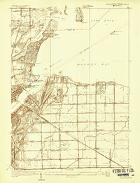
(13)- 1900 Map of Maumee Bay, 1921 Print
 1900 Maumee Bay1921 Print · USGSNorthwest Ohio and the Lake Erie shoreline are shown here just as the regions rail and energy sectors were maturing. Genealogists and historians can locate vanished post offices at Shepardsville Bono P. O. and trace early industrial sites like the Oil Wells and Coke Ovens near Curtice.2 unique versions available
 - 1934 Map of Point Place
 1934 Point Place1934 Print · USGSThe Lake Erie shoreline near Toledo comes to life in the mid-1930s, showing a landscape defined by maritime trade and residential growth. Genealogists and historians can trace family locations near Point Place, Momineetown, and landmarks like the Toledo Yacht Club.
 - 1938 Map of Point Place
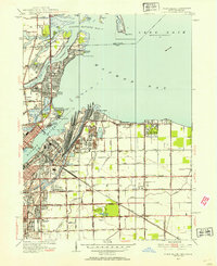
 1938 Point Place1938 Print · USGSCoastal life and heavy industry intersect along Maumee Bay in the late thirties as the region’s rail and maritime networks expanded. Researchers can trace the heritage of Point Place, the waterfront Naval Armory, and rural settlements like Momeneetown and Booth.2 unique versions available
 - 1952 Map of Point Place, 1954 Print
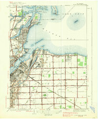
 1952 Point Place1954 Print · USGSThe Lake Erie shoreline near Toledo comes alive in this early fifties survey of the Maumee River mouth and its surrounding industrial rail yards. Genealogists and local historians can locate long-standing landmarks like St Ignatius Ch, Pearson State Park, and the old Drive-in Theater.
 - 1956 Map of Toledo, 1968 Print
 1956 Toledo1968 Print · USGSNorthwest Ohio and the Lake Erie shoreline are shown in detail during the late fifties, showcasing a landscape of heavy industry, railroads, and island communities. Genealogists and historians can trace rail networks like the Chesapeake & Ohio RR or locate landmarks such as the Erie Proving Ground and Kelleys Island.4 unique versions available
 - 1961 Map of Toledo
 1961 Toledo1961 Print · USGSThe western basin of Lake Erie and the industrial heart of Northern Ohio are captured here during the post-war era. Researchers can trace historical rail lines like the New York Central or locate landmarks like the Erie Ordnance Depot and Pelee Island.
 - 1965 Map of Oregon, 1966 Print
 1965 Oregon1966 Print · USGSThe industrial shoreline of Lake Erie comes alive in the mid-sixties, where the heavy rail yards of Toledo meet the growing suburbs of Oregon. Trace family roots at St Ignatius Ch or locate mid-century landmarks like the Drive-in Theater and Clay High Sch.5 unique versions available
 - 1986 Map of Toledo
 1986 Toledo1986 Print · USGSGreater Toledo and the Lake Erie shoreline are captured here in the mid-eighties, showcasing a massive network of industrial waterways and rail lines. You can trace the path of the Maumee River past Rossford or explore the conservation lands at Ottawa National Wildlife Refuge.2 unique versions available
 - 2011 Map of Oregon, 2011 Print
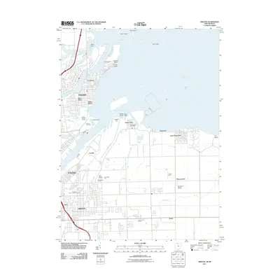 2011 Oregon2011 Print · USGSCovers Lynpark Estates, including Toledo, Oregon, and other nearby areas
 - 2013 Map of Oregon, 2013 Print
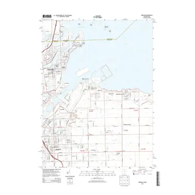 2013 Oregon2013 Print · USGSCovers Lynpark Estates, including Toledo, Oregon, and other nearby areas
 - 2016 Map of Oregon, 2016 Print
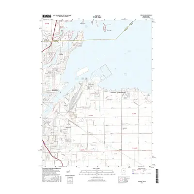 2016 Oregon2016 Print · USGSCovers Lynpark Estates, including Toledo, Oregon, and other nearby areas
 - 2019 Map of Oregon, 2019 Print
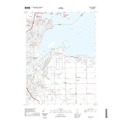 2019 Oregon2019 Print · USGSCovers Lynpark Estates, including Toledo, Oregon, and other nearby areas
 - 2023 Map of Oregon, 2023 Print
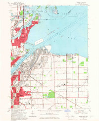
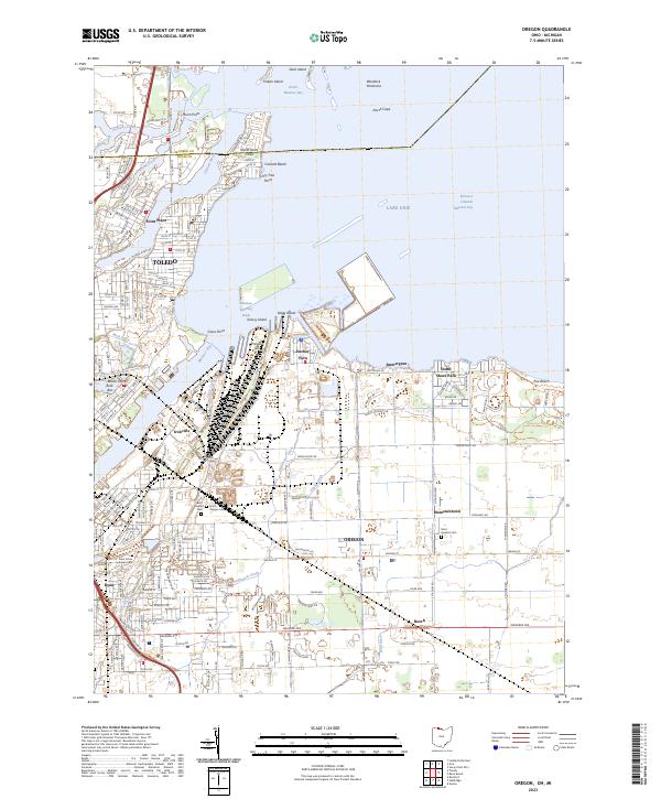 2023 Oregon2023 Print · USGSThe industrial shoreline of Lake Erie and the Maumee River are captured here in the early twenty-first century. Genealogists and local historians can trace family plots at Beth Shalom Cem or explore the waterfront layouts of Harbor View and Point Place.
End of results
Showing maps 1-13 of 13
Top cities near Lynpark Estates
- Toledo historical maps
- Bedford Township historical maps
- Perrysburg historical maps
- Oregon historical maps
- Sylvania historical maps
- Monroe Charter Township historical maps
See more
Frequently asked questions
- What are the different types of historical maps available for Lynpark Estates?
- What is the oldest map of Lynpark Estates?
- Where can I purchase historical maps of Lynpark Estates for my home or office?
- Where can I download high-res historical maps of Lynpark Estates?
- Are there historical topographic maps available for Lynpark Estates?
- Is there historical aerial imagery available for Lynpark Estates?
- Where are historical maps of Lynpark Estates sourced from?