Old Maps of Wadsworth, Ohio for Genealogy
Trace your family roots with 48 historic maps of Wadsworth. These high-res maps reveal old neighborhoods, homesites, landmarks, and streets — helping you uncover where your ancestors lived and how the area evolved over time.
- Explore historic neighborhoods: Identify where your relatives may have lived in the 1800s or 1900s.
- Compare maps over time: Trace the changes in streets, buildings, and landmarks for multi-generational research.
- Perfect for genealogy & ancestry research: Used by family historians and researchers to map out lineage and migration.
These maps are an incredible resource for exploring your personal connection to Wadsworth's past.
Wadsworth, OH maps
(48)- 1901 Map of Massillon, 1955 Print
 1901 Massillon1955 Print · USGSMassillon and the Tuscarawas valley thrive at the turn of the century as centers of canal transit and heavy rail industry. Local historians can trace the paths of the Ohio and Erie Canal, the massive Insane Asylum, and coal operations like the Turkeyfoot Mine.2 unique versions available
 - 1901 Map of Wooster, 1961 Print
 1901 Wooster1961 Print · USGSWayne County was a bustling corridor of rail and agriculture at the turn of the century, dominated by the growth of Wooster and Orrville. Researchers can trace historic institutions like Wooster University or locate the Mennonite Home and State Experiment Station.
 - 1903 Map of Massillon, 1934 Print
 1903 Massillon1934 Print · USGSNortheastern Ohio at the start of the century is a landscape of industrial growth and intricate canal-side settlements. Genealogists and historians can trace the early rail-and-water economy through features like the Ohio Canal, Turkeyfoot Mine, and the Insane Asylum.2 unique versions available
 - 1903 Map of Wooster, 1938 Print
 1903 Wooster1938 Print · USGSWayne County is shown at the height of its early rail-and-river economy, with every township and rural hamlet meticulously plotted. Researchers can trace historic landmarks like Wooster University, the Mennonite Home, and the State Experiment Station as they appeared just after the turn of the century.2 unique versions available
 - 1903 Map of Akron, 1961 Print
 1903 Akron1961 Print · USGSAkron and the surrounding Summit County townships were at a peak of rail and canal activity in the early 1900s. Trace the Ohio and Erie Canal locks, family-named crossroads like Osborn Corners, and local landmarks from Glendale Cemetery to the Boston Ledges.
 - 1904 Map of Medina, 1954 Print
 1904 Medina1954 Print · USGSMedina and its surrounding townships are captured in the early 1900s, showing a landscape defined by the intersection of early pikes and competing steam and electric railroads. Genealogists can trace family connections in vanished stops and crossroads like River Styx, Abbeyville, and Sherman Corners.2 unique versions available
 - 1905 Map of Akron
 1905 Akron1905 Print · USGSIn the first years of the twentieth century, the industrial corridor between Akron and Barberton was a hive of canal and rail activity. Trace the path of the Ohio Canal through Peninsula and locate early settlements like Ghent and Coddingville.7 unique versions available
 - 1906 Map of Medina, 1941 Print
 1906 Medina1941 Print · USGSIn Medina County at the dawn of the twentieth century, the rural landscape is a bustling network of electric rail lines and crossroads hamlets. Trace the early paths of the Cleveland Southwestern and Columbus Electric RR and find vanished rail stops like Lester or the community of River Styx.
 - 1950 Map of Cleveland
 1950 Cleveland1950 Print · USGSCovers Wadsworth, including Cleveland, Akron, and other nearby areas
 - 1951 Map of Canton
 1951 Canton1951 Print · USGSThe industrial heartland of Ohio and Pennsylvania reached its mid-century peak during this era of heavy rail and river transit. Genealogists and historians can trace the development of steel towns like Aliquippa and Weirton alongside the Ohio River and major lines of the Pennsylvania RR.
 - 1953 Map of Canton
 1953 Canton1953 Print · USGSThe industrial heartland of Ohio and Pennsylvania is captured at its mid-century peak in this detailed regional survey. Genealogists and historians can trace the vast rail networks of the Pennsylvania RR and find local landmarks like Nimisila Reservoir and Tappan Reservoir.
 - 1956 Map of Cleveland, 1967 Print
 1956 Cleveland1967 Print · USGSNortheast Ohio and Western Pennsylvania are shown at their industrial height during the mid-fifties, from the steel mills to the lakeshore. Researchers can trace the massive Ravenna Arsenal, the Ohio Turnpike, and vanished rail sidings of the B & O RR.3 unique versions available
 - 1957 Map of Canton, 1971 Print
 1957 Canton1971 Print · USGSThe industrial heartland of eastern Ohio and western Pennsylvania comes alive in this mid-century survey of the Ohio River Valley. Trace the heritage of rail and river commerce through Pittsburgh, the massive steel towns along the Ohio River, and major junctions on the Pennsylvania RR.3 unique versions available
 - 1958 Map of Wadsworth, 1959 Print
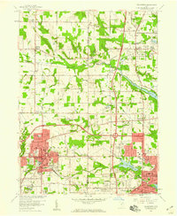 1958 Wadsworth1959 Print · USGSMedina and Summit Counties are captured here in the late fifties as residential growth begins to bridge the gaps between industrial hubs. Genealogists and local historians can trace family roots through Woodlawn Cemetery, Sharon Center, and neighborhood landmarks like Mt Zwingle Ch and Lincoln Sch.
 - 1958 Map of Doylestown, 1959 Print
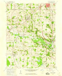 1958 Doylestown1959 Print · USGSDoylestown and the Tuscarawas River valley are shown in the late fifties at the intersection of four major rail lines. Researchers can trace rural lineages through numerous country landmarks like St Michaels Ch, Maple Grove Cem, and Harvey Sch.
 - 1961 Map of Seville, 1962 Print
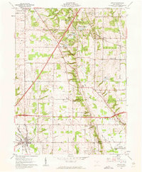 1961 Seville1962 Print · USGSMedina County during the early sixties shows the arrival of the interstate system through a landscape of historic Western Reserve townships. Genealogists can locate family sites near Mound Hill Cem or trace rural life through the Old Mennonite Ch and River Styx corridor.5 unique versions available
 - 1961 Map of Rittman, 1962 Print
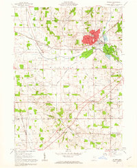 1961 Rittman1962 Print · USGSWayne County saw significant industrial salt extraction and rail development in the early sixties. Researchers can trace historic township boundaries and burial sites like Flickinger Cem or church locations such as Crown Hill Ch.3 unique versions available
 - 1962 Map of Canton
 1962 Canton1962 Print · USGSThe industrial heartland of Eastern Ohio and Western Pennsylvania thrives in the early sixties as steel mills and rail lines dominate the river valleys. Genealogists and historians can trace local landmarks like McKinley National Memorial, Malone College, and industrial sites such as Republic Steel Corp.2 unique versions available
 - 1962 Map of Cleveland
 1962 Cleveland1962 Print · USGSNortheast Ohio and the Pennsylvania borderlands appear here during the industrial peak of the early sixties. Genealogists and historians can trace the expansive rail lines of the Nickel Plate Road and the growth of suburbs from Parma to Lyndhurst.
 - 1969 Map of Wadsworth, 1971 Print
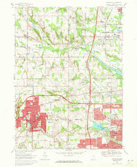 1969 Wadsworth1971 Print · USGSWestern Medina and Summit Counties are shown in the late sixties as suburban growth begins to merge old farming communities with industrial hubs. Researchers can trace the development of Wadsworth and Norton, locating vanished landmarks like the Drive-In Theater or long-standing sites like Sharon Center.2 unique versions available
 - 1969 Map of Doylestown, 1971 Print
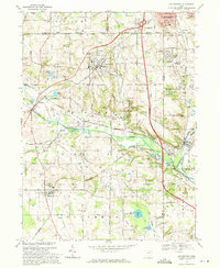 1969 Doylestown1971 Print · USGSNortheast Ohio's industrial and agricultural character is captured here during the late sixties as suburban growth reached toward Doylestown. Researchers can trace rural lineages through sites like Maple Grove Cem or locate the Harvey Sch and the Penn Central rail lines.2 unique versions available
 - 1986 Map of Canton
 1986 Canton1986 Print · USGSNortheastern Ohio’s industrial corridor and rural heartland are captured here in the mid-1980s as the region's rail and highway networks reached their modern form. Researchers can trace the layout of Canton and Massillon, locate family sites near West Lawn Cemetery, or explore the grounds of Malone College and Walsh College.2 unique versions available
 - 1986 Map of Cleveland South
 1986 Cleveland South1986 Print · USGSNortheast Ohio in the mid-eighties shows the expanding reach of the Akron and Cleveland suburbs into the surrounding countryside. Trace the industrial rail networks of the Erie Lackawanna RR or find local landmarks like Kent State University and the Ravenna Arsenal.
 - 1994 Map of Cleveland South
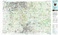 1994 Cleveland South1994 Print · USGSThe metropolitan corridor between Akron and Cleveland is shown here in the mid-nineties during a period of significant suburban growth. Researchers can trace the path of the Ohio Turnpike or explore expansive recreation lands like West Branch State Park.
 - 1994 Map of Wadsworth, 1997 Print
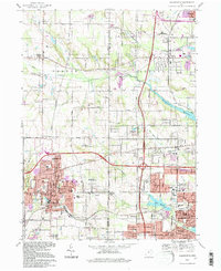 1994 Wadsworth1997 Print · USGSMedina and Summit counties show a complex transition from rural township life to suburban industrial hubs during the mid-nineties. Researchers can locate family landmarks like Woodlawn Cemetery, the historic Sharon Center Ch, and the old settlement of Western Star.
Showing maps 1-25 of 48
Top cities near Wadsworth
- Akron historical maps
- Cuyahoga Falls historical maps
- Brunswick historical maps
- Massillon historical maps
- Green historical maps
- Wooster historical maps
See more
Top neighborhoods of Wadsworth
Frequently asked questions
- What are the different types of historical maps available for Wadsworth?
- What is the oldest map of Wadsworth?
- Where can I purchase historical maps of Wadsworth for my home or office?
- Where can I download high-res historical maps of Wadsworth?
- Are there historical topographic maps available for Wadsworth?
- Is there historical aerial imagery available for Wadsworth?
- Where are historical maps of Wadsworth sourced from?