Old Maps of Ludlow Falls, Ohio for Academic Research
Study the evolution of Ludlow Falls with 21 high-resolution historic maps. Whether you're teaching, researching, or modeling changes in land use, these maps provide essential visual documentation of urban, environmental, and geographic change.
- Analyze long-term change: Track patterns in development, transportation, and natural features.
- Ideal for environmental or urban studies: Support academic projects with primary historical map data.
- Use in the classroom or lab: Educators and researchers rely on these maps to bring historical context to life.
These maps are a powerful tool for teaching, research, and visualizing how Ludlow Falls has changed over the decades.
Ludlow Falls, OH maps
(21)- 1905 Map of Brookville, 1953 Print
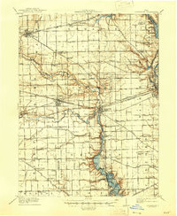
 1905 Brookville1953 Print · USGSWestern Montgomery County in the early 1900s shows a landscape of rail-connected farming towns and early river management. Trace the path of the historic National Road through Arlington or locate family sites near Shiloh Church and Harshbarger Schoolhouse.
 - 1911 Map of Covington, 1946 Print
 1911 Covington1946 Print · USGSWestern Ohio’s agricultural heartland is mapped here as a web of turnpikes and railroads connects thriving towns. Trace old family sites near Bradford, Gettysburg, and uniquely named rural landmarks like Lickskillet School or Cassels Corners.
 - 1944 Map of Covington
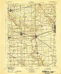 1944 Covington1944 Print · USGSWestern Ohio at the end of the Second World War remains a landscape of thriving rural rail towns and country schoolhouses. Researchers can trace the Stillwater River to find Greenville Falls, the Forest Hill Cem, and local landmarks like Tadpole Sch and Ludlow Falls.
 - 1953 Map of Cincinnati, 1965 Print
 1953 Cincinnati1965 Print · USGSThe Ohio River valley and the industrial heartland of Indiana and Ohio are captured here during the mid-century peak of rail and river commerce. Genealogists and historians can trace connections between Cincinnati and outlying military sites like Camp Atterbury and Bakalar AFB.3 unique versions available
 - 1953 Map of Muncie, 1966 Print
 1953 Muncie1966 Print · USGSIndiana and Ohio borderlands thrive in the early fifties, showing a landscape defined by manufacturing cities and an intensive railroad network. Genealogists can trace family roots across the Indiana-Ohio line through Muncie, Celina, and Portland via the Pennsylvania railroad.5 unique versions available
 - 1955 Map of West Milton, 1956 Print
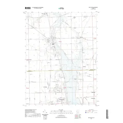
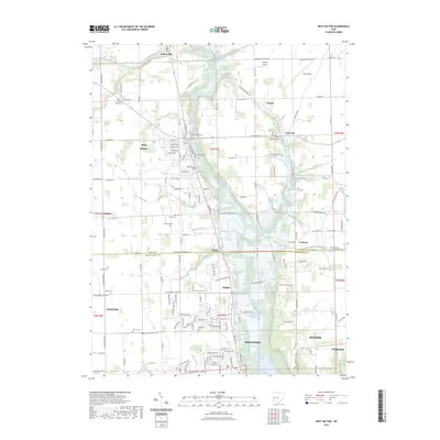
 1955 West Milton1956 Print · USGSMiami and Montgomery counties in the mid-fifties reveal a landscape of river-bend settlements and rural townships. Trace family roots at Wheelock Cem, locate the old Township Sch, or find the Drive-in Theater near the Stillwater River.5 unique versions available
 - 1956 Map of Muncie
 1956 Muncie1956 Print · USGSEastern Indiana and western Ohio are shown at a peak of rail-driven industry in the mid-fifties. Genealogists and rail historians can trace the paths of the Pennsylvania RR through Muncie or locate landmarks like Lake Saint Marys (Grand Lake Reservoir) and Frances Slocum State Forest.
 - 1957 Map of Cincinnati
 1957 Cincinnati1957 Print · USGSThe Ohio River valley and its surrounding highlands thrived during the mid-fifties industrial peak, centered on the bustling Cincinnati and Dayton metropolitan hubs. Researchers can trace the extensive rail networks and military sites like Wright-Patterson AFB and Camp Atterbury.
 - 1961 Map of Pleasant Hill, 1962 Print
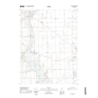
 1961 Pleasant Hill1962 Print · USGSMiami County at the start of the sixties reveals a landscape of thriving river towns and established family farms. Researchers can trace the ancestral connections between Pleasant Hill and Covington or locate specific sites like the Concord Township Sch and Old Union Cem.2 unique versions available
 - 1986 Map of Piqua
 1986 Piqua1986 Print · USGSThe western Ohio and eastern Indiana borderlands appear here in the mid-1980s, showcasing a landscape of river-valley industry and fertile plains. Researchers can trace historic rail lines like Conrail and Norfolk and Western through towns like Greenville and Winchester.3 unique versions available
 - 1986 Map of Dayton
 1986 Dayton1986 Print · USGSThe Miami Valley and the Indiana-Ohio borderlands reached a peak of suburban and industrial connectivity in the mid-eighties. Genealogists and historians can trace family burial sites at Miami Memorial Garden (Cem) and the development surrounding Wright-Patterson Air Force Base.2 unique versions available
 - 2010 Map of West Milton, 2010 Print
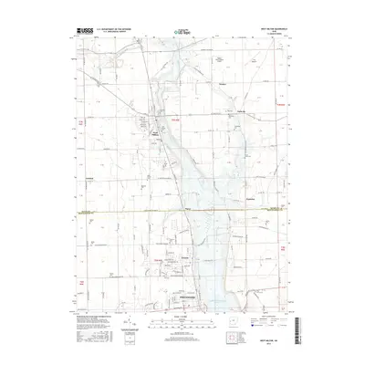
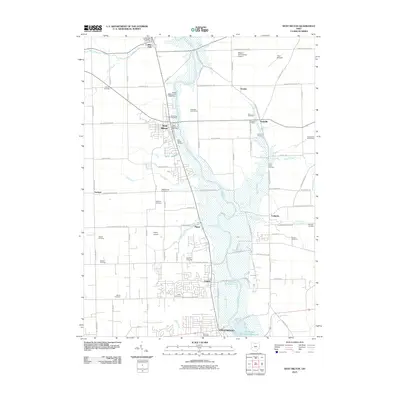 2010 West Milton2010 Print · USGSCovers Ludlow Falls, including Dayton, Vandalia, and other nearby areas
 - 2010 Map of Pleasant Hill, 2010 Print
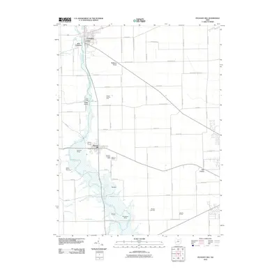 2010 Pleasant Hill2010 Print · USGSCovers Ludlow Falls, including Troy, Piqua, and other nearby areas
 - 2013 Map of West Milton, 2013 Print
 2013 West Milton2013 Print · USGSCovers Ludlow Falls, including Dayton, Vandalia, and other nearby areas
 - 2013 Map of Pleasant Hill, 2013 Print
 2013 Pleasant Hill2013 Print · USGSCovers Ludlow Falls, including Troy, Piqua, and other nearby areas
 - 2016 Map of West Milton, 2016 Print
 2016 West Milton2016 Print · USGSCovers Ludlow Falls, including Dayton, Vandalia, and other nearby areas
 - 2016 Map of Pleasant Hill, 2016 Print
 2016 Pleasant Hill2016 Print · USGSCovers Ludlow Falls, including Troy, Piqua, and other nearby areas
 - 2019 Map of West Milton, 2019 Print
 2019 West Milton2019 Print · USGSCovers Ludlow Falls, including Dayton, Vandalia, and other nearby areas
 - 2019 Map of Pleasant Hill, 2019 Print
 2019 Pleasant Hill2019 Print · USGSCovers Ludlow Falls, including Troy, Piqua, and other nearby areas
 - 2023 Map of Pleasant Hill, 2023 Print
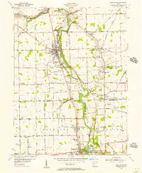
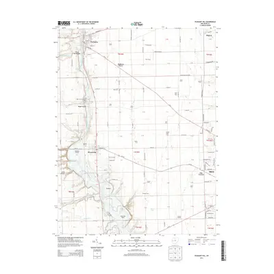
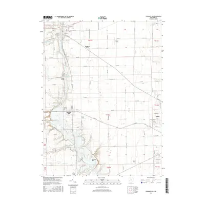
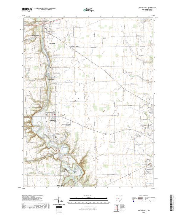 2023 Pleasant Hill2023 Print · USGSMiami County's river-carved landscape is documented here in the early twenty-first century, showing the enduring agricultural and village patterns of the Stillwater Valley. Researchers can locate family sites and landmarks like Pleasant Hill Cem, Sugar Grove, and the distinctive Horseshoe Bend.
 - 2023 Map of West Milton, 2023 Print
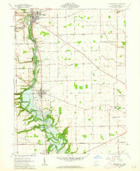
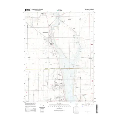
 2023 West Milton2023 Print · USGSThe Stillwater River valley in Miami County is seen here in a modern survey of its long-established towns and family farms. Researchers can trace ancestral roots at several local burial sites, including Old Milton Cem, Riverside Cem, and Curtis Union Cem.
End of results
Showing maps 1-21 of 21
Top cities near Ludlow Falls
- Dayton historical maps
- Huber Heights historical maps
- Trotwood historical maps
- Riverside historical maps
- Troy historical maps
- Piqua historical maps
See more
Frequently asked questions
- What are the different types of historical maps available for Ludlow Falls?
- What is the oldest map of Ludlow Falls?
- Where can I purchase historical maps of Ludlow Falls for my home or office?
- Where can I download high-res historical maps of Ludlow Falls?
- Are there historical topographic maps available for Ludlow Falls?
- Is there historical aerial imagery available for Ludlow Falls?
- Where are historical maps of Ludlow Falls sourced from?