Old Maps of Salem Township, Ohio
Explore 35 old maps of Salem Township, spanning from 1905 to today. These high-resolution historic maps reveal how streets, neighborhoods, landmarks, and natural features evolved over time — perfect for genealogy, metal detecting, research, and local history exploration.
What you can do with these maps:
- See how Salem Township changed over time: Compare historical maps to modern-day views to trace roads, homesites, rail lines & more.
- View detailed metadata: Each map includes creators, publishers, year, scale, and archive source.
- Overlay maps with satellite & LiDAR: Visualize the past alongside modern tools to explore terrain & human change.
- Trusted historical sources: Maps sourced from the USGS, Library of Congress, and other archives.
- Access maps your way: View online, download high-res files, or order prints for personal or research use.
Start exploring old maps of Salem Township to uncover forgotten places, hidden landmarks, and the deep history beneath your feet.
Salem Township, OH maps
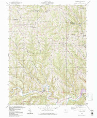
(35)- 1905 Map of Clarington, 1913 Print
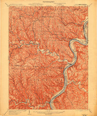 1905 Clarington1913 Print · USGSThe Ohio River valley at the turn of the century shows a bustling corridor of coal mining and rail transport between Ohio and West Virginia. Genealogists can locate family homesteads near Armstrongs Mills, Powhatan Point, and several rural post offices like Welcome P.O.
 - 1906 Map of New Martinsville
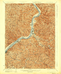
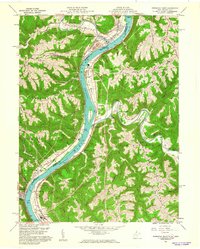
 1906 New Martinsville1906 Print · USGSThe Ohio River valley at the turn of the century shows a landscape of busy rail lines and riverside towns. You can trace the Baltimore and Ohio railroad through Sistersville or locate early industrial sites like Winders Mill and Porters Falls.2 unique versions available
 - 1924 Map of New Martinsville, 1956 Print
 1924 New Martinsville1956 Print · USGSThe Ohio River valley in the early twenties reveals a landscape of busy rail corridors and riverfront towns. Genealogists can locate family names and rural landmarks from Winders Mill to dozens of country schoolhouses like Democracy School and Wayne School.2 unique versions available
 - 1926 Map of New Martinsville
 1926 New Martinsville1926 Print · USGSThe Ohio River valley in the mid-1920s reveals a bustling corridor of rail and river commerce connecting New Martinsville and Sistersville. Genealogists can trace hundreds of rural landmarks, from the County Infirmary to isolated hill schools like Rothlisberger School and Sugar Valley School.2 unique versions available
 - 1935 Map of Clarington, 1957 Print
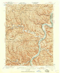 1935 Clarington1957 Print · USGSThe Ohio River valley during the mid-1930s reveals a landscape of ridge-top schools and creek-side coal works. Genealogists can locate family landmarks like McLain Chapel, Centerville Demos P.O., and the Woodland Hill Sch.2 unique versions available
 - 1940 Map of Clarington
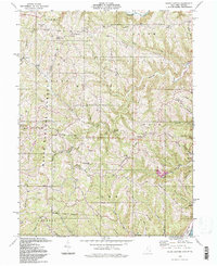
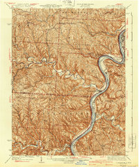 1940 Clarington1940 Print · USGSThe Ohio River borderlands between Belmont, Monroe, and Marshall counties are captured here just before the mid-century industrial shift. Genealogists can trace family names and small-town roots at Armstrongs Mills, McLain Chapel, and many rural schoolhouses like Mt Hobart Sch.
 - 1949 Map of Clarksburg
 1949 Clarksburg1949 Print · USGSThe upper Ohio River valley and the industrial heart of West Virginia come into focus during this post-war period. Genealogists and researchers can trace the rail corridors of the Baltimore and Ohio and locate centers like Fairmont, Grafton, and Waynesburg.
 - 1956 Map of Clarksburg, 1966 Print
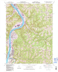
 1956 Clarksburg1966 Print · USGSThe Ohio River valley and the industrial heart of West Virginia are seen here in the mid-1950s as rail and river commerce thrived. Researchers can trace historic transport lines like the Baltimore and Ohio RR and locate ancestral homes in Clarksburg, Moundsville, or Parkersburg.2 unique versions available
 - 1960 Map of Powhatan Point, 1961 Print
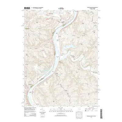
 1960 Powhatan Point1961 Print · USGSThe Ohio River valley at the start of the 1960s shows a landscape of industrial growth and rail transit. Trace the river-and-rail economy through Powhatan Point, Natrium, and the facilities at Lock No. 14.5 unique versions available
 - 1960 Map of Round Bottom, 1962 Print
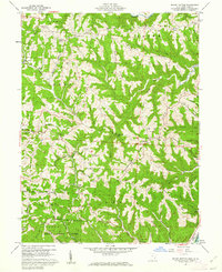 1960 Round Bottom1962 Print · USGSThe Ohio River hills of Monroe County are shown here in the early sixties, a landscape of ridge-top farms and river towns. Researchers can trace family history through sites like Winklers Mill, Emma Grove Cem, and the interior settlement of Round Bottom.4 unique versions available
 - 1960 Map of New Martinsville, 1962 Print
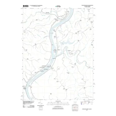
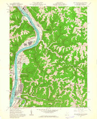 1960 New Martinsville1962 Print · USGSThe industrial and river life of the Ohio Valley is captured here at the start of the 1960s, centered on the growing hub of New Martinsville. Genealogists and historians can trace the B & O rail lines, old schools like Steelton Sch, and numerous family-named landmarks from Wells Bottom to Schupbach Ridge.4 unique versions available
 - 1960 Map of Cameron, 1962 Print
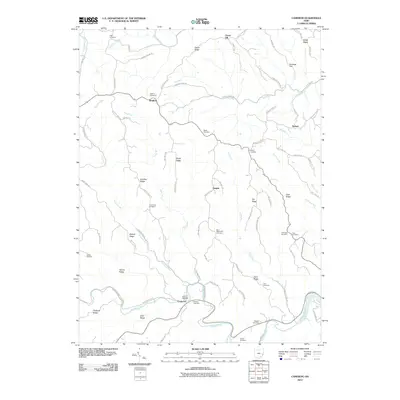
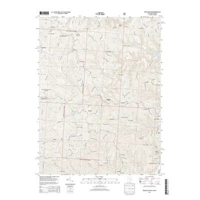
 1960 Cameron1962 Print · USGSMonroe County in the early sixties remains a landscape of high ridges and deep hollows where rural life followed the contours of the land. Genealogists and historians can trace family roots at Pugh Cem, find the rural crossroads of Cameron, and locate old landmarks like Zion Ch.4 unique versions available
 - 1961 Map of Clarksburg
 1961 Clarksburg1961 Print · USGSThe mid-century industrial and river landscapes of West Virginia and Ohio are detailed here, centered on the Ohio River. Researchers can trace the Baltimore and Ohio rail lines connecting towns like Parkersburg, Clarksburg, and Monongah.
 - 1984 Map of Moundsville
 1984 Moundsville1984 Print · USGSThe Ohio River valley and the Appalachian interior meet in the mid-eighties as a hub of rail and river commerce. Genealogists and historians can trace the development of river towns like New Martinsville, inland hubs like Waynesburg, and the path of the B & O RR.
 - 1988 Map of Clarksburg, 1989 Print
 1988 Clarksburg1989 Print · USGSThe central Appalachians are documented in detail during the late eighties, showing the industrial and river-based economies of West Virginia, Ohio, and Pennsylvania. Researchers can trace historic rail routes like the B & O RR and locate river towns from St Marys to Parkersburg.
 - 1994 Map of Cameron, 1998 Print
 1994 Cameron1998 Print · USGSMonroe County’s high ridges and deep hollows are captured here in the late twentieth century, showing a landscape of persistent rural settlements. Genealogists can locate family-named landmarks like Pugh Ridge and old meeting houses such as Captain Ch or Mellott Ridge Ch.
 - 1994 Map of Round Bottom, 1998 Print
 1994 Round Bottom1998 Print · USGSThe wooded ridges of Monroe County are shown here in the mid-1990s, where the Wayne National Forest meets the riverside towns of Hannibal and Sardis. Genealogists and historians can trace numerous rural landmarks, from Chapel Hill Ch to the McIntire Cem and the small settlement at Round Bottom.
 - 1994 Map of New Martinsville, 1998 Print
 1994 New Martinsville1998 Print · USGSThe riverfront communities of Wetzel County were still thriving industrial centers when this mid-nineties survey was conducted. Local researchers can trace family landmarks and civic history through sites like the County Infirmary, Steelton Sch, and Palestine Ch.
 - 2002 Map of Round Bottom, 2006 Print
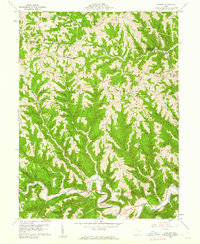
 2002 Round Bottom2006 Print · USGSThe riverfront communities of Monroe County thrive along the Ohio River at the start of the twenty-first century. Genealogists and historians can trace numerous rural landmarks like Winklers Mill, Chapel Hill Ch, and the Emma Grove Cem.
 - 2010 Map of Cameron, 2010 Print
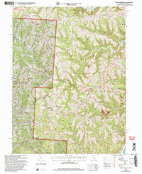
 2010 Cameron2010 Print · USGSCovers Salem Township, including Clarington, Clover Hill, and other nearby areas
 - 2011 Map of Powhatan Point, 2011 Print
 2011 Powhatan Point2011 Print · USGSCovers Salem Township, including Powhatan Point, Clarington, and other nearby areas
 - 2011 Map of Round Bottom, 2011 Print
 2011 Round Bottom2011 Print · USGSCovers Salem Township, including Green Township, Oak, and other nearby areas
 - 2013 Map of Cameron, 2013 Print
 2013 Cameron2013 Print · USGSCovers Salem Township, including Clarington, Clover Hill, and other nearby areas
 - 2013 Map of Powhatan Point, 2013 Print
 2013 Powhatan Point2013 Print · USGSCovers Salem Township, including Powhatan Point, Clarington, and other nearby areas
 - 2013 Map of Round Bottom, 2013 Print
 2013 Round Bottom2013 Print · USGSCovers Salem Township, including Green Township, Oak, and other nearby areas
Showing maps 1-25 of 35
Top cities near Salem Township
- Moundsville historical maps
- New Martinsville historical maps
- Shadyside historical maps
- Woodsfield historical maps
- McMechen historical maps
- Glen Dale historical maps
See more
Top neighborhoods of Salem Township
Frequently asked questions
- What are the different types of historical maps available for Salem Township?
- What is the oldest map of Salem Township?
- Where can I purchase historical maps of Salem Township for my home or office?
- Where can I download high-res historical maps of Salem Township?
- Are there historical topographic maps available for Salem Township?
- Is there historical aerial imagery available for Salem Township?
- Where are historical maps of Salem Township sourced from?