Loading...
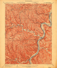
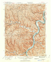
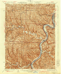
Loading map...1905 Map of Clarington
USGS Topo · Published 1913About this map
Industrial activity along the Ohio River defines this riverbank landscape at the start of the twentieth century, where the Captina Coal Works marks the intersection of mineral extraction and heavy transport. The Baltimore and Ohio West Virginia railroad traces the eastern bank through Marshall Co, while the Ohio River Division and the Cleve and Pitts Div lines service the Ohio side.
Find a feature on this map
81 named features on this map. Tap any name to fly to it.
Don’t see what you’re looking for? This feature index may not catch every label — zoom into the map to look around manually.
Map Details
Date Portrayed1905
Date Published1913
PublisherU.S. Geological Survey
Map TypeTopographic
Scale1:62,500
Physical Dimensions16.5 x 19.7 inches
Editions of this 1905 Clarington Map
This is the sole edition of this map. No revisions or reprints were ever made.
Historical Maps of Moundsville Through Time
3 maps found
Featured Locations
Source Details
SourceU.S. Geological Survey
CopyrightPublic Domain