
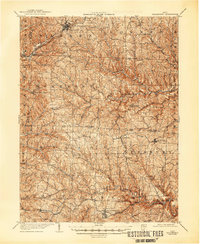
1905 Map of Woodsfield
USGS Topo · Published 1946About this map
Woodsfield serves as the focal point for this 1903 survey of southeastern Ohio, an area defined by deep drainage basins and a dense network of small agricultural and postal settlements. The Baltimore and Ohio RR cuts through the northern section, connecting Barnesville and Tacoma to the larger regional economy. This era reveals the importance of rural post offices as community hubs, visible at Boston Atlas P.O. and Newcastle Pilcher P.O.. The landscape is carved by numerous waterways including Sunfish Creek and the various forks of Captina Creek, which dictated the placement of early roads and homesteads. Local naming traditions are preserved in features like Cat Hollow and Dog Hollow, providing a look at the cultural geography of Monroe and Belmont counties during the early twentieth century.
Find a feature on this map
63 named features on this map. Tap any name to fly to it.
Don’t see what you’re looking for? This feature index may not catch every label — zoom into the map to look around manually.
Map Details
Editions of this 1905 Woodsfield Map
2 editions found
Other maps of this area

1903 · Macksburg
USGS Topo · 1:62,500

1903 · Flushing
USGS Topo · 1:62,500

1905 · Clarington
USGS Topo · 1:62,500

1905 · New Matamoras
USGS Topo · 1:62,500

1905 · St. Clairsville
USGS Topo · 1:62,500

1905 · Flushing
USGS Topo · 1:62,500

1905 · Macksburg
USGS Topo · 1:62,500

1906 · New Martinsville
USGS Topo · 1:62,500

1909 · Antrim
USGS Topo · 1:48,000

1909 · Summerfield
USGS Topo · 1:62,500