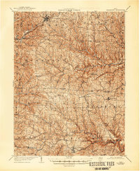
1905 Map of Woodsfield
USGS Topo · Published 1946About this map
Woodsfield serves as the focal point of this 1903 survey, anchoring a network of small agricultural and mail-stop settlements across Monroe and Belmont Counties. The landscape is defined by the sharp dendritic drainage of Sunfish Creek and the Seneca Fork Wills Creek, which dictated the placement of early ridgeside roads and scattered farmsteads. To the north, the Baltimore and Ohio RR cuts through Barnesville and Tacoma, providing a vital industrial link for the region's produce and commerce.
Find a feature on this map
48 named features on this map. Tap any name to fly to it.
Don’t see what you’re looking for? This feature index may not catch every label — zoom into the map to look around manually.
Map Details
Editions of this 1905 Woodsfield Map
2 editions found
Other maps of this area

1903 · Macksburg
USGS Topo · 1:62,500

1903 · Flushing
USGS Topo · 1:62,500

1905 · Clarington
USGS Topo · 1:62,500

1905 · New Matamoras
USGS Topo · 1:62,500

1905 · St. Clairsville
USGS Topo · 1:62,500

1905 · Woodsfield
USGS Topo · 1:62,500

1905 · Flushing
USGS Topo · 1:62,500

1905 · Macksburg
USGS Topo · 1:62,500

1906 · New Martinsville
USGS Topo · 1:62,500

1909 · Antrim
USGS Topo · 1:48,000