Old Maps of Zanesville, Ohio
Explore 21 old maps of Zanesville, spanning from 1910 to today. These high-resolution historic maps reveal how streets, neighborhoods, landmarks, and natural features evolved over time — perfect for genealogy, metal detecting, research, and local history exploration.
What you can do with these maps:
- See how Zanesville changed over time: Compare historical maps to modern-day views to trace roads, homesites, rail lines & more.
- View detailed metadata: Each map includes creators, publishers, year, scale, and archive source.
- Overlay maps with satellite & LiDAR: Visualize the past alongside modern tools to explore terrain & human change.
- Trusted historical sources: Maps sourced from the USGS, Library of Congress, and other archives.
- Access maps your way: View online, download high-res files, or order prints for personal or research use.
Start exploring old maps of Zanesville to uncover forgotten places, hidden landmarks, and the deep history beneath your feet.
Zanesville, OH maps
(21)- 1910 Map of Frazeysburg, 1937 Print
 1910 Frazeysburg1937 Print · USGSCovers Zanesville, including Dresden, Frazeysburg, and other nearby areas2 unique versions available
 - 1910 Map of Philo, 1938 Print
 1910 Philo1938 Print · USGSCovers Zanesville, including New Concord, Brush Creek, and other nearby areas2 unique versions available
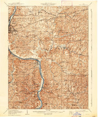
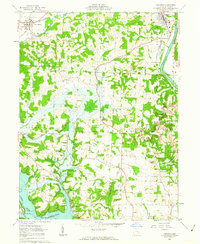
 - 1910 Map of Zanesville, 1939 Print
 1910 Zanesville1939 Print · USGSCovers Zanesville, including Hopewell, Crooksville, and other nearby areas2 unique versions available
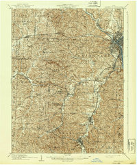
 - 1947 Map of Columbus, 1948 Print
 1947 Columbus1948 Print · USGSCovers Zanesville, including Columbus, Springfield, and other nearby areas
 - 1949 Map of Clarksburg
 1949 Clarksburg1949 Print · USGSCovers Zanesville, including Parkersburg, Fairmont, and other nearby areas
 - 1950 Map of Marion
 1950 Marion1950 Print · USGSCovers Zanesville, including Columbus, Newark, and other nearby areas
 - 1956 Map of Clarksburg, 1966 Print
 1956 Clarksburg1966 Print · USGSCovers Zanesville, including Parkersburg, Fairmont, and other nearby areas2 unique versions available
 - 1961 Map of Columbus
 1961 Columbus1961 Print · USGSCovers Zanesville, including Columbus, Springfield, and other nearby areas
 - 1961 Map of Clarksburg
 1961 Clarksburg1961 Print · USGSCovers Zanesville, including Parkersburg, Fairmont, and other nearby areas
 - 1961 Map of Zanesville West, 1962 Print
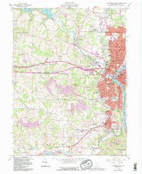
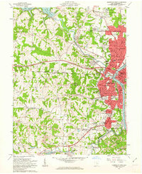 1961 Zanesville West1962 Print · USGSCovers Zanesville, including South Zanesville, Dillon Falls, and other nearby areas4 unique versions available
 - 1961 Map of Zanesville East, 1963 Print
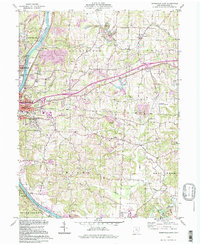
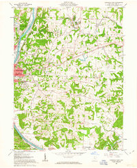 1961 Zanesville East1963 Print · USGSCovers Zanesville, including Riverview, Pleasant Grove, and other nearby areas5 unique versions available
 - 1962 Map of Columbus
 1962 Columbus1962 Print · USGSCovers Zanesville, including Columbus, Springfield, and other nearby areas
 - 1962 Map of Marion
 1962 Marion1962 Print · USGSCovers Zanesville, including Columbus, Newark, and other nearby areas
 - 1962 Map of Dresden, 1963 Print
 1962 Dresden1963 Print · USGSCovers Zanesville, including Dresden, Frazeysburg, and other nearby areas4 unique versions available
 - 1966 Map of Marion, 1968 Print
 1966 Marion1968 Print · USGSCovers Zanesville, including Columbus, Newark, and other nearby areas3 unique versions available
 - 1967 Map of Columbus, 1969 Print
 1967 Columbus1969 Print · USGSCovers Zanesville, including Columbus, Springfield, and other nearby areas2 unique versions available
 - 1980 Map of Senecaville, 1983 Print
 1980 Senecaville1983 Print · USGSCovers Zanesville, including Cambridge, Barnesville, and other nearby areas2 unique versions available
 - 1984 Map of Lancaster, 1985 Print
 1984 Lancaster1985 Print · USGSCovers Zanesville, including Columbus, Lancaster, and other nearby areas
 - 1988 Map of Clarksburg, 1989 Print
 1988 Clarksburg1989 Print · USGSCovers Zanesville, including Parkersburg, Fairmont, and other nearby areas
 - 1992 Map of Zanesville West, 1995 Print
 1992 Zanesville West1995 Print · USGSCovers Zanesville, including South Zanesville, Dillon Falls, and other nearby areas
 - 1994 Map of Zanesville East, 1998 Print
 1994 Zanesville East1998 Print · USGSCovers Zanesville, including Riverview, Pleasant Grove, and other nearby areas
End of results
Showing maps 1-21 of 21
Top cities near Zanesville
- Hopewell historical maps
- Crooksville historical maps
- South Zanesville historical maps
- Dresden historical maps
- Brush Creek historical maps
- Frazeysburg historical maps
See more
Top neighborhoods of Zanesville
- Brighton historical maps
- Putnam historical maps
- Fairmont Avenue Historic District historical maps
- Kensington Village historical maps
- McIntire Terrace Historic District historical maps
- Putnam Historic District historical maps
See more
Frequently asked questions
- What are the different types of historical maps available for Zanesville?
- What is the oldest map of Zanesville?
- Where can I purchase historical maps of Zanesville for my home or office?
- Where can I download high-res historical maps of Zanesville?
- Are there historical topographic maps available for Zanesville?
- Is there historical aerial imagery available for Zanesville?
- Where are historical maps of Zanesville sourced from?