Old Maps of Zanesville, Ohio for Metal Detecting
Plan your next treasure hunt with 36 historic maps of Zanesville. Find old homesites, ghost towns, trails, and gathering spots that may be lost to time — perfect for identifying promising metal detecting locations.
- Locate forgotten sites: Uncover places like long-lost settlements, abandoned rail lines, or gathering spots.
- Plan better hunts: Use map overlays combined with LiDAR or satellite views to narrow in on historically rich areas.
- Made for detectorists: Thousands of hobbyists use these maps to discover relics, coins, and hidden history.
Use these historic maps to boost your research and find new opportunities beneath the surface of Zanesville.
Zanesville, OH maps
(36)- 1910 Map of Frazeysburg, 1937 Print
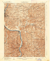
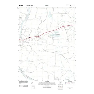
 1910 Frazeysburg1937 Print · USGSMuskingum and Licking Counties are captured here during a pivotal era of rail dominance and canal obsolescence. Researchers can locate vanished rural schoolhouses like Pisgah School or trace the early paths of the Ohio Canal near Dresden.2 unique versions available
 - 1910 Map of Philo, 1938 Print
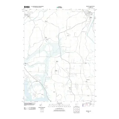
 1910 Philo1938 Print · USGSThe Muskingum River valley was a bustling corridor of rail and river commerce at the turn of the century. Genealogists can locate dozens of country schoolhouses like Toadtown School and Sleepy Hollow School, or trace family roots near Taylorsville and the National Road.2 unique versions available
 - 1910 Map of Zanesville, 1939 Print
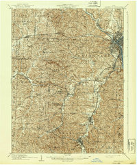 1910 Zanesville1939 Print · USGSMuskingum and Perry counties are shown here in the early twentieth century as Zanesville emerged as a powerhouse of rail and river commerce. Researchers can trace historic transport routes like the National Road or locate local landmarks such as Moxahala Park and the Fultonham (Axline PO).2 unique versions available
 - 1947 Map of Columbus, 1948 Print
 1947 Columbus1948 Print · USGSCentral Ohio in the late 1940s is captured in this survey, showing the post-war transition of its rail hubs and military airfield expansions. Genealogists and historians can trace the paths of the Ohio Canal, the Pennsylvania RR lines, and the Camp Sherman Military Reservation.
 - 1949 Map of Clarksburg
 1949 Clarksburg1949 Print · USGSThe upper Ohio River valley and the industrial heart of West Virginia come into focus during this post-war period. Genealogists and researchers can trace the rail corridors of the Baltimore and Ohio and locate centers like Fairmont, Grafton, and Waynesburg.
 - 1950 Map of Marion
 1950 Marion1950 Print · USGSCentral Ohio was a powerhouse of rail and river industry at the mid-century point, serving as a vital corridor between the Great Lakes and the Ohio River valley. Genealogists and rail historians can trace the paths of the Erie RR and Nickel Plate Road through towns like Bucyrus, Galion, and Upper Sandusky.
 - 1956 Map of Clarksburg, 1966 Print
 1956 Clarksburg1966 Print · USGSThe Ohio River valley and the industrial heart of West Virginia are seen here in the mid-1950s as rail and river commerce thrived. Researchers can trace historic transport lines like the Baltimore and Ohio RR and locate ancestral homes in Clarksburg, Moundsville, or Parkersburg.2 unique versions available
 - 1961 Map of Columbus
 1961 Columbus1961 Print · USGSCentral and Southern Ohio are captured here in the early sixties, as the region's industrial rail hubs and military bases reached their peak. Genealogists and historians can trace the transition from urban Columbus to rural townships along the Scioto River, locating Lockbourne USAF and old junctions like Washington Court House.
 - 1961 Map of Clarksburg
 1961 Clarksburg1961 Print · USGSThe mid-century industrial and river landscapes of West Virginia and Ohio are detailed here, centered on the Ohio River. Researchers can trace the Baltimore and Ohio rail lines connecting towns like Parkersburg, Clarksburg, and Monongah.
 - 1961 Map of Zanesville West, 1962 Print
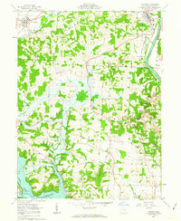
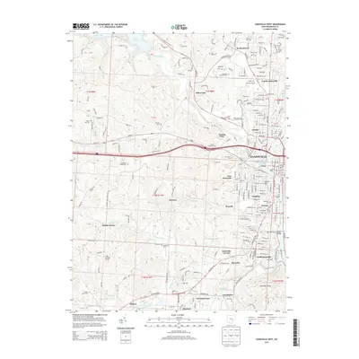
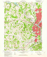 1961 Zanesville West1962 Print · USGSZanesville and its river valleys are captured here in the early sixties as the city expanded alongside its industrial and rail hubs. Researchers can trace local lineage through numerous burial grounds like United Jewish Cem or explore the New York Central rail lines and early Strip Mine sites.4 unique versions available
 - 1961 Map of Zanesville East, 1963 Print
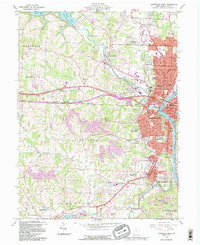
 1961 Zanesville East1963 Print · USGSMuskingum County at the start of the sixties reveals a landscape of river-valley industry and expanding coal works. Genealogists and historians can trace rail-side neighborhoods near North Zanesville or locate rural landmarks like Rural Chapel and the Paul Mine.5 unique versions available
 - 1962 Map of Columbus
 1962 Columbus1962 Print · USGSCentral Ohio during the early sixties reveals a transition from the industrial corridors of Columbus to the forested ridges of the south. Genealogists and historians can trace the rail networks of the Baltimore & Ohio RR and find local landmarks like Washington Court House and Camp Sherman Military Reservation.
 - 1962 Map of Marion
 1962 Marion1962 Print · USGSCentral Ohio during the post-war era showcases a dense network of railroad towns and emerging interstate highways. Genealogists can trace family roots in smaller settlements like Houcktown and Marseilles or locate landmarks near Indian Lake.
 - 1962 Map of Dresden, 1963 Print
 1962 Dresden1963 Print · USGSThe Muskingum and Licking river valleys are captured here in the early sixties as new water projects and industry reshaped the terrain. Trace local history at Dresden or search for family roots at Irville-Nashport Cem, Nashport Sch, and Shannon.4 unique versions available
 - 1966 Map of Marion, 1968 Print
 1966 Marion1968 Print · USGSCentral Ohio in the mid-sixties is captured during a period of rapid highway expansion and industrial connectivity. Genealogists and historians can trace rail-and-river networks through towns like Marion, Urbana, and Mount Vernon, or locate landmarks such as Malabar Farm and Black Hand Rock.3 unique versions available
 - 1967 Map of Columbus, 1969 Print
 1967 Columbus1969 Print · USGSCentral Ohio during the late sixties serves as a vital corridor of rail and aviation, from the industrial streets of Springfield to the hangar lines of Lockbourne Air Force Base. Genealogists and researchers can trace the growth of towns like Circleville and London or locate rural landmarks such as St Paul church and the London Correctional Institution.2 unique versions available
 - 1980 Map of Senecaville, 1983 Print
 1980 Senecaville1983 Print · USGSEastern Ohio at the start of the eighties reveals a complex landscape of coal extraction and river commerce. Genealogists and historians can trace rail lines like the Conrail and Baltimore and Ohio RR connecting towns like Byesville and Woodsfield.2 unique versions available
 - 1984 Map of Lancaster, 1985 Print
 1984 Lancaster1985 Print · USGSCentral Ohio and the Hocking Valley come into focus during the mid-eighties as suburban growth meets the wooded ridges of the southeast. Researchers can trace transportation networks through Buckeye Lake or locate landmarks like Flint Ridge State Memorial and Moxahala Park.
 - 1988 Map of Clarksburg, 1989 Print
 1988 Clarksburg1989 Print · USGSThe central Appalachians are documented in detail during the late eighties, showing the industrial and river-based economies of West Virginia, Ohio, and Pennsylvania. Researchers can trace historic rail routes like the B & O RR and locate river towns from St Marys to Parkersburg.
 - 1992 Map of Zanesville West, 1995 Print
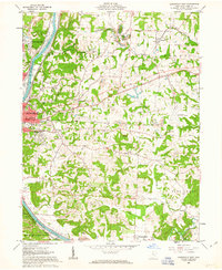
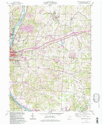
 1992 Zanesville West1995 Print · USGSZanesville and the Muskingum River valley are shown in the early nineties, documenting the city's growth and its industrial periphery. Researchers can locate numerous family landmarks like Wesley Union Cem, Williams Cem, and schools such as Norval Park Sch.
 - 1994 Map of Zanesville East, 1998 Print
 1994 Zanesville East1998 Print · USGSZanesville and the Muskingum River valley appear here in the mid-1990s as a landscape of industry and community. Genealogists can trace family names at Greenwood Cemetery or Bowers Cem and locate vanished rural schoolhouses like Monroe Sch.
 - 2010 Map of Zanesville West, 2010 Print
 2010 Zanesville West2010 Print · USGSCovers Zanesville, including South Zanesville, Darlington, and other nearby areas
 - 2010 Map of Zanesville East, 2010 Print
 2010 Zanesville East2010 Print · USGSCovers Zanesville, including Pleasant Grove, Georgetown, and other nearby areas
 - 2010 Map of Dresden, 2010 Print
 2010 Dresden2010 Print · USGSCovers Zanesville, including Dresden, Frazeysburg, and other nearby areas
 - 2013 Map of Zanesville West, 2013 Print
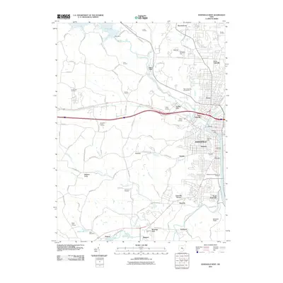
 2013 Zanesville West2013 Print · USGSCovers Zanesville, including South Zanesville, Darlington, and other nearby areas
Showing maps 1-25 of 36
Top cities near Zanesville
- Hopewell historical maps
- Crooksville historical maps
- South Zanesville historical maps
- Dresden historical maps
- Brush Creek historical maps
- Frazeysburg historical maps
See more
Top neighborhoods of Zanesville
- Putnam historical maps
- Brighton historical maps
- Fairmont Avenue Historic District historical maps
- McIntire Terrace Historic District historical maps
- Putnam Historic District historical maps
- The Village at Joe's Run historical maps
See more
Frequently asked questions
- What are the different types of historical maps available for Zanesville?
- What is the oldest map of Zanesville?
- Where can I purchase historical maps of Zanesville for my home or office?
- Where can I download high-res historical maps of Zanesville?
- Are there historical topographic maps available for Zanesville?
- Is there historical aerial imagery available for Zanesville?
- Where are historical maps of Zanesville sourced from?