2020s Maps of Charlestown Township, Ohio
Explore 2 historic maps of Charlestown Township from the 2020s. These maps offer a rare glimpse into what life looked like during the 2020s — showing old roads, neighborhoods, homes, and landmarks that have changed or disappeared over time.
Whether you're researching your family's past, planning a metal detecting trip, or studying how Charlestown Township's landscape evolved across the 2020s, these high-resolution maps are a powerful tool for exploring the history of this region.
- Focus on a specific era: All maps on this page are from the 2020s, giving you a focused view of this time period.
- See what’s changed: Compare century-old streets, trails, and buildings to today's modern landscape using overlays and satellite layers.
- Research with precision: Use these maps for genealogy, historical research, land use analysis, or educational projects.
- View, download, or print: Maps are fully viewable online in high resolution, and can be downloaded or printed for your own records.
Start exploring Charlestown Township's history through authentic maps from the 2020s. This is your window into the past.
Charlestown Township, OH maps
(2)- 2023 Map of Ravenna, 2023 Print
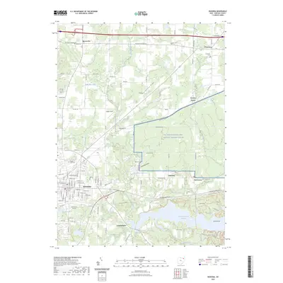 2023 Ravenna2023 Print · USGSPortage County, Ohio, is shown in modern detail as the city of Ravenna transitions from its historic town center into vast military and conservation lands. Genealogists and local historians can trace burial sites like Maple Grove Cem and explore the geography around the Michael J Kirwan Reservoir.
 - 2023 Map of Windham, 2023 Print
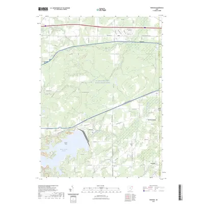 2023 Windham2023 Print · USGSPortage County in the 2020s is defined by the massive NG Camp Ravenna and the waters of the Michael J Kirwan Reservoir. Genealogists can trace family burial sites at Saint Josephs Cem and Welsh Cem near the old crossroads of McClintocksburg.
End of results
Showing maps 1-2 of 2
Top cities near Charlestown Township
- Kent historical maps
- Streetsboro historical maps
- Aurora historical maps
- Ravenna historical maps
- Newton historical maps
- Newton Township historical maps
See more
Top neighborhoods of Charlestown Township
Frequently asked questions
- What are the different types of historical maps available for Charlestown Township?
- What is the oldest map of Charlestown Township?
- Where can I purchase historical maps of Charlestown Township for my home or office?
- Where can I download high-res historical maps of Charlestown Township?
- Are there historical topographic maps available for Charlestown Township?
- Is there historical aerial imagery available for Charlestown Township?
- Where are historical maps of Charlestown Township sourced from?