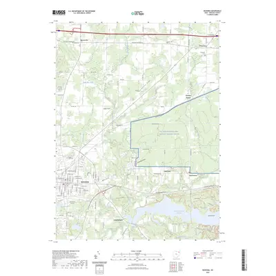
2023 Map of Ravenna
USGS Topo · Published 2023About this map
The Portage County Courthouse stands as the central landmark of Ravenna, a city shaped by its intersection of rail and road networks in northeastern Ohio. To the east, the landscape is defined by the massive footprint of the Ravenna Arsenal and the NG Camp Ravenna Joint Military Training Center, a significant military installation that borders the smaller settlements of Augerburg and Charlestown. This 2023 survey illustrates a region where industrial history and modern water management converge, dominated in the south by the Michael J Kirwan Reservoir on the West Branch Mahoning River.
Find a feature on this map
73 named features on this map. Tap any name to fly to it.
Don’t see what you’re looking for? This feature index may not catch every label — zoom into the map to look around manually.
Map Details
Editions of this 2023 Ravenna Map
This is the sole edition of this map. No revisions or reprints were ever made.
Other maps of this area

1905 · Garrettsville
USGS Topo · 1:62,500

1906 · Kent
USGS Topo · 1:62,500

1906 · Chagrin Falls
USGS Topo · 1:62,500

1906 · Ravenna
USGS Topo · 1:62,500

1907 · Garrettsville
USGS Topo · 1:62,500

1908 · Chagrin Falls
USGS Topo · 1:62,500

1908 · Ravenna
USGS Topo · 1:62,500

1950 · Cleveland
USGS Topo · 1:250,000

1953 · Aurora
USGS Topo · 1:24,000

1956 · Cleveland
USGS Topo · 1:250,000