1950s Maps of Hiram Township, Ohio
Explore 4 historic maps of Hiram Township from the 1950s. These maps offer a rare glimpse into what life looked like during the 1950s — showing old roads, neighborhoods, homes, and landmarks that have changed or disappeared over time.
Whether you're researching your family's past, planning a metal detecting trip, or studying how Hiram Township's landscape evolved across the 1950s, these high-resolution maps are a powerful tool for exploring the history of this region.
- Focus on a specific era: All maps on this page are from the 1950s, giving you a focused view of this time period.
- See what’s changed: Compare century-old streets, trails, and buildings to today's modern landscape using overlays and satellite layers.
- Research with precision: Use these maps for genealogy, historical research, land use analysis, or educational projects.
- View, download, or print: Maps are fully viewable online in high resolution, and can be downloaded or printed for your own records.
Start exploring Hiram Township's history through authentic maps from the 1950s. This is your window into the past.
Hiram Township, OH maps
(4)- 1950 Map of Cleveland
 1950 Cleveland1950 Print · USGSCovers Hiram Township, including Cleveland, Akron, and other nearby areas
 - 1956 Map of Cleveland, 1967 Print
 1956 Cleveland1967 Print · USGSNortheast Ohio and Western Pennsylvania are shown at their industrial height during the mid-fifties, from the steel mills to the lakeshore. Researchers can trace the massive Ravenna Arsenal, the Ohio Turnpike, and vanished rail sidings of the B & O RR.3 unique versions available
 - 1959 Map of Mantua, 1960 Print
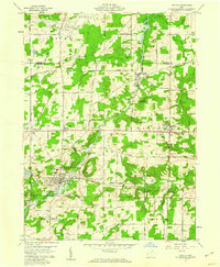 1959 Mantua1960 Print · USGSNorthern Portage County is shown at a mid-century crossroads as the village of Hiram and its historic Hiram College expand. Genealogists and local historians can trace family-named routes like Dudley Road or locate the Mennonite Ch and Westlawn Cem.3 unique versions available
 - 1959 Map of Garrettsville, 1960 Print
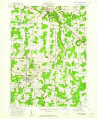 1959 Garrettsville1960 Print · USGSGarrettsville and the surrounding townships are captured in the late fifties, showing a landscape defined by the Western Reserve survey grid and rocky ledges. Researchers can locate several family cemeteries, the Erie RR line, and landmarks like Nelson Ledge State Park.3 unique versions available
End of results
Showing maps 1-4 of 4
Top cities near Hiram Township
- Kent historical maps
- Streetsboro historical maps
- Aurora historical maps
- Ravenna historical maps
- Newton Township historical maps
- Newton historical maps
See more
Top neighborhoods of Hiram Township
Frequently asked questions
- What are the different types of historical maps available for Hiram Township?
- What is the oldest map of Hiram Township?
- Where can I purchase historical maps of Hiram Township for my home or office?
- Where can I download high-res historical maps of Hiram Township?
- Are there historical topographic maps available for Hiram Township?
- Is there historical aerial imagery available for Hiram Township?
- Where are historical maps of Hiram Township sourced from?