2020s Maps of Loudon Township, Ohio
Explore 4 historic maps of Loudon Township from the 2020s. These maps offer a rare glimpse into what life looked like during the 2020s — showing old roads, neighborhoods, homes, and landmarks that have changed or disappeared over time.
Whether you're researching your family's past, planning a metal detecting trip, or studying how Loudon Township's landscape evolved across the 2020s, these high-resolution maps are a powerful tool for exploring the history of this region.
- Focus on a specific era: All maps on this page are from the 2020s, giving you a focused view of this time period.
- See what’s changed: Compare century-old streets, trails, and buildings to today's modern landscape using overlays and satellite layers.
- Research with precision: Use these maps for genealogy, historical research, land use analysis, or educational projects.
- View, download, or print: Maps are fully viewable online in high resolution, and can be downloaded or printed for your own records.
Start exploring Loudon Township's history through authentic maps from the 2020s. This is your window into the past.
Loudon Township, OH maps
(4)- 2023 Map of Fostoria, 2023 Print
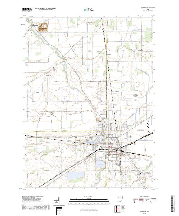 2023 Fostoria2023 Print · USGSFostoria and the tri-county borderlands of Wood, Hancock, and Seneca counties are shown here in recent detail. Researchers can trace family roots at Saint Wendelin Cem or locate rural landmarks like West Millgrove and Lamberjack Lake.
 - 2023 Map of New Riegel, 2023 Print
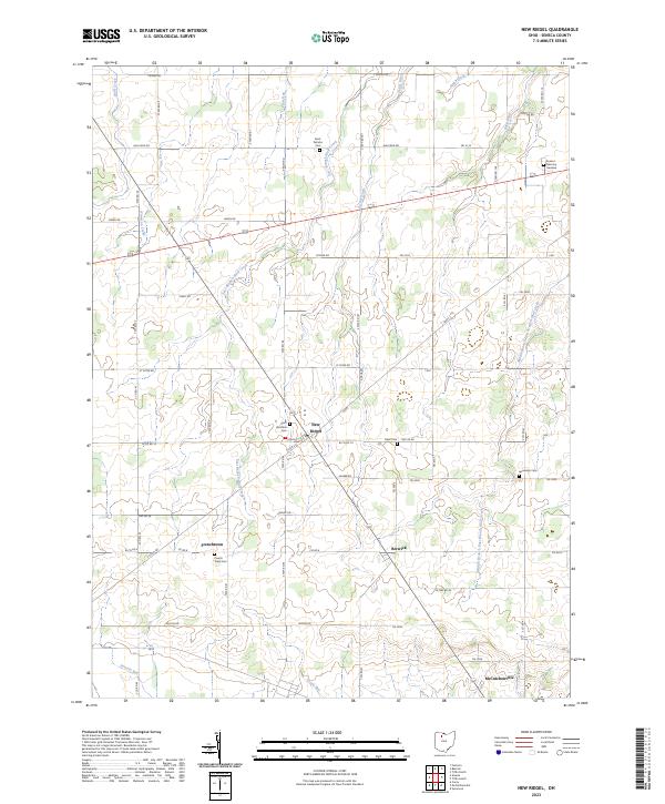 2023 New Riegel2023 Print · USGSSeneca County's rural landscape is captured here in the early twenty-first century, showing a network of historic family settlements. Genealogists can trace local roots at Saint Boniface Cem, French Town Cem, and the village of New Riegel.
 - 2023 Map of Alvada, 2023 Print
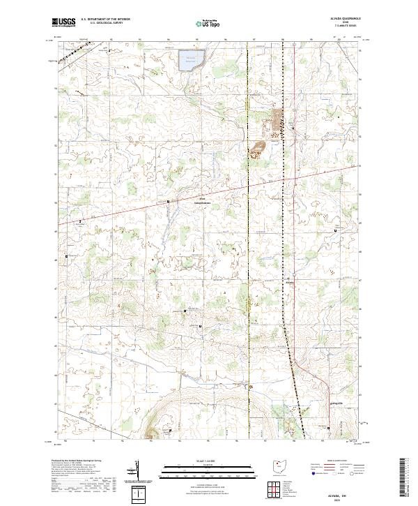 2023 Alvada2023 Print · USGSNorthwest Ohio at the edge of Hancock and Seneca counties reveals a landscape of systematic drainage and deep-rooted family history. Genealogists can locate small rural burial grounds like Union Cem and Saint Peters Cem near the village of Alvada.
 - 2023 Map of Bascom, 2023 Print
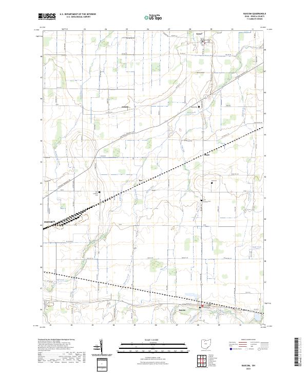 2023 Bascom2023 Print · USGSSeneca County's rural landscape is captured here in the early twenty-first century, showing a region defined by its agricultural roots and drainage systems. Researchers can locate family landmarks such as Zion Lutheran Cem, Sand Ridge Cem, and the small settlements of Amsden and Iler.
End of results
Showing maps 1-4 of 4
Top cities near Loudon Township
- Findlay historical maps
- Tiffin historical maps
- Fremont historical maps
- Fostoria historical maps
- Crawford historical maps
- Carey historical maps
See more
Frequently asked questions
- What are the different types of historical maps available for Loudon Township?
- What is the oldest map of Loudon Township?
- Where can I purchase historical maps of Loudon Township for my home or office?
- Where can I download high-res historical maps of Loudon Township?
- Are there historical topographic maps available for Loudon Township?
- Is there historical aerial imagery available for Loudon Township?
- Where are historical maps of Loudon Township sourced from?