Old Maps of Shelby County, Ohio
Explore 84 old maps of Shelby County, spanning from 1909 to today. These high-resolution historic maps reveal how streets, neighborhoods, landmarks, and natural features evolved over time — perfect for genealogy, metal detecting, research, and local history exploration.
What you can do with these maps:
- See how Shelby County changed over time: Compare historical maps to modern-day views to trace roads, homesites, rail lines & more.
- View detailed metadata: Each map includes creators, publishers, year, scale, and archive source.
- Overlay maps with satellite & LiDAR: Visualize the past alongside modern tools to explore terrain & human change.
- Trusted historical sources: Maps sourced from the USGS, Library of Congress, and other archives.
- Access maps your way: View online, download high-res files, or order prints for personal or research use.
Start exploring old maps of Shelby County to uncover forgotten places, hidden landmarks, and the deep history beneath your feet.
Shelby County, OH maps
(84)- 1909 Map of Loramie, 1961 Print
 1909 Loramie1961 Print · USGSWestern Ohio at the opening of the twentieth century was a landscape defined by the transition from canal transport to electric rail. Genealogists can trace family names across dozens of rural school districts like Walkup School and Diters School, or locate old parish centers such as Maria Stein and St John.
 - 1911 Map of Loramie, 1936 Print
 1911 Loramie1936 Print · USGSWestern Ohio at the start of the twentieth century shows a landscape transitioning from the canal era to the age of electric rail. Researchers can trace the Miami and Erie Canal through Minster and New Bremen, or locate family sites near St Patricks Church and Schwaberow School.
 - 1911 Map of Covington, 1946 Print
 1911 Covington1946 Print · USGSWestern Ohio’s agricultural heartland is mapped here as a web of turnpikes and railroads connects thriving towns. Trace old family sites near Bradford, Gettysburg, and uniquely named rural landmarks like Lickskillet School or Cassels Corners.
 - 1913 Map of Sidney, 1934 Print
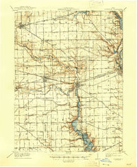
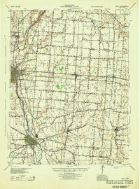
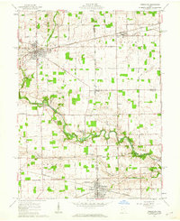
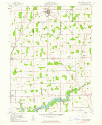
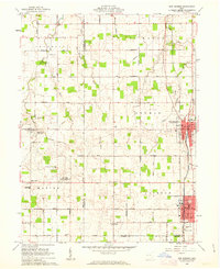
 1913 Sidney1934 Print · USGSShelby County at the height of the steam and electric rail era features a landscape defined by the Miami and Erie Canal and the historic Greenville Treaty Line. Genealogists and historians can trace dozens of rural schoolhouses, including Poplar Knob School and Walnut Grove School, alongside the early streetcar route of the Western Ohio RR.2 unique versions available
 - 1914 Map of Troy, 1931 Print
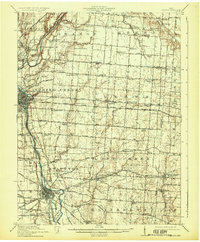 1914 Troy1931 Print · USGSMiami County at the height of the interurban era shows a landscape defined by the Miami River and competing rail lines. Genealogists can locate family landmarks like the County Infirmary or schools such as Sheepskin School and Frogpond School.2 unique versions available
 - 1944 Map of Covington
 1944 Covington1944 Print · USGSWestern Ohio at the end of the Second World War remains a landscape of thriving rural rail towns and country schoolhouses. Researchers can trace the Stillwater River to find Greenville Falls, the Forest Hill Cem, and local landmarks like Tadpole Sch and Ludlow Falls.
 - 1944 Map of Sidney
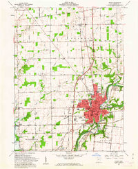
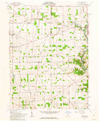
 1944 Sidney1944 Print · USGSShelby County thrived as a rail and river hub in the mid-1940s, centered on the growing industrial town of Sidney. Researchers can trace old rural school districts and family-named landmarks such as Walnut Grove Sch, Poplar Knob, and the Childrens Home.
 - 1944 Map of Loramie
 1944 Loramie1944 Print · USGSWest-central Ohio farmland is captured here during the mid-forties, showing the intricate grid of rural school districts and turnpikes. Researchers can trace family-named sites like Fledderjohn Sch and St Patricks Ch near the Loramie Reservoir.
 - 1944 Map of Troy
 1944 Troy1944 Print · USGSMiami County during the mid-forties reveals a landscape of industrial river towns and an incredibly dense network of rural schools. Researchers can trace the path of the Miami and Erie Canal and locate family-named landmarks like Rhodhammel Sch and Staunton.
 - 1953 Map of Muncie, 1966 Print
 1953 Muncie1966 Print · USGSIndiana and Ohio borderlands thrive in the early fifties, showing a landscape defined by manufacturing cities and an intensive railroad network. Genealogists can trace family roots across the Indiana-Ohio line through Muncie, Celina, and Portland via the Pennsylvania railroad.5 unique versions available
 - 1956 Map of Muncie
 1956 Muncie1956 Print · USGSEastern Indiana and western Ohio are shown at a peak of rail-driven industry in the mid-fifties. Genealogists and rail historians can trace the paths of the Pennsylvania RR through Muncie or locate landmarks like Lake Saint Marys (Grand Lake Reservoir) and Frances Slocum State Forest.
 - 1961 Map of Piqua West, 1962 Print
 1961 Piqua West1962 Print · USGSWestern Miami County is captured here in the early sixties as the suburbs of Piqua expanded toward Newberry and Washington townships. Researchers can trace family history through sites like Forest Hill Cemetery, St Teresas Ch, and the rural Mount Jefferson crossroads.4 unique versions available
 - 1961 Map of Piqua East, 1962 Print
 1961 Piqua East1962 Print · USGSMiami County during the early sixties shows the industrial hub of Piqua at a crossroads of rail and river commerce. Genealogists and local historians can trace the Miami and Erie Canal path or locate family sites at Garby Cem No 1 and Kirkwood.4 unique versions available
 - 1961 Map of Fort Loramie, 1962 Print
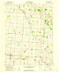
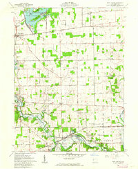 1961 Fort Loramie1962 Print · USGSShelby County's rural townships are mapped here in the early sixties, showing a landscape defined by the old Greenville Treaty Line and the historic Miami Canal. Genealogists can locate family landmarks like St Michaels New Cem, Angel Street Cem, and Hegemanns Landing.2 unique versions available
 - 1961 Map of Versailles, 1962 Print
 1961 Versailles1962 Print · USGSThe rural crossroads of Darke, Shelby, and Miami counties come into focus during the early sixties, centered on the rail hubs of Versailles and Bradford. Researchers can trace old family sites and rural landmarks like St Peters Ch, St Valberts Cem, and the Childrens Home.2 unique versions available
 - 1961 Map of Botkins, 1962 Print
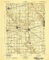
 1961 Botkins1962 Print · USGSShelby and Auglaize counties are captured here in the early sixties, showing the complex intersection of early land surveys along the Greenville Treaty Line. Genealogists can trace family names across Old Loramie Valley Cem, Redman Cem, and the small community of Rumley.3 unique versions available
 - 1961 Map of Sidney, 1962 Print
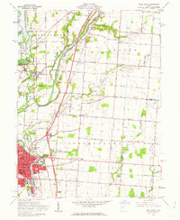
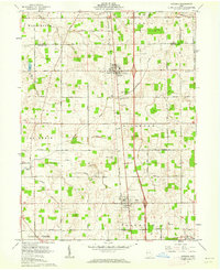
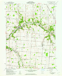
 1961 Sidney1962 Print · USGSThe Miami River valley in the early 1960s shows Sidney as a thriving rail hub at the crossing of the Baltimore and Ohio and New York Central. Researchers can locate the Greenville Treaty Line, the County Fairgrounds, and old rural cemeteries like Carey Cem.3 unique versions available
 - 1961 Map of Fletcher, 1962 Print
 1961 Fletcher1962 Print · USGSIn the early 1960s, these western Ohio farm communities remained centered on their rail stops and rural churches. Genealogists can trace family footprints near Fletcher, Conover, and Plattsville, or find local burial grounds like Pioneer Cem and Sturm Cem.3 unique versions available
 - 1961 Map of New Knoxville, 1962 Print
 1961 New Knoxville1962 Print · USGSWestern Ohio farmland and the waters of Lake Loramie are frozen in time during the early sixties. Genealogists can locate family-named cemeteries like Pilger Ruhe Cem while historians trace legacy infrastructure at Lock Two and Lehmkuhl Landing.3 unique versions available
 - 1961 Map of Port Jefferson, 1962 Print
 1961 Port Jefferson1962 Print · USGSShelby County farmland and the Miami River valley appear here in the early sixties, as the local economy balanced rail transport with new pipeline infrastructure. Genealogists and local historians can locate early burial sites like Old Dunkard Cem and trace the path of the old Miami Canal.3 unique versions available
 - 1961 Map of Osgood, 1963 Print
 1961 Osgood1963 Print · USGSThis western Ohio landscape at the start of the sixties reveals a countryside shaped by the historic Treaty Line and the remnants of the canal era. Genealogists can locate numerous rural burial sites like Walkup Cem and St Martins Cem near settlements like Osgood and Willowdell.3 unique versions available
 - 1961 Map of Jackson Center, 1963 Print
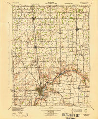
 1961 Jackson Center1963 Print · USGSShelby and Auglaize counties in the early sixties reveal a landscape defined by pioneer-era boundaries and small rail towns. Genealogists can trace family names through McCord Cem and St Jacobs Ch, or follow the path of the Detroit Toledo and Ironton railroad.3 unique versions available
 - 1961 Map of New Bremen, 1963 Print
 1961 New Bremen1963 Print · USGSAgricultural West-Central Ohio comes alive in the early sixties, showing the vital canal and rail corridors through the Auglaize and Mercer county border. Trace family roots through the Maria Stein Shrine or settlements like Egypt and Chickasaw.
 - 1986 Map of Piqua
 1986 Piqua1986 Print · USGSThe western Ohio and eastern Indiana borderlands appear here in the mid-1980s, showcasing a landscape of river-valley industry and fertile plains. Researchers can trace historic rail lines like Conrail and Norfolk and Western through towns like Greenville and Winchester.3 unique versions available
 - 2010 Map of Piqua West, 2010 Print
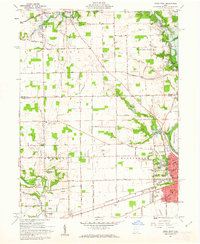
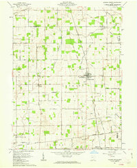
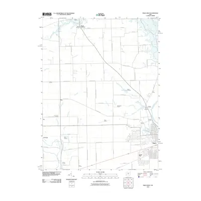 2010 Piqua West2010 Print · USGSCovers Shelby County, including Piqua, Covington, and other nearby areas
Showing maps 1-25 of 84
Top cities of Shelby County
- Sidney historical maps
- Fort Loramie historical maps
- Anna historical maps
- Jackson Center historical maps
- Botkins historical maps
- Russia historical maps
See more
Frequently asked questions
- What are the different types of historical maps available for Shelby County?
- What is the oldest map of Shelby County?
- Where can I purchase historical maps of Shelby County for my home or office?
- Where can I download high-res historical maps of Shelby County?
- Are there historical topographic maps available for Shelby County?
- Is there historical aerial imagery available for Shelby County?
- Where are historical maps of Shelby County sourced from?