Old Maps of Sidney, Ohio for Metal Detecting
Plan your next treasure hunt with 17 historic maps of Sidney. Find old homesites, ghost towns, trails, and gathering spots that may be lost to time — perfect for identifying promising metal detecting locations.
- Locate forgotten sites: Uncover places like long-lost settlements, abandoned rail lines, or gathering spots.
- Plan better hunts: Use map overlays combined with LiDAR or satellite views to narrow in on historically rich areas.
- Made for detectorists: Thousands of hobbyists use these maps to discover relics, coins, and hidden history.
Use these historic maps to boost your research and find new opportunities beneath the surface of Sidney.
Sidney, OH maps
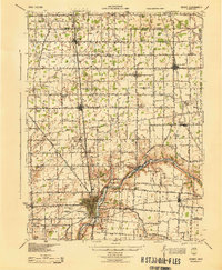
(17)- 1913 Map of Sidney, 1934 Print
 1913 Sidney1934 Print · USGSShelby County at the height of the steam and electric rail era features a landscape defined by the Miami and Erie Canal and the historic Greenville Treaty Line. Genealogists and historians can trace dozens of rural schoolhouses, including Poplar Knob School and Walnut Grove School, alongside the early streetcar route of the Western Ohio RR.2 unique versions available
 - 1944 Map of Sidney
 1944 Sidney1944 Print · USGSShelby County thrived as a rail and river hub in the mid-1940s, centered on the growing industrial town of Sidney. Researchers can trace old rural school districts and family-named landmarks such as Walnut Grove Sch, Poplar Knob, and the Childrens Home.
 - 1953 Map of Muncie, 1966 Print
 1953 Muncie1966 Print · USGSIndiana and Ohio borderlands thrive in the early fifties, showing a landscape defined by manufacturing cities and an intensive railroad network. Genealogists can trace family roots across the Indiana-Ohio line through Muncie, Celina, and Portland via the Pennsylvania railroad.5 unique versions available
 - 1956 Map of Muncie
 1956 Muncie1956 Print · USGSEastern Indiana and western Ohio are shown at a peak of rail-driven industry in the mid-fifties. Genealogists and rail historians can trace the paths of the Pennsylvania RR through Muncie or locate landmarks like Lake Saint Marys (Grand Lake Reservoir) and Frances Slocum State Forest.
 - 1961 Map of Sidney, 1962 Print
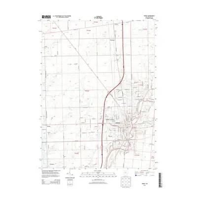
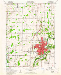 1961 Sidney1962 Print · USGSThe Miami River valley in the early 1960s shows Sidney as a thriving rail hub at the crossing of the Baltimore and Ohio and New York Central. Researchers can locate the Greenville Treaty Line, the County Fairgrounds, and old rural cemeteries like Carey Cem.3 unique versions available
 - 1961 Map of Port Jefferson, 1962 Print
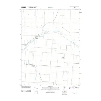
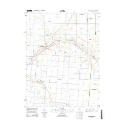
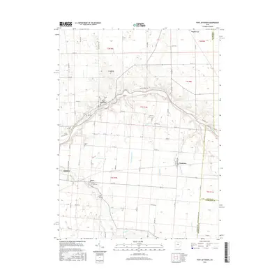
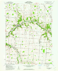 1961 Port Jefferson1962 Print · USGSShelby County farmland and the Miami River valley appear here in the early sixties, as the local economy balanced rail transport with new pipeline infrastructure. Genealogists and local historians can locate early burial sites like Old Dunkard Cem and trace the path of the old Miami Canal.3 unique versions available
 - 1986 Map of Piqua
 1986 Piqua1986 Print · USGSThe western Ohio and eastern Indiana borderlands appear here in the mid-1980s, showcasing a landscape of river-valley industry and fertile plains. Researchers can trace historic rail lines like Conrail and Norfolk and Western through towns like Greenville and Winchester.3 unique versions available
 - 2010 Map of Sidney, 2010 Print
 2010 Sidney2010 Print · USGSCovers Sidney, including Newbern, Hardin, and other nearby areas
 - 2010 Map of Port Jefferson, 2010 Print
 2010 Port Jefferson2010 Print · USGSCovers Sidney, including Port Jefferson, Pemberton, and other nearby areas
 - 2013 Map of Port Jefferson, 2013 Print
 2013 Port Jefferson2013 Print · USGSCovers Sidney, including Port Jefferson, Pemberton, and other nearby areas
 - 2013 Map of Sidney, 2013 Print
 2013 Sidney2013 Print · USGSCovers Sidney, including Newbern, Hardin, and other nearby areas
 - 2016 Map of Port Jefferson, 2016 Print
 2016 Port Jefferson2016 Print · USGSCovers Sidney, including Port Jefferson, Pemberton, and other nearby areas
 - 2016 Map of Sidney, 2016 Print
 2016 Sidney2016 Print · USGSCovers Sidney, including Newbern, Hardin, and other nearby areas
 - 2019 Map of Sidney, 2019 Print
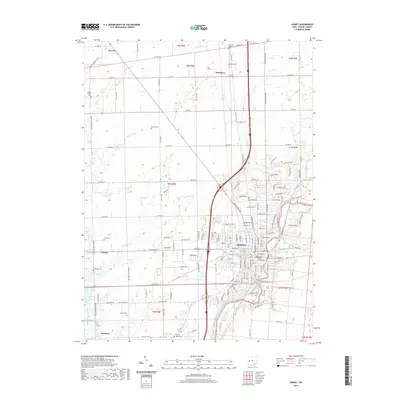 2019 Sidney2019 Print · USGSCovers Sidney, including Newbern, Hardin, and other nearby areas
 - 2019 Map of Port Jefferson, 2019 Print
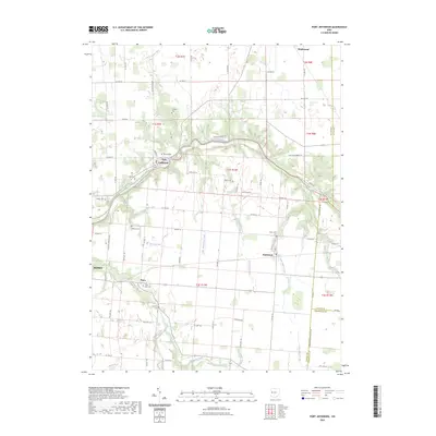
 2019 Port Jefferson2019 Print · USGSCovers Sidney, including Port Jefferson, Pemberton, and other nearby areas
 - 2023 Map of Sidney, 2023 Print
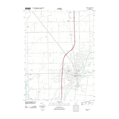
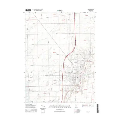
 2023 Sidney2023 Print · USGSSidney and its rural surroundings in Shelby County are captured here at the start of the 2020s. Researchers can locate several historic burial grounds like Old Saint James Cem and Brookside Cem, or trace the path of the Great Miami River.
 - 2023 Map of Port Jefferson, 2023 Print
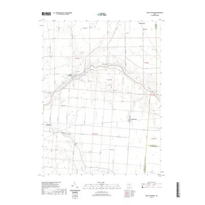
 2023 Port Jefferson2023 Print · USGSWestern Ohio's agricultural landscape and the winding Great Miami River define this area in the 2020s. Researchers can locate numerous family burial sites like Cedar Point Cem and Indian Creek Cem near the village of Pemberton.
End of results
Showing maps 1-17 of 17
Top cities near Sidney
- Troy historical maps
- Piqua historical maps
- New Bremen historical maps
- Minster historical maps
- Covington historical maps
- Saint Paris historical maps
See more
Top neighborhoods of Sidney
- Buckeye Terrace historical maps
- Sidney Courthouse Square Historic District historical maps
- Sidney Walnut Avenue Historic District historical maps
Frequently asked questions
- What are the different types of historical maps available for Sidney?
- What is the oldest map of Sidney?
- Where can I purchase historical maps of Sidney for my home or office?
- Where can I download high-res historical maps of Sidney?
- Are there historical topographic maps available for Sidney?
- Is there historical aerial imagery available for Sidney?
- Where are historical maps of Sidney sourced from?