Old Maps of Stark County, Ohio for Metal Detecting
Plan your next treasure hunt with 148 historic maps of Stark County. Find old homesites, ghost towns, trails, and gathering spots that may be lost to time — perfect for identifying promising metal detecting locations.
- Locate forgotten sites: Uncover places like long-lost settlements, abandoned rail lines, or gathering spots.
- Plan better hunts: Use map overlays combined with LiDAR or satellite views to narrow in on historically rich areas.
- Made for detectorists: Thousands of hobbyists use these maps to discover relics, coins, and hidden history.
Use these historic maps to boost your research and find new opportunities beneath the surface of Stark County.
Stark County, OH maps
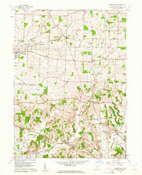
(148)- 1901 Map of Massillon, 1955 Print
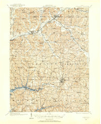
 1901 Massillon1955 Print · USGSMassillon and the Tuscarawas valley thrive at the turn of the century as centers of canal transit and heavy rail industry. Local historians can trace the paths of the Ohio and Erie Canal, the massive Insane Asylum, and coal operations like the Turkeyfoot Mine.2 unique versions available
 - 1901 Map of Canton, 1958 Print
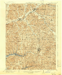
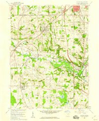
 1901 Canton1958 Print · USGSStark County at the turn of the century is a landscape of growing industrial towns and busy rail corridors. Genealogists can trace family roots in New Berlin and Louisville or locate landmarks like Westlawn Cem and the Infirmary.
 - 1903 Map of Massillon, 1934 Print
 1903 Massillon1934 Print · USGSNortheastern Ohio at the start of the century is a landscape of industrial growth and intricate canal-side settlements. Genealogists and historians can trace the early rail-and-water economy through features like the Ohio Canal, Turkeyfoot Mine, and the Insane Asylum.2 unique versions available
 - 1903 Map of Canton, 1939 Print
 1903 Canton1939 Print · USGSCanton was a flourishing rail and manufacturing center at the dawn of the century, serving as the nexus for multiple major lines. Genealogists can trace early homesteads and community centers near New Berlin, Osnaburg, and the Westlawn Cem.2 unique versions available
 - 1909 Map of Alliance
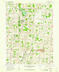
 1909 Alliance1909 Print · USGSAlliance and its surrounding industrial townships are captured in detail just after the turn of the century as the rail network reached its peak. Genealogists can trace family roots through numerous rural schools like Linden Hall School and vanished stations such as Freeburg Sta.4 unique versions available
 - 1910 Map of Carrollton, 1957 Print
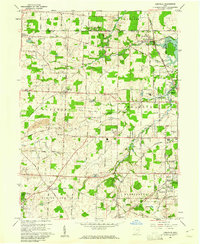
 1910 Carrollton1957 Print · USGSCarroll County and parts of Stark and Columbiana counties are documented here during an era of robust rail expansion and rural development. Genealogists can trace family footprints across dozens of local landmarks like Phalana Hall School, Macedonia Church, and the County Infirmary.
 - 1912 Map of Dover, 1939 Print
 1912 Dover1939 Print · USGSTuscarawas and Stark Counties are shown in the early twentieth century as coal and rail corridors shaped the valley floors. Researchers can locate unique landmarks like the Octagonal School, the historic Zoar community, and the path of the Ohio Treaty Line.2 unique versions available
 - 1912 Map of Carrollton, 1943 Print
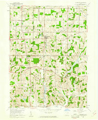
 1912 Carrollton1943 Print · USGSThe hills of Carroll County are shown at a peak of rural development in the early 20th century, before major modern changes. Genealogists can trace family roots through numerous local landmarks like Mud School, the County Infirmary, and Harlem Springs.
 - 1914 Map of Navarre, 1940 Print
 1914 Navarre1940 Print · USGSNortheast Ohio’s industrial and rural landscape is shown here as the coal and rail era reached its peak. Genealogists can trace family roots through dozens of local schools like Frogpond School and follow the angled path of the historic Military Treaty Line.2 unique versions available
 - 1944 Map of Navarre
 1944 Navarre1944 Print · USGSDuring the mid-1940s, this portion of East Central Ohio was a thriving network of rail-towns and coal mines. Researchers can trace the Treaty Line, locate dozens of rural schoolhouses like Brush College Sch, and see the footprint of Brewster and Sugar Creek.
 - 1944 Map of Dover
 1944 Dover1944 Print · USGSEastern Ohio during the mid-1940s reveals a landscape of river-valley industry and rural schoolhouses. Researchers can trace the rail lines of the Wheeling and Lake Erie or locate community hubs like Octagonal Sch and Zoar Station.
 - 1951 Map of Canton
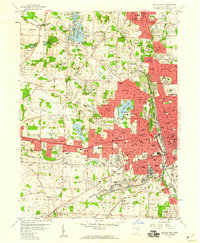
 1951 Canton1951 Print · USGSThe industrial heartland of Ohio and Pennsylvania reached its mid-century peak during this era of heavy rail and river transit. Genealogists and historians can trace the development of steel towns like Aliquippa and Weirton alongside the Ohio River and major lines of the Pennsylvania RR.
 - 1951 Map of Bolivar, 1968 Print
 1951 Bolivar1968 Print · USGSTuscarawas and Stark counties during the mid-century are shown here as a landscape of active resource extraction and watershed management. You can trace the path of the Ohio Canal and locate family markers at Fort Laurens Cem and the Siffert Cem.
 - 1952 Map of Alliance, 1954 Print
 1952 Alliance1954 Print · USGSAlliance and its surrounding industrial townships are captured in the early fifties, showcasing a dense rail and school network. Genealogists can trace family names through several burial sites like Old German Cem and Hartzell Cem, or locate historic homes near Mt Union College.3 unique versions available
 - 1953 Map of Canton
 1953 Canton1953 Print · USGSThe industrial heartland of Ohio and Pennsylvania is captured at its mid-century peak in this detailed regional survey. Genealogists and historians can trace the vast rail networks of the Pennsylvania RR and find local landmarks like Nimisila Reservoir and Tappan Reservoir.
 - 1957 Map of Canton, 1971 Print
 1957 Canton1971 Print · USGSThe industrial heartland of eastern Ohio and western Pennsylvania comes alive in this mid-century survey of the Ohio River Valley. Trace the heritage of rail and river commerce through Pittsburgh, the massive steel towns along the Ohio River, and major junctions on the Pennsylvania RR.3 unique versions available
 - 1958 Map of Doylestown, 1959 Print
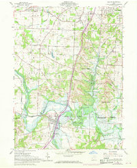
 1958 Doylestown1959 Print · USGSDoylestown and the Tuscarawas River valley are shown in the late fifties at the intersection of four major rail lines. Researchers can trace rural lineages through numerous country landmarks like St Michaels Ch, Maple Grove Cem, and Harvey Sch.
 - 1958 Map of Canal Fulton, 1959 Print
 1958 Canal Fulton1959 Print · USGSNortheastern Ohio’s transition from a canal-era landscape to a post-war recreational and suburban hub is on display during the late fifties. Genealogists and local historians can trace family locations near Manchester, identify old rural schools like Township Sch, or locate the path of the Ohio Canal.4 unique versions available
 - 1958 Map of North Canton, 1959 Print
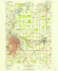
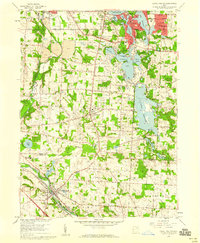
 1958 North Canton1959 Print · USGSNortheast Ohio saw significant expansion in the late fifties as suburban life developed around major transportation hubs. Genealogists and local historians can trace the footprint of Greentown and Uniontown, or locate smaller sites like Tritts Millpond and Klinefelter Cem.
 - 1958 Map of Canton East, 1960 Print
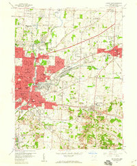 1958 Canton East1960 Print · USGSThe industrial and suburban expansion of Stark County is documented here just before the 1960s. Genealogists can trace family landmarks and neighborhood history at McKinley High Sch, St Louis Cem, and along the historic Lincoln Highway.
 - 1958 Map of Canton West, 1960 Print
 1958 Canton West1960 Print · USGSWestern Canton and its surrounding townships show a period of rapid suburban growth and industrial strength during the late fifties. Genealogists and local historians can trace family locations near Calvary Cemetery, Sippo Lake, and dozens of neighborhood schools like Lehman High Sch.
 - 1960 Map of Limaville, 1961 Print
 1960 Limaville1961 Print · USGSStark and Portage counties are captured here at the dawn of the sixties as small villages like Limaville and Marlboro sit amid a busy rail network. Genealogists can locate family sites like St Pauls Cem or trace the old Railroad Grade near Lexington.4 unique versions available
 - 1960 Map of Hartville, 1961 Print
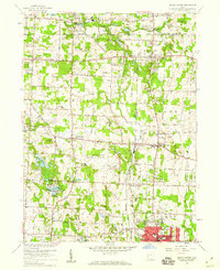
 1960 Hartville1961 Print · USGSHartville and its surrounding townships are shown here in the early sixties, capturing a landscape of family farms, historic cemeteries, and local industry. Genealogists and historians can trace church sites like St Jacobs Ch and old burial grounds including Walnut Grove Sch Cem and Machamer Cem.6 unique versions available
 - 1960 Map of Homeworth, 1961 Print
 1960 Homeworth1961 Print · USGSEastern Ohio farm country and small rail towns come alive in the early sixties as the Pennsylvania railroad cuts through Homeworth. Researchers can locate family landmarks like the Fairmount Childrens Home, Walker Cemetery, and the Knox School.4 unique versions available
 - 1960 Map of Robertsville, 1961 Print
 1960 Robertsville1961 Print · USGSStark County in the early 1960s was a landscape defined by its mining operations and rural rail hubs. Researchers can trace the New York Chicago and St Louis line through Robertsville or locate family sites like Beech Ch and Zwick Cem.4 unique versions available
Showing maps 1-25 of 148
Top cities of Stark County
- Canton historical maps
- Plain historical maps
- Massillon historical maps
- Alliance historical maps
- North Canton historical maps
- Louisville historical maps
See more
Frequently asked questions
- What are the different types of historical maps available for Stark County?
- What is the oldest map of Stark County?
- Where can I purchase historical maps of Stark County for my home or office?
- Where can I download high-res historical maps of Stark County?
- Are there historical topographic maps available for Stark County?
- Is there historical aerial imagery available for Stark County?
- Where are historical maps of Stark County sourced from?