1990s Maps of South Side, New Philadelphia
Explore 2 historic maps of South Side from the 1990s. These maps offer a rare glimpse into what life looked like during the 1990s — showing old roads, neighborhoods, homes, and landmarks that have changed or disappeared over time.
Whether you're researching your family's past, planning a metal detecting trip, or studying how South Side's landscape evolved across the 1990s, these high-resolution maps are a powerful tool for exploring the history of this region.
- Focus on a specific era: All maps on this page are from the 1990s, giving you a focused view of this time period.
- See what’s changed: Compare century-old streets, trails, and buildings to today's modern landscape using overlays and satellite layers.
- Research with precision: Use these maps for genealogy, historical research, land use analysis, or educational projects.
- View, download, or print: Maps are fully viewable online in high resolution, and can be downloaded or printed for your own records.
Start exploring South Side's history through authentic maps from the 1990s. This is your window into the past.
South Side, New Philadelphia maps
(2)- 1993 Map of New Philadephia, 1994 Print
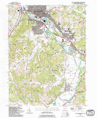 1993 New Philadephia1994 Print · USGSTuscarawas County in the early nineties shows a transition from coal and canal history to a modern educational and retail hub. Trace the Ohio Canal (Abandoned) near Tuscarawas or locate the St Peters Ch and Mud Run Cem.
 - 1994 Map of New Philadephia, 1998 Print
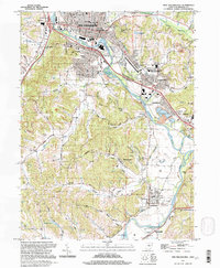 1994 New Philadephia1998 Print · USGSThe Tuscarawas Valley in the mid-nineties shows a landscape where industrial heritage meets academic growth and historic preservation. Genealogists can locate family sites near St Peters Ch, Fair St Cem, and old settlements like Wainwright and Midvale.
End of results
Showing maps 1-2 of 2
Top cities near South Side
- New Philadelphia historical maps
- Dover historical maps
- Uhrichsville historical maps
- Goshen historical maps
- Newcomerstown historical maps
- Dennison historical maps
See more
Frequently asked questions
- What are the different types of historical maps available for South Side?
- What is the oldest map of South Side?
- Where can I purchase historical maps of South Side for my home or office?
- Where can I download high-res historical maps of South Side?
- Are there historical topographic maps available for South Side?
- Is there historical aerial imagery available for South Side?
- Where are historical maps of South Side sourced from?