Old Maps of Union County, Ohio for Genealogy
Trace your family roots with 149 historic maps of Union County. These high-res maps reveal old neighborhoods, homesites, landmarks, and streets — helping you uncover where your ancestors lived and how the area evolved over time.
- Explore historic neighborhoods: Identify where your relatives may have lived in the 1800s or 1900s.
- Compare maps over time: Trace the changes in streets, buildings, and landmarks for multi-generational research.
- Perfect for genealogy & ancestry research: Used by family historians and researchers to map out lineage and migration.
These maps are an incredible resource for exploring your personal connection to Union County's past.
Union County, OH maps
(149)- 1901 Map of Dublin, 1955 Print
 1901 Dublin1955 Print · USGSCentral Ohio at the turn of the century reveals a landscape of independent agricultural villages and busy rail corridors long before the suburban expansion. Trace early property and settlement patterns in Dublin, Worthington, and Hilliard, and locate vanished rail stops along the Pennsylvania System and the Columbus Delaware and Marion Electric Ry.
 - 1903 Map of Dublin, 1939 Print
 1903 Dublin1939 Print · USGSCentral Ohio at the turn of the century is captured here as a landscape of river valleys and emerging railroad towns. Genealogists can trace early homesteads and routes between established centers like Worthington and smaller rural stops such as Amlin and Powell.2 unique versions available
 - 1903 Map of Marion, 1961 Print
 1903 Marion1961 Print · USGSMarion emerges as a powerful rail hub at the turn of the century, with nearly ten different lines intersecting at the city's heart. Local historians can trace the early industrial landscape through the Electric RR and the Quarry near Owen.
 - 1905 Map of Marion, 1944 Print
 1905 Marion1944 Print · USGSMarion became a bustling railroad crossroads at the turn of the century, serving as a vital link for the state's industrial and agricultural transport. Researchers can trace the early city grid, the path of the Hocking Valley Line, and rural outposts like Morral and Little Sandusky.
 - 1913 Map of East Liberty, 1961 Print
 1913 East Liberty1961 Print · USGSLogan and Union counties are shown here just before the First World War, when a dense network of country schools and steam railroads bound the countryside together. Genealogists can trace family footprints at Marl City, Indian Mound School, or the Greenville Treaty Line.
 - 1913 Map of Richwood, 1962 Print
 1913 Richwood1962 Print · USGSUnion County during the pre-war era was a thriving network of rural schools and rail junctions centered around Richwood. Genealogists and historians can trace the exact locations of dozens of district schoolhouses like Deadwood School and vanished stations along the Erie Railroad.
 - 1914 Map of Mechanicsburg, 1954 Print
 1914 Mechanicsburg1954 Print · USGSChampaign County at the start of the Great War was a thriving landscape of rail-connected villages and one-room schoolhouses. Genealogists can trace family footprints at Pretty Prairie School, the ancient Indian Mound, or along the busy tracks of the Erie RR in North Lewisburg.
 - 1915 Map of Richwood, 1936 Print
 1915 Richwood1936 Print · USGSUnion County farming communities are caught in detail just before the Great War, showing a landscape defined by small-town rail commerce and rural schools. Genealogists can trace family connections through dozens of named sites like Magnetic Springs, the County Infirmary, and Grace Temple School.
 - 1915 Map of East Liberty, 1941 Print
 1915 East Liberty1941 Print · USGSLogan County at the start of the twentieth century shows a landscape of established rail hubs and numerous rural school districts. Genealogists can trace family roots through landmarks like Zanesfield, Bethany School, and the historic Greenville Treaty Line.
 - 1915 Map of Kenton, 1942 Print
 1915 Kenton1942 Print · USGSHardin County at the dawn of the motorized age shows a landscape deeply connected by competing rail lines and rural school districts. Genealogists and historians can trace family roots at dozens of named schoolhouses like Henpeck and Brush College, or locate vanished stops along the Toledo and Ohio Central Railroad.
 - 1915 Map of La Rue, 1944 Print
 1915 La Rue1944 Print · USGSRailroad hubs and rural school districts define the landscape of Marion and Wyandot Counties in the years before the Great War. Genealogists can trace family roots through numerous local landmarks like York Street School, the village of La Rue, and the Scioto Military Land.
 - 1916 Map of Mechanicsburg, 1936 Print
 1916 Mechanicsburg1936 Print · USGSChampaign County at the height of the rail era shows a landscape where small villages and rural schoolhouses thrived alongside major transit corridors. Genealogists and historians can trace family locations near landmarks like Indian Mound, Catawba Station, and Five Points School.
 - 1916 Map of Milford Center, 1948 Print
 1916 Milford Center1948 Print · USGSThe rural expanse of central Ohio is captured here in the mid-nineteen-tens, centered on the rail junctions of Marysville and Milford Center. Genealogists and local historians can trace family roots through numerous country schools like Minoque School and the Industrial Home for Women.
 - 1924 Map of Delaware, 1954 Print
 1924 Delaware1954 Print · USGSDelaware and its surrounding townships thrive in the mid-twenties as vital rail and river hubs. Researchers can trace the heritage of rural communities through dozens of local landmarks like Cherry Ridge School, Bethlehem Church, and Warrensburg.
 - 1925 Map of Delaware, 1940 Print
 1925 Delaware1940 Print · USGSCentral Ohio in the mid-1920s is defined by its vibrant river valleys and shifting rail corridors. Genealogists can trace family roots through numerous country schools like Schoor School, rural parishes such as St James Church, and early settlements like Ostrander and Radnor.
 - 1944 Map of East Liberty
 1944 East Liberty1944 Print · USGSThe rail-and-river network of Logan County is at its peak in the 1940s, connecting small farming towns across the Central Ohio landscape. Local researchers can trace family landmarks like Bethany Sch, the Treaty Line, and the high peak at Campbell Hill.
 - 1944 Map of Mechanicsburg
 1944 Mechanicsburg1944 Print · USGSChampaign County and its borders with Logan, Union, and Clark counties are shown here during the peak of the rail era in the 1940s. Genealogists and historians can locate numerous rural schools like Pretty Prairie Sch and landmarks such as the Indian Mound and White Cem.
 - 1944 Map of Kenton
 1944 Kenton1944 Print · USGSHardin County was a thriving agricultural and railroad hub in the 1940s, centered on the busy junction at Kenton. Researchers can locate dozens of country schools like Brush College and trace the legacy of the Virginia Military Land near Silver Creek.
 - 1944 Map of Richwood
 1944 Richwood1944 Print · USGSMid-century Union County is captured here at the height of the rural rail-and-road era. Genealogists and historians can trace family roots through an exceptional density of country schools like Deadwood Sch and Sunnyside Sch, or locate vanished homesteads near Arbela and Claiborne.
 - 1944 Map of Milford Center
 1944 Milford Center1944 Print · USGSCentral Ohio during the war years shows a landscape of busy rail junctions and fertile creek valleys. Genealogists and local historians can locate old rural schoolhouses like Lombard Sch and trace the paths of the Pennsylvania railroad through Milford Center.
 - 1944 Map of Delaware
 1944 Delaware1944 Print · USGSCentral Ohio during the Second World War shows a landscape of busy rail corridors and small crossroads settlements along the Scioto River. Genealogists can trace family roots through numerous country schools like Drumm Sch and landmarks such as Newhouse Cemetery.
 - 1950 Map of Marion
 1950 Marion1950 Print · USGSCentral Ohio was a powerhouse of rail and river industry at the mid-century point, serving as a vital corridor between the Great Lakes and the Ohio River valley. Genealogists and rail historians can trace the paths of the Erie RR and Nickel Plate Road through towns like Bucyrus, Galion, and Upper Sandusky.
 - 1954 Map of Shawnee Hills, 1956 Print
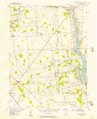 1954 Shawnee Hills1956 Print · USGSUnion and Delaware counties are captured in the mid-fifties, just as the area around the O'Shaughnessy Reservoir was becoming a focal point of the region. Researchers can trace ancestral sites including the Girls Industrial Sch, Oller Cem, and the small settlement of Bellepoint.
 - 1954 Map of Hilliard, 1956 Print
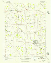 1954 Hilliard1956 Print · USGSCentral Ohio farm country and railway junctions are captured here in the mid-fifties, centered on the growing village of Hilliard. Genealogists can locate old rural landmarks like Mudsock, St John Ch, and the Hilliard Cemetery as they appeared before suburbanization.
 - 1961 Map of East Liberty
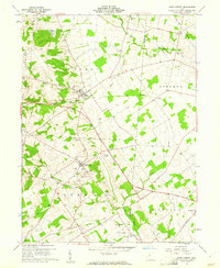 1961 East Liberty1961 Print · USGSCentral Ohio farmland at the start of the 1960s reveals a dense network of family cemeteries and rural schools. Genealogists can trace local roots through sites like Quaker Cem and Middleburg Cem, or locate the Old Railroad Grade near East Liberty.4 unique versions available
Showing maps 1-25 of 149
Top cities of Union County
Frequently asked questions
- What are the different types of historical maps available for Union County?
- What is the oldest map of Union County?
- Where can I purchase historical maps of Union County for my home or office?
- Where can I download high-res historical maps of Union County?
- Are there historical topographic maps available for Union County?
- Is there historical aerial imagery available for Union County?
- Where are historical maps of Union County sourced from?