1960s Maps of Jackson Township, Ohio
Explore 8 historic maps of Jackson Township from the 1960s. These maps offer a rare glimpse into what life looked like during the 1960s — showing old roads, neighborhoods, homes, and landmarks that have changed or disappeared over time.
Whether you're researching your family's past, planning a metal detecting trip, or studying how Jackson Township's landscape evolved across the 1960s, these high-resolution maps are a powerful tool for exploring the history of this region.
- Focus on a specific era: All maps on this page are from the 1960s, giving you a focused view of this time period.
- See what’s changed: Compare century-old streets, trails, and buildings to today's modern landscape using overlays and satellite layers.
- Research with precision: Use these maps for genealogy, historical research, land use analysis, or educational projects.
- View, download, or print: Maps are fully viewable online in high resolution, and can be downloaded or printed for your own records.
Start exploring Jackson Township's history through authentic maps from the 1960s. This is your window into the past.
Jackson Township, OH maps
(8)- 1961 Map of New Bloomington, 1962 Print
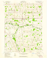 1961 New Bloomington1962 Print · USGSMarion County's rural townships are captured here in the early sixties, showing a landscape defined by the Scioto River and active rail lines. Researchers can trace family history through numerous small burial sites like Guthery and Salem Ch Cem, or locate the old Bell School.3 unique versions available
 - 1961 Map of La Rue, 1962 Print
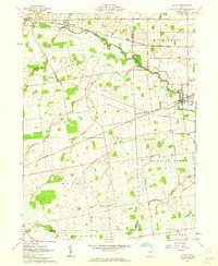 1961 La Rue1962 Print · USGSIn the early 1960s, this pocket of Marion and Hardin counties was a crossroads of the Erie-Lackawanna and New York Central railroads. Genealogists can locate numerous family burial grounds including Bonner Cem and Virden Cem, or trace the path of the Scioto River through La Rue.2 unique versions available
 - 1961 Map of Prospect, 1963 Print
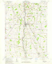 1961 Prospect1963 Print · USGSCentral Ohio's agricultural heartland is documented here in the early sixties, showing the vital river crossings and rail lines of Marion and Delaware Counties. Trace local genealogy and infrastructure via Prospect Cem, the Erie Railroad, and Hoskins Bridge Gaging Station.2 unique versions available
 - 1961 Map of York Center, 1963 Print
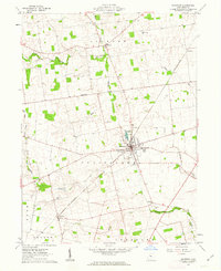
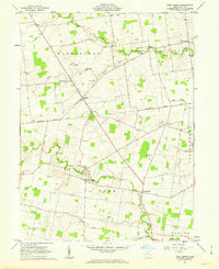 1961 York Center1963 Print · USGSUnion County's rural landscape is captured in the early sixties, showing the agricultural heart of the Virginia Military District. Trace local history through the Greenville Treaty Line or explore old sites like Grace Chapel, Camp Union, and Byhalia Cem.2 unique versions available
 - 1961 Map of Marion West, 1963 Print
 1961 Marion West1963 Print · USGSMarion emerges as a powerful rail hub in the early sixties, defined by the intersection of four major rail lines. Genealogists and local historians can trace the foundations of the community through its numerous neighborhood schools like Baker Jr High Sch and historic sites such as Green Camp Cem.4 unique versions available
 - 1961 Map of Richwood, 1963 Print
 1961 Richwood1963 Print · USGSRichwood and the surrounding Union County townships are captured here in the early sixties, a period of established rail and agricultural life. Researchers can locate numerous family burial sites like Hamilton Cem, trace the historic Greenville Treaty Line, and find the Bethlehem Ch.
 - 1962 Map of Marion
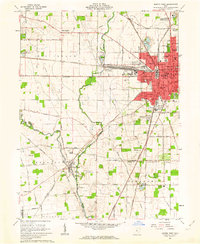
 1962 Marion1962 Print · USGSCentral Ohio during the post-war era showcases a dense network of railroad towns and emerging interstate highways. Genealogists can trace family roots in smaller settlements like Houcktown and Marseilles or locate landmarks near Indian Lake.
 - 1966 Map of Marion, 1968 Print
 1966 Marion1968 Print · USGSCentral Ohio in the mid-sixties is captured during a period of rapid highway expansion and industrial connectivity. Genealogists and historians can trace rail-and-river networks through towns like Marion, Urbana, and Mount Vernon, or locate landmarks such as Malabar Farm and Black Hand Rock.3 unique versions available
End of results
Showing maps 1-8 of 8
Top cities near Jackson Township
- Delaware historical maps
- Marion historical maps
- Marysville historical maps
- Scioto historical maps
- Radnor historical maps
- Richwood historical maps
See more
Top neighborhoods of Jackson Township
Frequently asked questions
- What are the different types of historical maps available for Jackson Township?
- What is the oldest map of Jackson Township?
- Where can I purchase historical maps of Jackson Township for my home or office?
- Where can I download high-res historical maps of Jackson Township?
- Are there historical topographic maps available for Jackson Township?
- Is there historical aerial imagery available for Jackson Township?
- Where are historical maps of Jackson Township sourced from?