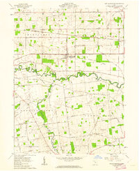
1961 Map of New Bloomington
USGS Topo · Published 1962About this map
The Scioto River and its meandering tributaries dominate this central Ohio landscape, where the Erie Lackawanna and New York Central railroads parallel each other through the farming communities of De Cliff and Espyville. The village of New Bloomington serves as a central hub, surrounded by numerous family and community burial grounds including the Agosta and Hoover-Crossing cemeteries. Large tracts of land are preserved within the Big Island Wildlife Area, while the surrounding townships of Montgomery and Bowling Green are etched with a geometric grid of rural roads such as Linwood Road and Windfall Road. Genealogists may find interest in the scattered rural landmarks like the Bell School and Townhall, which suggest the historic civic structure of the region before modern consolidation changed the rural landscape.
Find a feature on this map
68 named features on this map. Tap any name to fly to it.
Don’t see what you’re looking for? This feature index may not catch every label — zoom into the map to look around manually.
Map Details
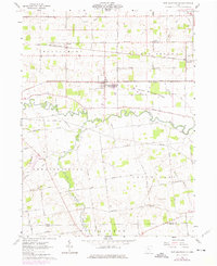
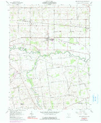
Editions of this 1961 New Bloomington Map
3 editions found
Other maps of this area

1903 · Marion
USGS Topo · 1:62,500

1905 · Marion
USGS Topo · 1:62,500

1913 · Richwood
USGS Topo · 1:62,500

1915 · Richwood
USGS Topo · 1:62,500

1915 · La Rue
USGS Topo · 1:62,500

1924 · Delaware
USGS Topo · 1:62,500

1925 · Delaware
USGS Topo · 1:62,500

1944 · Richwood
USGS Topo · 1:62,500

1944 · Delaware
USGS Topo · 1:62,500

1950 · Marion
USGS Topo · 1:250,000
Featured Places
- New Bloomington, OH
- DeCliff, OH
- Big Island Township, OH
- Bowling Green Township, OH
- Green Camp Township, OH