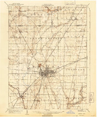
1905 Map of Marion
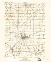
USGS Topo · Published 1944About this map
Marion emerges as a significant regional rail hub at the start of the twentieth century, defined by a dense radial network of tracks including the Hocking Valley Line, Pennsylvania System, and St Louis and lines. The urban grid is established around a central Cemetery and nearby Reservoir, with industrial activity anchored by a large Quarry on the northwestern edge of the city. Beyond the city center, the landscape is divided into a geometric grid of rural townships like Grand Prairie and Pleasant. The survey details the convergence of multiple waterways, notably the Little Scioto River and Scioto River, which dictated the early placement of smaller settlements such as Greencamp and Little Sandusky. This layout illustrates the transition from a river-dependent frontier to a steam-powered industrial center, with the Electric and Steam R R pushing south toward Owen.
Find a feature on this map
50 named features on this map. Tap any name to fly to it.
Don’t see what you’re looking for? This feature index may not catch every label — zoom into the map to look around manually.
Map Details
Editions of this 1905 Marion Map
This is the sole edition of this map. No revisions or reprints were ever made.
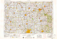
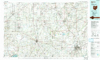
Historical Maps of Marion Through Time
6 maps found


Featured Locations
- Marion, OH
- Morral, Salt Rock Township
- Harpster, Pitt Township
- Green Camp, Green Camp Township
- Big Island, Big Island Township