2020s Maps of Van Wert, Ohio
Explore 3 historic maps of Van Wert from the 2020s. These maps offer a rare glimpse into what life looked like during the 2020s — showing old roads, neighborhoods, homes, and landmarks that have changed or disappeared over time.
Whether you're researching your family's past, planning a metal detecting trip, or studying how Van Wert's landscape evolved across the 2020s, these high-resolution maps are a powerful tool for exploring the history of this region.
- Focus on a specific era: All maps on this page are from the 2020s, giving you a focused view of this time period.
- See what’s changed: Compare century-old streets, trails, and buildings to today's modern landscape using overlays and satellite layers.
- Research with precision: Use these maps for genealogy, historical research, land use analysis, or educational projects.
- View, download, or print: Maps are fully viewable online in high resolution, and can be downloaded or printed for your own records.
Start exploring Van Wert's history through authentic maps from the 2020s. This is your window into the past.
Van Wert, OH maps
(3)- 2023 Map of Glenmore, 2023 Print
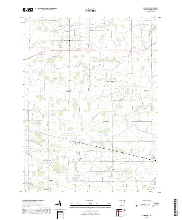 2023 Glenmore2023 Print · USGSVan Wert County's rural landscape is mapped here in the modern era, showing the enduring grid of crossroads and family burial grounds. Researchers can trace ancestral roots at Greenbriar Cem or locate old community sites like Abanaka and Schumm.
 - 2023 Map of Van Wert, 2023 Print
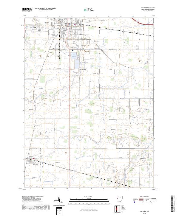 2023 Van Wert2023 Print · USGSWestern Ohio’s glacial ridges and rural townships are captured here in the early twenty-first century as agricultural traditions meet modern water management. Researchers can locate family plots at Woodland Union Cem or trace the early path of the Lincoln Hwy near the Van Wert County Courthouse.
 - 2023 Map of Scott, 2023 Print
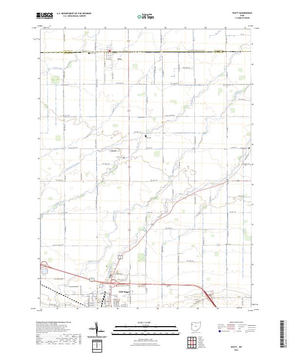 2023 Scott2023 Print · USGSNorthwest Ohio's agricultural heartland is documented here at the Paulding and Van Wert county line. Researchers can trace family history through sites like Scott Cem and Dunkard Cem or follow the paths of Pottawatomie Creek and Stripe Creek.
End of results
Showing maps 1-3 of 3
Top cities near Van Wert
- Spencerville historical maps
- Payne historical maps
- Rockford historical maps
- Convoy historical maps
- Ohio City historical maps
- Mendon historical maps
See more
Frequently asked questions
- What are the different types of historical maps available for Van Wert?
- What is the oldest map of Van Wert?
- Where can I purchase historical maps of Van Wert for my home or office?
- Where can I download high-res historical maps of Van Wert?
- Are there historical topographic maps available for Van Wert?
- Is there historical aerial imagery available for Van Wert?
- Where are historical maps of Van Wert sourced from?