2020s Maps of Clearcreek Township, Ohio
Explore 4 historic maps of Clearcreek Township from the 2020s. These maps offer a rare glimpse into what life looked like during the 2020s — showing old roads, neighborhoods, homes, and landmarks that have changed or disappeared over time.
Whether you're researching your family's past, planning a metal detecting trip, or studying how Clearcreek Township's landscape evolved across the 2020s, these high-resolution maps are a powerful tool for exploring the history of this region.
- Focus on a specific era: All maps on this page are from the 2020s, giving you a focused view of this time period.
- See what’s changed: Compare century-old streets, trails, and buildings to today's modern landscape using overlays and satellite layers.
- Research with precision: Use these maps for genealogy, historical research, land use analysis, or educational projects.
- View, download, or print: Maps are fully viewable online in high resolution, and can be downloaded or printed for your own records.
Start exploring Clearcreek Township's history through authentic maps from the 2020s. This is your window into the past.
Clearcreek Township, OH maps
(4)- 2023 Map of Lebanon, 2023 Print
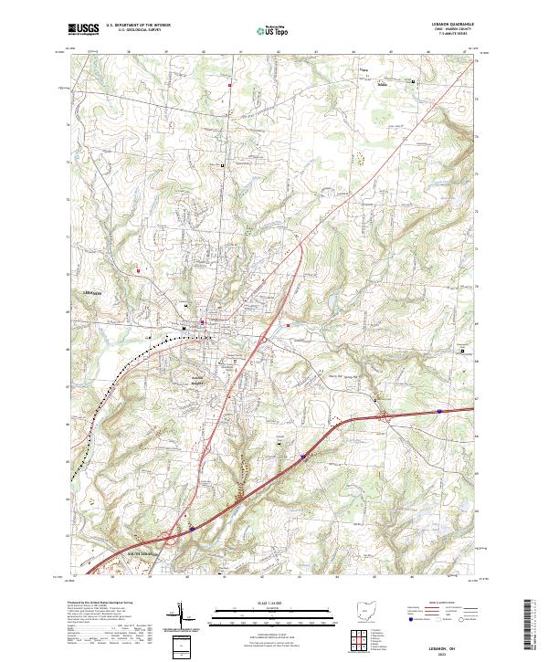 2023 Lebanon2023 Print · USGSWarren County shows its modern growth and deep roots in this recent survey of the area around the county seat. Researchers can find numerous family and community burial sites like Pioneer Cem, Dodds Cem, and Hatfield Cem alongside the historic Warren County Courthouse Annex.
 - 2023 Map of Monroe, 2023 Print
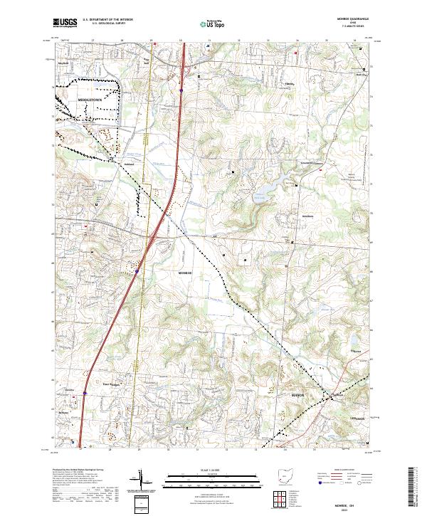 2023 Monroe2023 Print · USGSSouthwestern Ohio's transition from rural farmsteads to suburban hubs is captured here at the Butler and Warren County line. Researchers can trace old family burial sites like Dicks Creek Cemetery and Mound Cemetery near Monroe.
 - 2023 Map of Springboro, 2023 Print
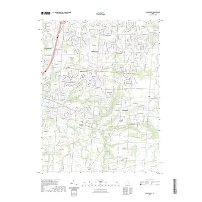 2023 Springboro2023 Print · USGSSpringboro and its surrounding Montgomery and Warren County hamlets are shown in modern detail, preserving a deep record of nineteenth-century settlement. Genealogists can locate numerous pioneer burial sites including Hicksite Quaker Cem, Graham Cem, and Salem Reformed Church Cem.
 - 2023 Map of Franklin, 2023 Print
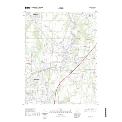 2023 Franklin2023 Print · USGSSouthwestern Ohio's industrial and river corridor comes into focus in this contemporary survey of the Miami Valley. Genealogists and local historians can trace family roots at Swartzel Cem and Tapscott Cem, or locate landmarks like Hummel Airport and Chautauqua.
End of results
Showing maps 1-4 of 4
Top cities near Clearcreek Township
- Dayton historical maps
- Kettering historical maps
- Middletown historical maps
- Beavercreek historical maps
- Mason historical maps
- Trotwood historical maps
See more
Top neighborhoods of Clearcreek Township
- Red Lion historical maps
- Flat Iron historical maps
- Kenricksville historical maps
- Pekin historical maps
- Ridgeville historical maps
- Dodds historical maps
See more
Frequently asked questions
- What are the different types of historical maps available for Clearcreek Township?
- What is the oldest map of Clearcreek Township?
- Where can I purchase historical maps of Clearcreek Township for my home or office?
- Where can I download high-res historical maps of Clearcreek Township?
- Are there historical topographic maps available for Clearcreek Township?
- Is there historical aerial imagery available for Clearcreek Township?
- Where are historical maps of Clearcreek Township sourced from?