Old Maps of Harveysburg, Ohio for Hiking & Exploration
Hike through history with 44 historic maps of Harveysburg. Explore old trails, ghost towns, and forgotten backroads — perfect for outdoor adventurers and local explorers.
- Rediscover forgotten places: Map out old mining camps, roads, and footpaths that no longer exist on modern maps.
- Layer with modern tools: Combine with LiDAR or satellite views to plan hikes through historical terrain.
- Made for exploration: Popular among hikers, overlanders, and local history lovers.
Use these maps to find adventure and explore the hidden past of Harveysburg.
Harveysburg, OH maps
(44)- 1907 Map of Blanchester
 1907 Blanchester1907 Print · USGSClinton County at the dawn of the twentieth century was a landscape of well-connected rail towns and country parishes. Genealogists can trace family roots through numerous landmarks like Macedonia Chapel, Dutch School, and the Childrens Home near Wilmington.3 unique versions available
 - 1913 Map of Waynesville
 1913 Waynesville1913 Print · USGSThe Miami and Erie Canal and a dense network of electric railways define this Ohio landscape in the decade before the Great War. Researchers can trace the early footprints of Waynesville, Centerville, and Springboro alongside rural landmarks like Washington Mills and Lantz School.
 - 1914 Map of Morrow, 1963 Print
 1914 Morrow1963 Print · USGSWarren County in the years before the Great War is a landscape of thriving river towns and busy rail junctions. Genealogists and historians can trace family locations through numerous rural schoolhouses like Chestnut Ridge School or landmarks like Fort Ancient and Stubbs Mill.
 - 1915 Map of Waynesville, 1942 Print
 1915 Waynesville1942 Print · USGSThe Dayton suburbs and Warren County countryside are captured here just before the Great War, during the heyday of electric interurban rail. Genealogists can locate specific local landmarks like Lantz School, Wittes Corners, and the historic community of Shakertown.
 - 1916 Map of Morrow, 1936 Print
 1916 Morrow1936 Print · USGSWarren County at the start of the Great War is a landscape of thriving river towns and dense rural school districts. Genealogists can locate family-named schools and early settlements like Harveysburg, Maineville, and the landmark Fort Ancient.2 unique versions available
 - 1917 Map of Xenia, 1934 Print
 1917 Xenia1934 Print · USGSGreene County was a thriving center of rail and education during the early twentieth century, anchored by the hub of Xenia. Genealogists can trace family roots through dozens of local landmarks, from Wilberforce University to the Soldiers and Sailors Orphans Home and Lumberton.2 unique versions available
 - 1947 Map of Columbus, 1948 Print
 1947 Columbus1948 Print · USGSCentral Ohio in the late 1940s is captured in this survey, showing the post-war transition of its rail hubs and military airfield expansions. Genealogists and historians can trace the paths of the Ohio Canal, the Pennsylvania RR lines, and the Camp Sherman Military Reservation.
 - 1953 Map of Cincinnati, 1965 Print
 1953 Cincinnati1965 Print · USGSThe Ohio River valley and the industrial heartland of Indiana and Ohio are captured here during the mid-century peak of rail and river commerce. Genealogists and historians can trace connections between Cincinnati and outlying military sites like Camp Atterbury and Bakalar AFB.3 unique versions available
 - 1955 Map of New Burlington, 1956 Print
 1955 New Burlington1956 Print · USGSGreene and Clinton Counties are shown in the mid-1950s as a landscape of established townships and winding creek forks. Genealogists and local historians can trace family roots through numerous sites like New Burlington Cem, Richland Ch, and McKay Cem.2 unique versions available
 - 1955 Map of Waynesville, 1956 Print
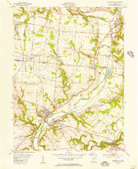 1955 Waynesville1956 Print · USGSThe Little Miami River valley in the mid-fifties remains a landscape of small railroad hamlets and historic church communities. Genealogists and historians can trace family locations near Waynesville, Spring Valley, and the now-submerged banks of Caesar Creek.2 unique versions available
 - 1955 Map of Oregonia, 1956 Print
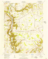 1955 Oregonia1956 Print · USGSWarren County at the dawn of the interstate era still revolves around the river valley and its rail connections. Researchers can trace ancestral locations at Mathers Mills, Harveysburg, and local landmarks like Olive Branch Ch.2 unique versions available
 - 1957 Map of Cincinnati
 1957 Cincinnati1957 Print · USGSThe Ohio River valley and its surrounding highlands thrived during the mid-fifties industrial peak, centered on the bustling Cincinnati and Dayton metropolitan hubs. Researchers can trace the extensive rail networks and military sites like Wright-Patterson AFB and Camp Atterbury.
 - 1960 Map of Clarksville, 1962 Print
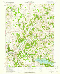 1960 Clarksville1962 Print · USGSThe Clinton and Warren county line runs through this early 1960s landscape as the newly established Cowan State Park takes shape. Genealogists can trace local roots at Jonahs Run Ch, Sewell Cem, and the village of Clarksville.3 unique versions available
 - 1961 Map of Columbus
 1961 Columbus1961 Print · USGSCentral and Southern Ohio are captured here in the early sixties, as the region's industrial rail hubs and military bases reached their peak. Genealogists and historians can trace the transition from urban Columbus to rural townships along the Scioto River, locating Lockbourne USAF and old junctions like Washington Court House.
 - 1962 Map of Columbus
 1962 Columbus1962 Print · USGSCentral Ohio during the early sixties reveals a transition from the industrial corridors of Columbus to the forested ridges of the south. Genealogists and historians can trace the rail networks of the Baltimore & Ohio RR and find local landmarks like Washington Court House and Camp Sherman Military Reservation.
 - 1967 Map of Columbus, 1969 Print
 1967 Columbus1969 Print · USGSCentral Ohio during the late sixties serves as a vital corridor of rail and aviation, from the industrial streets of Springfield to the hangar lines of Lockbourne Air Force Base. Genealogists and researchers can trace the growth of towns like Circleville and London or locate rural landmarks such as St Paul church and the London Correctional Institution.2 unique versions available
 - 1968 Map of New Burlington, 1969 Print
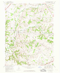 1968 New Burlington1969 Print · USGSSouthwestern Ohio at the close of the sixties reveals a landscape of quiet rural villages and river crossings. Researchers can locate the Covered Bridge at New Burlington, the Indian Mound in Massie, and family sites near Richland Church.4 unique versions available
 - 1968 Map of Oregonia, 1970 Print
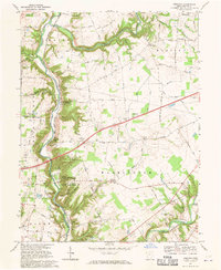 1968 Oregonia1970 Print · USGSWarren County's river bluffs and prehistoric earthworks are preserved here in the late sixties. Genealogists and historians can trace family land via Lukens Road or locate early markers at Turtle Creek Cem and the ancient Burial Mounds.3 unique versions available
 - 1968 Map of Waynesville, 1970 Print
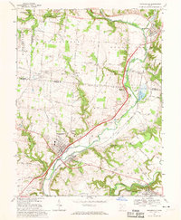 1968 Waynesville1970 Print · USGSThe Little Miami River valley in the late sixties shows a landscape of established river towns and expanding conservation areas. Genealogists can trace family landmarks and burial sites like Miami Cemetery, Roxanna, and the village of Waynesville.3 unique versions available
 - 1986 Map of Springfield
 1986 Springfield1986 Print · USGSCentral Ohio in the mid-1980s shows the bustling rail-and-road network connecting Springfield and Xenia to the western outskirts of Columbus. Researchers can trace old family sites and transit routes through Glen Haven Mem Cem, Madison Lake State Park, and the CONRAIL line.2 unique versions available
 - 1986 Map of Hillsboro
 1986 Hillsboro1986 Print · USGSThe rural landscapes of Highland and Clinton counties appear in the mid-eighties as a busy corridor of railroads and regional airports. Genealogists and historians can trace old community centers like Reesville and Starbucktown alongside significant landmarks like Wilmington College and Fort Hill State Memorial.2 unique versions available
 - 1986 Map of Cincinnati
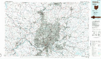 1986 Cincinnati1986 Print · USGSGreater Cincinnati and its tri-state surrounds are captured here in the mid-eighties as suburban growth reached into the neighboring hills and river valleys. Researchers can trace the development of transit hubs like Greater Cincinnati International Airport and historic sites such as Spring Grove Cemetery.3 unique versions available
 - 1986 Map of Dayton
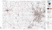 1986 Dayton1986 Print · USGSThe Miami Valley and the Indiana-Ohio borderlands reached a peak of suburban and industrial connectivity in the mid-eighties. Genealogists and historians can trace family burial sites at Miami Memorial Garden (Cem) and the development surrounding Wright-Patterson Air Force Base.2 unique versions available
 - 1996 Map of Oregonia, 1999 Print
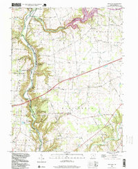 1996 Oregonia1999 Print · USGSWarren County at the close of the twentieth century reveals a landscape where ancient earthworks meet modern conservation efforts. Genealogists and historians can trace family sites at Turtle Creek Cem or explore the river-valley hamlets of Oregonia and Mathers Mills.
 - 2010 Map of Clarksville, 2010 Print
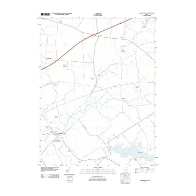 2010 Clarksville2010 Print · USGSWarren County at the start of the 2010s reveals a landscape of historic crossroads and significant agricultural heritage. Researchers can trace family roots through the many local burial sites, including the Quaker Cemetery and Sewell Cemetery, or locate regional landmarks like the Dale Stokes Raspberry Farm.
Showing maps 1-25 of 44
Top cities near Harveysburg
- Dayton historical maps
- Kettering historical maps
- Beavercreek historical maps
- Xenia historical maps
- Centerville historical maps
- Lebanon historical maps
See more
Frequently asked questions
- What are the different types of historical maps available for Harveysburg?
- What is the oldest map of Harveysburg?
- Where can I purchase historical maps of Harveysburg for my home or office?
- Where can I download high-res historical maps of Harveysburg?
- Are there historical topographic maps available for Harveysburg?
- Is there historical aerial imagery available for Harveysburg?
- Where are historical maps of Harveysburg sourced from?