1990s Maps of Washington County, Ohio
Explore 20 historic maps of Washington County from the 1990s. These maps offer a rare glimpse into what life looked like during the 1990s — showing old roads, neighborhoods, homes, and landmarks that have changed or disappeared over time.
Whether you're researching your family's past, planning a metal detecting trip, or studying how Washington County's landscape evolved across the 1990s, these high-resolution maps are a powerful tool for exploring the history of this region.
- Focus on a specific era: All maps on this page are from the 1990s, giving you a focused view of this time period.
- See what’s changed: Compare century-old streets, trails, and buildings to today's modern landscape using overlays and satellite layers.
- Research with precision: Use these maps for genealogy, historical research, land use analysis, or educational projects.
- View, download, or print: Maps are fully viewable online in high resolution, and can be downloaded or printed for your own records.
Start exploring Washington County's history through authentic maps from the 1990s. This is your window into the past.
Washington County, OH maps
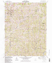
(20)- 1994 Map of Marietta, 1998 Print
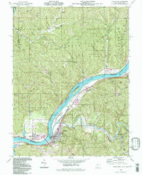
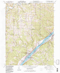
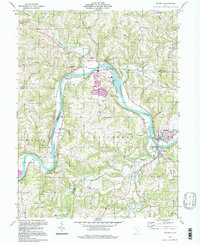
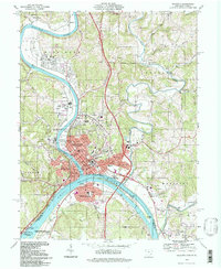 1994 Marietta1998 Print · USGSMarietta and its riverfront neighborhoods thrive at the confluence of the Ohio and Muskingum rivers in the mid-nineties. Genealogists and historians can trace local heritage through Marietta College, the Putnam Cem, and landmarks like the Campus Martius Museum.
 - 1994 Map of Macksburg, 1998 Print
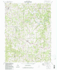
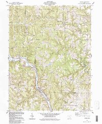
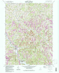 1994 Macksburg1998 Print · USGSSoutheastern Ohio’s ridge-and-valley landscape is documented here in the 1990s as the communities of the Noble and Washington county border maintained their rural character. Researchers can pinpoint several family burial sites like Hesson Cem and Rado Cem or trace the early paths through South Olive and Middleburg.
 - 1994 Map of Fleming, 1998 Print
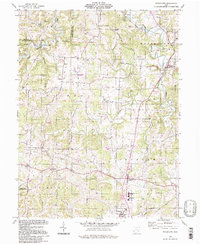
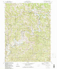
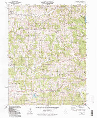 1994 Fleming1998 Print · USGSWashington County during the late twentieth century maintains its rural character even as energy extraction intensifies across the ridges. Genealogists and local historians can trace family locations near the Covered Bridge on Horse Run or explore church records from St John Ch and Pleasant Grove Ch.
 - 1994 Map of Valley Mills, 1998 Print
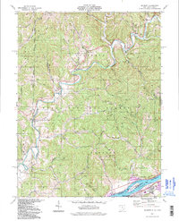
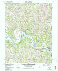
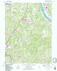 1994 Valley Mills1998 Print · USGSThe West Virginia-Ohio border near Parkersburg comes to life in this mid-nineties survey of the river valley and its ridge-top communities. Genealogists can trace family landmarks like Henderson Cem, Boreman Sch, and the riverside Old Lock No 17.
 - 1994 Map of Dalzell, 1998 Print
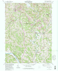
 1994 Dalzell1998 Print · USGSSoutheast Ohio's deeply wooded ridges and hollows appear in the 1990s as a landscape of small hamlets and resource extraction. Genealogists can trace family names and local landmarks at Masterton Cem, Waxler Ch, and the settlement of Germantown.
 - 1994 Map of Willow Island, 1998 Print
 1994 Willow Island1998 Print · USGSThe Ohio River valley and its rugged West Virginia hinterlands are captured here in the late twentieth century. Genealogists can trace local roots through numerous country landmarks like Pleasant Grove Ch, Old Parrish Cem, and the historic Volcano Oil Field.
 - 1994 Map of Belmont, 1998 Print
 1994 Belmont1998 Print · USGSThe Ohio River corridor near the West Virginia border comes to life in this late-twentieth-century study of rural river life. Genealogists and historians can trace family locations through numerous sites like Yankeeburg, the Old Dutch Cem, and the Covered Bridge near the riverbanks.2 unique versions available
 - 1994 Map of Chesterhill, 1998 Print
 1994 Chesterhill1998 Print · USGSThe rural highlands of Morgan and Washington counties are captured here in the late twentieth century. Genealogists can trace small-town life through Patten Mills, Plantsville, and numerous country churches like Wesleyan Ch.
 - 1994 Map of Watertown, 1998 Print
 1994 Watertown1998 Print · USGSWestern Washington County's rural character remains centered on the Wolf Creek valley during the late twentieth century. Genealogists and historians can trace family locations through landmarks like Oak Hill Ch, Stanley Cem, and the Old Railroad Grade.
 - 1994 Map of Rinard Mills, 1998 Print
 1994 Rinard Mills1998 Print · USGSThe Little Muskingum River valley of southeastern Ohio is shown here during the late twentieth century within the Wayne National Forest. Researchers can locate old congregations and family burial sites such as Merrell Ridge Ch, Cline Cem, and Bloomfield.
 - 1994 Map of Little Hocking, 1998 Print
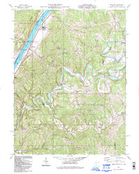
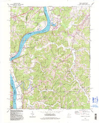
 1994 Little Hocking1998 Print · USGSAlong the Ohio River during the late twentieth century, this area shows the historic river-bottom lands of Washington Bottom. Researchers can locate riverside landmarks like Blennerhassett Island and trace rural lineages through the McDougle Cem and Fairfield Cem.
 - 1994 Map of Raven Rock, 1998 Print
 1994 Raven Rock1998 Print · USGSThe Ohio River valley was still a busy corridor of rail and river industry in the 1990s, anchored by the riverfront communities of St Marys and Newport. Researchers can trace the heritage of local families and industry through landmarks like Union Mills, Vaucluse, and the B & O RR line.
 - 1994 Map of Bens Run, 1998 Print
 1994 Bens Run1998 Print · USGSPleasants and Tyler Counties are shown in the mid-1990s as a landscape of winding river bottoms and high ridge settlements. Researchers can trace family sites at Point Lookout Ch Cem, locate industrial markers like Lock and Dam No 16, and explore the rural character of Arvilla.
 - 1994 Map of New Matamoras, 1998 Print
 1994 New Matamoras1998 Print · USGSThe Ohio River corridor near New Matamoras and Sistersville is captured here in the 1990s, showing a river valley shaped by navigation and industry. Researchers can find old family landmarks and rural sites like Salem Hall, Yellow House, and Grandview Cem.
 - 1994 Map of Cutler, 1998 Print
 1994 Cutler1998 Print · USGSSoutheastern Ohio's ridges and river bends appear here in the final decade of the century, showing the enduring rural layout of Washington County. Researchers can trace ancestral sites at Haga Mission, Old Railroad Grade, and Norris Cem.
 - 1994 Map of Lowell, 1998 Print
 1994 Lowell1998 Print · USGSThe Muskingum River valley in the 1990s remains a landscape of river-bend hamlets and deep-rooted family landmarks. Genealogists and local historians can trace legacy sites like the Old German Cem, Our Lady of Mercy Ch, and the riverside community of Coal Run.
 - 1994 Map of Lower Salem, 1998 Print
 1994 Lower Salem1998 Print · USGSWashington County’s ridge-and-valley landscape is documented here in the 1990s, where the confluence of the Duck Creek forks defines the local geography. Genealogists can locate family sites at Flanders Cem, Mt Ephraim Ch, or the small community of Whipple along the river.
 - 1994 Map of Beverly, 1998 Print
 1994 Beverly1998 Print · USGSThe Muskingum River valley in the 1990s remained a landscape defined by its river-bend settlements and deep family roots. Genealogists can locate numerous historic burial sites such as DeLong Cem and Milnor Cem or trace the legacy of schools like Fort Frye Sch.
 - 1994 Map of Parkersburg, 1998 Print
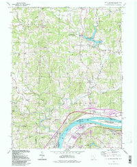
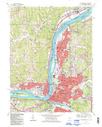 1994 Parkersburg1998 Print · USGSThe industrial and riverfront corridor of the Ohio Valley is captured here in the late twentieth century as it connects West Virginia and Ohio. Researchers can trace family sites from Mt Olivet Cemetery to the schools of Vienna and the landmark Blennerhassett Island Historic State Park.
 - 1994 Map of Lubeck, 1998 Print
 1994 Lubeck1998 Print · USGSThe Ohio River valley near the Wood and Athens county lines appears here during the mid-to-late twentieth century. Researchers can trace riverfront history at Fort Belleville and Harris Ferry, or locate family sites like Munchmeyer Ch and Newberry Cem.
End of results
Showing maps 1-20 of 20
Top cities of Washington County
- Marietta historical maps
- Belpre historical maps
- Waterford historical maps
- Dunham historical maps
- Barlow historical maps
- Newport historical maps
See more
Frequently asked questions
- What are the different types of historical maps available for Washington County?
- What is the oldest map of Washington County?
- Where can I purchase historical maps of Washington County for my home or office?
- Where can I download high-res historical maps of Washington County?
- Are there historical topographic maps available for Washington County?
- Is there historical aerial imagery available for Washington County?
- Where are historical maps of Washington County sourced from?