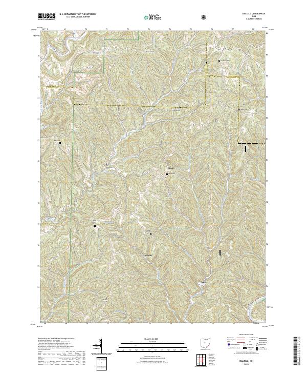
Old Maps of Dalzell, Ohio for Metal Detecting
Plan your next treasure hunt with 15 historic maps of Dalzell. Find old homesites, ghost towns, trails, and gathering spots that may be lost to time — perfect for identifying promising metal detecting locations.
- Locate forgotten sites: Uncover places like long-lost settlements, abandoned rail lines, or gathering spots.
- Plan better hunts: Use map overlays combined with LiDAR or satellite views to narrow in on historically rich areas.
- Made for detectorists: Thousands of hobbyists use these maps to discover relics, coins, and hidden history.
Use these historic maps to boost your research and find new opportunities beneath the surface of Dalzell.
Dalzell, OH maps
(15)- 1903 Map of Macksburg, 1958 Print
 1903 Macksburg1958 Print · USGSSoutheast Ohio's river valleys and rail corridors were the lifelines of Noble and Washington counties at the turn of the century. Genealogists can trace family roots through rural post offices like Germantown Saltpeter PO and rail hubs such as Macksburg and Dexter City.
 - 1905 Map of Macksburg, 1948 Print
 1905 Macksburg1948 Print · USGSSoutheastern Ohio at the turn of the century was a landscape of deep creek valleys and rising ridges connected by river and rail. Local historians can trace early post offices like Carlisle Berne P.O. and the winding P. R. R. railroad.
 - 1949 Map of Clarksburg
 1949 Clarksburg1949 Print · USGSThe upper Ohio River valley and the industrial heart of West Virginia come into focus during this post-war period. Genealogists and researchers can trace the rail corridors of the Baltimore and Ohio and locate centers like Fairmont, Grafton, and Waynesburg.
 - 1956 Map of Clarksburg, 1966 Print
 1956 Clarksburg1966 Print · USGSThe Ohio River valley and the industrial heart of West Virginia are seen here in the mid-1950s as rail and river commerce thrived. Researchers can trace historic transport lines like the Baltimore and Ohio RR and locate ancestral homes in Clarksburg, Moundsville, or Parkersburg.2 unique versions available
 - 1961 Map of Clarksburg
 1961 Clarksburg1961 Print · USGSThe mid-century industrial and river landscapes of West Virginia and Ohio are detailed here, centered on the Ohio River. Researchers can trace the Baltimore and Ohio rail lines connecting towns like Parkersburg, Clarksburg, and Monongah.
 - 1961 Map of Dalzell, 1963 Print
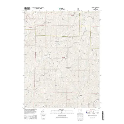
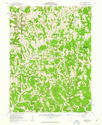 1961 Dalzell1963 Print · USGSSoutheast Ohio’s rural landscape is captured here in the early sixties, showing the deeply etched valleys of the Wayne National Forest. Researchers can locate several country congregations and small settlements like Lebanon, Masterton, and Gasville.4 unique versions available
 - 1980 Map of Senecaville, 1983 Print
 1980 Senecaville1983 Print · USGSEastern Ohio at the start of the eighties reveals a complex landscape of coal extraction and river commerce. Genealogists and historians can trace rail lines like the Conrail and Baltimore and Ohio RR connecting towns like Byesville and Woodsfield.2 unique versions available
 - 1988 Map of Clarksburg, 1989 Print
 1988 Clarksburg1989 Print · USGSThe central Appalachians are documented in detail during the late eighties, showing the industrial and river-based economies of West Virginia, Ohio, and Pennsylvania. Researchers can trace historic rail routes like the B & O RR and locate river towns from St Marys to Parkersburg.
 - 1994 Map of Dalzell, 1998 Print
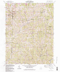 1994 Dalzell1998 Print · USGSSoutheast Ohio's deeply wooded ridges and hollows appear in the 1990s as a landscape of small hamlets and resource extraction. Genealogists can trace family names and local landmarks at Masterton Cem, Waxler Ch, and the settlement of Germantown.
 - 2002 Map of Dalzell, 2006 Print
 2002 Dalzell2006 Print · USGSSoutheast Ohio’s rural landscape is captured here just after the turn of the millennium, showing a region defined by forest and small-scale industry. Genealogists and local historians can trace family ties at Zion Ch (Cem) or find the historic Hune Covered Bridge.
 - 2011 Map of Dalzell, 2011 Print
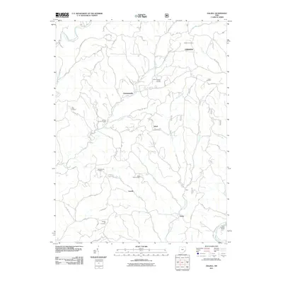 2011 Dalzell2011 Print · USGSCovers Dalzell, including Gasville, Heslop, and other nearby areas
 - 2013 Map of Dalzell, 2013 Print
 2013 Dalzell2013 Print · USGSCovers Dalzell, including Gasville, Heslop, and other nearby areas
 - 2016 Map of Dalzell, 2016 Print
 2016 Dalzell2016 Print · USGSCovers Dalzell, including Gasville, Heslop, and other nearby areas
 - 2019 Map of Dalzell, 2019 Print
 2019 Dalzell2019 Print · USGSCovers Dalzell, including Gasville, Heslop, and other nearby areas
 - 2023 Map of Dalzell, 2023 Print
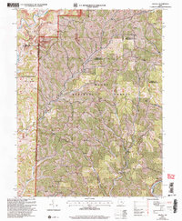
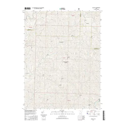
 2023 Dalzell2023 Print · USGSWashington County at the start of the 2020s shows a landscape of ridge-top roads and creek-valley settlements. Researchers can locate many local landmarks, including Dalzell Cem, the village of Gasville, and the Scotts Ridge Cem within the Wayne National Forest.
End of results
Showing maps 1-15 of 15
Top cities near Dalzell
- Marietta historical maps
- Vienna historical maps
- Williamstown historical maps
- Woodsfield historical maps
- Newport historical maps
- Caldwell historical maps
See more
Frequently asked questions
- What are the different types of historical maps available for Dalzell?
- What is the oldest map of Dalzell?
- Where can I purchase historical maps of Dalzell for my home or office?
- Where can I download high-res historical maps of Dalzell?
- Are there historical topographic maps available for Dalzell?
- Is there historical aerial imagery available for Dalzell?
- Where are historical maps of Dalzell sourced from?