Old Maps of Paint Township, Ohio for Academic Research
Study the evolution of Paint Township with 23 high-resolution historic maps. Whether you're teaching, researching, or modeling changes in land use, these maps provide essential visual documentation of urban, environmental, and geographic change.
- Analyze long-term change: Track patterns in development, transportation, and natural features.
- Ideal for environmental or urban studies: Support academic projects with primary historical map data.
- Use in the classroom or lab: Educators and researchers rely on these maps to bring historical context to life.
These maps are a powerful tool for teaching, research, and visualizing how Paint Township has changed over the decades.
Paint Township, OH maps
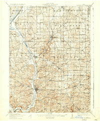
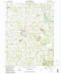
(23)- 1914 Map of Navarre, 1940 Print
 1914 Navarre1940 Print · USGSNortheast Ohio’s industrial and rural landscape is shown here as the coal and rail era reached its peak. Genealogists can trace family roots through dozens of local schools like Frogpond School and follow the angled path of the historic Military Treaty Line.2 unique versions available
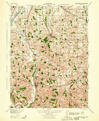
 - 1915 Map of Millersburg, 1935 Print
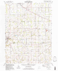
 1915 Millersburg1935 Print · USGSHolmes County and southern Wayne County appear here during the early twentieth century, showing a landscape defined by small farming hamlets and a dense network of country schools. Genealogists can trace family footprints near Millersburg or locate landmarks like the GREENVILLE TREATY LINE, Mount Hope, and the Indian Trail.2 unique versions available
 - 1943 Map of Millersburg
 1943 Millersburg1943 Print · USGSHolmes County and southern Wayne County are shown in the 1940s as a landscape of small farms and rail-connected villages. Genealogists can locate numerous local institutions like Hazeldell Sch, follow the Pennsylvania RR through Millersburg, or find early Oil Wells.
 - 1944 Map of Navarre
 1944 Navarre1944 Print · USGSDuring the mid-1940s, this portion of East Central Ohio was a thriving network of rail-towns and coal mines. Researchers can trace the Treaty Line, locate dozens of rural schoolhouses like Brush College Sch, and see the footprint of Brewster and Sugar Creek.
 - 1951 Map of Canton
 1951 Canton1951 Print · USGSThe industrial heartland of Ohio and Pennsylvania reached its mid-century peak during this era of heavy rail and river transit. Genealogists and historians can trace the development of steel towns like Aliquippa and Weirton alongside the Ohio River and major lines of the Pennsylvania RR.
 - 1953 Map of Canton
 1953 Canton1953 Print · USGSThe industrial heartland of Ohio and Pennsylvania is captured at its mid-century peak in this detailed regional survey. Genealogists and historians can trace the vast rail networks of the Pennsylvania RR and find local landmarks like Nimisila Reservoir and Tappan Reservoir.
 - 1957 Map of Canton, 1971 Print
 1957 Canton1971 Print · USGSThe industrial heartland of eastern Ohio and western Pennsylvania comes alive in this mid-century survey of the Ohio River Valley. Trace the heritage of rail and river commerce through Pittsburgh, the massive steel towns along the Ohio River, and major junctions on the Pennsylvania RR.3 unique versions available
 - 1961 Map of Fredericksburg, 1963 Print
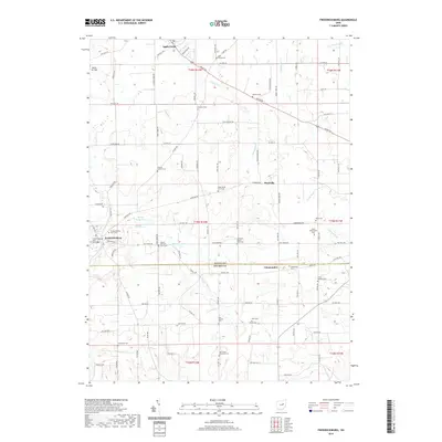
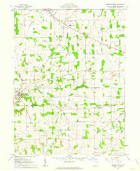 1961 Fredericksburg1963 Print · USGSThe rural landscapes of Wayne and Holmes counties are captured here in the early sixties, showing a dense network of country roads and farmsteads. Genealogists can locate family landmarks like Maysville Ch, Waynedale Sch, and the quiet hamlet of Calamoutier.2 unique versions available
 - 1961 Map of Wilmot, 1963 Print
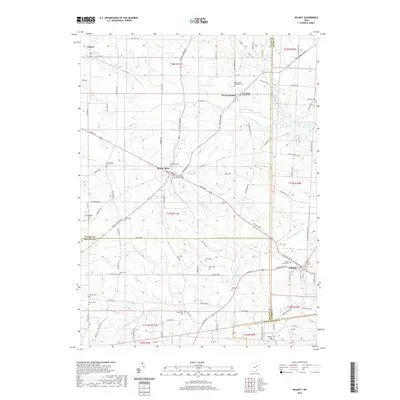
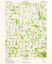 1961 Wilmot1963 Print · USGSThe intersection of Wayne, Stark, and Holmes counties comes into focus during the early 1960s, showing a landscape defined by family farming and rural industry. Genealogists can trace family names through several burial grounds like Hershberger Cem and Weaver Cem, or locate local landmarks like the Treaty Line.3 unique versions available
 - 1962 Map of Canton
 1962 Canton1962 Print · USGSThe industrial heartland of Eastern Ohio and Western Pennsylvania thrives in the early sixties as steel mills and rail lines dominate the river valleys. Genealogists and historians can trace local landmarks like McKinley National Memorial, Malone College, and industrial sites such as Republic Steel Corp.2 unique versions available
 - 1986 Map of Canton
 1986 Canton1986 Print · USGSNortheastern Ohio’s industrial corridor and rural heartland are captured here in the mid-1980s as the region's rail and highway networks reached their modern form. Researchers can trace the layout of Canton and Massillon, locate family sites near West Lawn Cemetery, or explore the grounds of Malone College and Walsh College.2 unique versions available
 - 1994 Map of Wilmot, 1998 Print
 1994 Wilmot1998 Print · USGSThe rural crossroads of Wayne, Stark, and Holmes counties are captured here in the late twentieth century. Genealogists and local historians can trace family-named sites like Hershberger Cem, Beidler Sch, and the settlements of Mount Eaton and Wilmot.
 - 1994 Map of Fredricksburg, 1998 Print
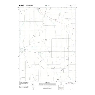
 1994 Fredricksburg1998 Print · USGSWayne and Holmes counties appear in the mid-1990s, showcasing a landscape of small townships and rural school districts. Genealogists can trace family landmarks and community hubs like Fredericksburg, Calamoutier, and the Dublin Sch.
 - 2010 Map of Wilmot, 2010 Print
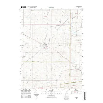
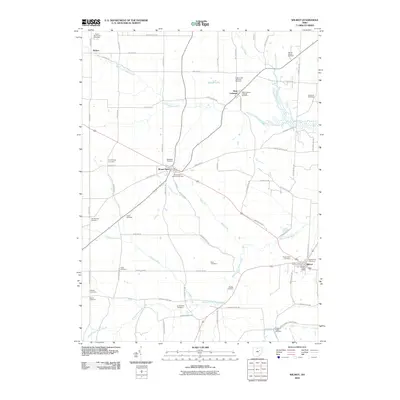 2010 Wilmot2010 Print · USGSCovers Paint Township, including Wilmot, Mount Eaton, and other nearby areas
 - 2010 Map of Fredericksburg, 2010 Print
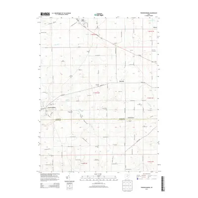
 2010 Fredericksburg2010 Print · USGSCovers Paint Township, including Apple Creek, Fredericksburg, and other nearby areas
 - 2013 Map of Wilmot, 2013 Print
 2013 Wilmot2013 Print · USGSCovers Paint Township, including Wilmot, Mount Eaton, and other nearby areas
 - 2013 Map of Fredericksburg, 2013 Print
 2013 Fredericksburg2013 Print · USGSCovers Paint Township, including Apple Creek, Fredericksburg, and other nearby areas
 - 2016 Map of Fredericksburg, 2016 Print
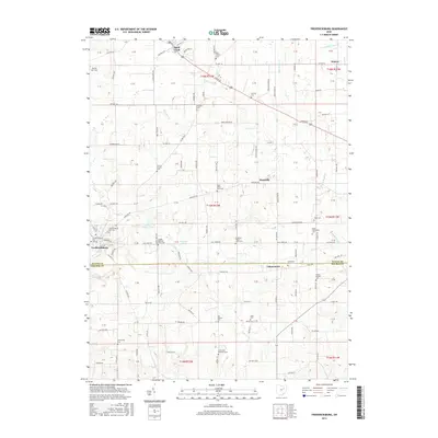 2016 Fredericksburg2016 Print · USGSCovers Paint Township, including Apple Creek, Fredericksburg, and other nearby areas
 - 2016 Map of Wilmot, 2016 Print
 2016 Wilmot2016 Print · USGSCovers Paint Township, including Wilmot, Mount Eaton, and other nearby areas
 - 2019 Map of Wilmot, 2019 Print
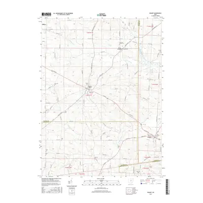
 2019 Wilmot2019 Print · USGSCovers Paint Township, including Wilmot, Mount Eaton, and other nearby areas
 - 2019 Map of Fredericksburg, 2019 Print
 2019 Fredericksburg2019 Print · USGSCovers Paint Township, including Apple Creek, Fredericksburg, and other nearby areas
 - 2023 Map of Fredericksburg, 2023 Print
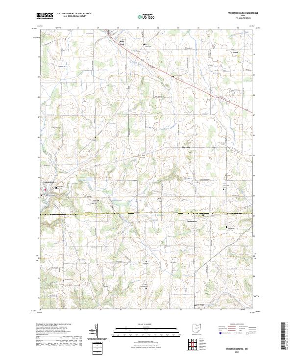 2023 Fredericksburg2023 Print · USGSWayne and Holmes counties are captured here in the early twenty-first century, showcasing the rural heart of Ohio. Genealogists and local historians can trace family land and heritage through numerous burial sites like the Bott Family Cem, Slutz Cem, and Traceys Corners Cem.
 - 2023 Map of Wilmot, 2023 Print
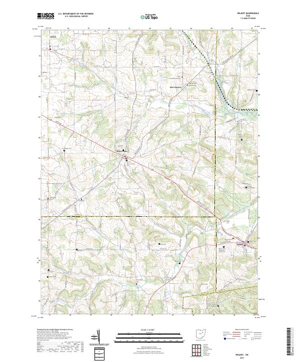 2023 Wilmot2023 Print · USGSThe intersection of four Ohio counties comes into focus in this contemporary survey of the rural landscape near Wilmot and Mount Eaton. Genealogists can trace numerous local burial sites including Keim Cem, Hershberger Cem, and Yoder Cem.
End of results
Showing maps 1-23 of 23
Top cities near Paint Township
- Massillon historical maps
- Green historical maps
- Wooster historical maps
- New Philadelphia historical maps
- New Franklin historical maps
- Dover historical maps
See more
Top neighborhoods of Paint Township
Frequently asked questions
- What are the different types of historical maps available for Paint Township?
- What is the oldest map of Paint Township?
- Where can I purchase historical maps of Paint Township for my home or office?
- Where can I download high-res historical maps of Paint Township?
- Are there historical topographic maps available for Paint Township?
- Is there historical aerial imagery available for Paint Township?
- Where are historical maps of Paint Township sourced from?