2020s Maps of Edgerton, St. Joseph Township
Explore 2 historic maps of Edgerton from the 2020s. These maps offer a rare glimpse into what life looked like during the 2020s — showing old roads, neighborhoods, homes, and landmarks that have changed or disappeared over time.
Whether you're researching your family's past, planning a metal detecting trip, or studying how Edgerton's landscape evolved across the 2020s, these high-resolution maps are a powerful tool for exploring the history of this region.
- Focus on a specific era: All maps on this page are from the 2020s, giving you a focused view of this time period.
- See what’s changed: Compare century-old streets, trails, and buildings to today's modern landscape using overlays and satellite layers.
- Research with precision: Use these maps for genealogy, historical research, land use analysis, or educational projects.
- View, download, or print: Maps are fully viewable online in high resolution, and can be downloaded or printed for your own records.
Start exploring Edgerton's history through authentic maps from the 2020s. This is your window into the past.
Edgerton, St. Joseph Township maps
(2)- 2022 Map of Butler East, 2022 Print
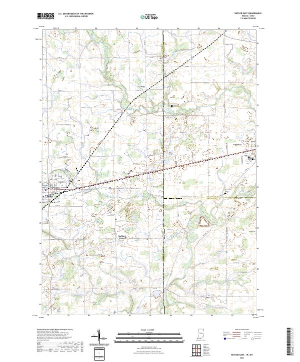 2022 Butler East2022 Print · USGSThe Indiana-Ohio borderlands come into focus in this contemporary survey of DeKalb and Williams Counties. Genealogists and local historians can trace the rural landscape between Edgerton and Butler, locating family sites near Saint Marys Cem and Ladd Lake.
 - 2023 Map of Edgerton, 2023 Print
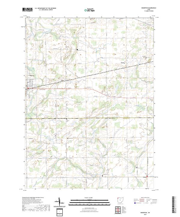 2023 Edgerton2023 Print · USGSThe rural landscapes of Williams and Defiance Counties come alive in this survey of agricultural hamlets and river valleys. Researchers can trace family history through numerous burial sites like Tamarack Cem and Farmer Cem near the banks of the Saint Joseph River.
End of results
Showing maps 1-2 of 2
Top cities near Edgerton
- Bryan historical maps
- Angola historical maps
- Montpelier historical maps
- Hicksville historical maps
- Butler historical maps
- Bridgewater Center historical maps
See more
Frequently asked questions
- What are the different types of historical maps available for Edgerton?
- What is the oldest map of Edgerton?
- Where can I purchase historical maps of Edgerton for my home or office?
- Where can I download high-res historical maps of Edgerton?
- Are there historical topographic maps available for Edgerton?
- Is there historical aerial imagery available for Edgerton?
- Where are historical maps of Edgerton sourced from?