Old Maps of Broken Arrow, Oklahoma for Hiking & Exploration
Hike through history with 19 historic maps of Broken Arrow. Explore old trails, ghost towns, and forgotten backroads — perfect for outdoor adventurers and local explorers.
- Rediscover forgotten places: Map out old mining camps, roads, and footpaths that no longer exist on modern maps.
- Layer with modern tools: Combine with LiDAR or satellite views to plan hikes through historical terrain.
- Made for exploration: Popular among hikers, overlanders, and local history lovers.
Use these maps to find adventure and explore the hidden past of Broken Arrow.
Broken Arrow, OK maps
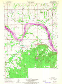
(19)- 1896 Map of Okmulgee, 1954 Print
 1896 Okmulgee1954 Print · USGSCovers Broken Arrow, including Tulsa, Bixby, and other nearby areas
 - 1900 Map of Okmulgee
 1900 Okmulgee1900 Print · USGSCovers Broken Arrow, including Tulsa, Bixby, and other nearby areas4 unique versions available
 - 1901 Map of Claremore
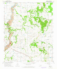
 1901 Claremore1901 Print · USGSCovers Broken Arrow, including Tulsa, Owasso, and other nearby areas4 unique versions available
 - 1914 Map of Claremore, 1959 Print
 1914 Claremore1959 Print · USGSCovers Broken Arrow, including Tulsa, Owasso, and other nearby areas
 - 1916 Map of Claremore
 1916 Claremore1916 Print · USGSCovers Broken Arrow, including Tulsa, Owasso, and other nearby areas4 unique versions available
 - 1946 Map of Fort Smith
 1946 Fort Smith1946 Print · USGSCovers Broken Arrow, including Tulsa, Fayetteville, and other nearby areas
 - 1954 Map of Tulsa
 1954 Tulsa1954 Print · USGSCovers Broken Arrow, including Tulsa, Fayetteville, and other nearby areas2 unique versions available
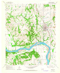
 - 1955 Map of Broken Arrow, 1956 Print
 1955 Broken Arrow1956 Print · USGSCovers Broken Arrow, including Tulsa, Bixby, and other nearby areas5 unique versions available
 - 1957 Map of Leonard, 1968 Print
 1957 Leonard1968 Print · USGSCovers Broken Arrow, including Bixby, Coweta, and other nearby areas3 unique versions available
 - 1958 Map of Tulsa, 1968 Print
 1958 Tulsa1968 Print · USGSCovers Broken Arrow, including Tulsa, Fayetteville, and other nearby areas3 unique versions available
 - 1963 Map of Tulsa
 1963 Tulsa1963 Print · USGSCovers Broken Arrow, including Tulsa, Fayetteville, and other nearby areas
 - 1963 Map of Coweta, 1964 Print
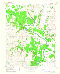
 1963 Coweta1964 Print · USGSCovers Broken Arrow, including Coweta, Stonebluff, and other nearby areas2 unique versions available
 - 1963 Map of Oneta, 1964 Print
 1963 Oneta1964 Print · USGSCovers Broken Arrow, including Tulsa, Coweta, and other nearby areas3 unique versions available
 - 1963 Map of Catoosa SE, 1964 Print
 1963 Catoosa SE1964 Print · USGSCovers Broken Arrow, including Inola, Rogers County, and other nearby areas4 unique versions available
 - 1965 Map of Fort Smith
 1965 Fort Smith1965 Print · USGSCovers Broken Arrow, including Tulsa, Fayetteville, and other nearby areas
 - 1967 Map of Fort Smith
 1967 Fort Smith1967 Print · USGSCovers Broken Arrow, including Tulsa, Fayetteville, and other nearby areas
 - 1978 Map of Muskogee, 1979 Print
 1978 Muskogee1979 Print · USGSCovers Broken Arrow, including Tulsa, Muskogee, and other nearby areas
 - 1978 Map of Fort Smith, 1979 Print
 1978 Fort Smith1979 Print · USGSCovers Broken Arrow, including Tulsa, Fayetteville, and other nearby areas2 unique versions available
 - 1985 Map of Tulsa
 1985 Tulsa1985 Print · USGSCovers Broken Arrow, including Tulsa, Owasso, and other nearby areas2 unique versions available
End of results
Showing maps 1-19 of 19
Frequently asked questions
- What are the different types of historical maps available for Broken Arrow?
- What is the oldest map of Broken Arrow?
- Where can I purchase historical maps of Broken Arrow for my home or office?
- Where can I download high-res historical maps of Broken Arrow?
- Are there historical topographic maps available for Broken Arrow?
- Is there historical aerial imagery available for Broken Arrow?
- Where are historical maps of Broken Arrow sourced from?