Old Maps of Broken Arrow, Oklahoma for Metal Detecting
Plan your next treasure hunt with 19 historic maps of Broken Arrow. Find old homesites, ghost towns, trails, and gathering spots that may be lost to time — perfect for identifying promising metal detecting locations.
- Locate forgotten sites: Uncover places like long-lost settlements, abandoned rail lines, or gathering spots.
- Plan better hunts: Use map overlays combined with LiDAR or satellite views to narrow in on historically rich areas.
- Made for detectorists: Thousands of hobbyists use these maps to discover relics, coins, and hidden history.
Use these historic maps to boost your research and find new opportunities beneath the surface of Broken Arrow.
Broken Arrow, OK maps
(19)- 1896 Map of Okmulgee, 1954 Print
 1896 Okmulgee1954 Print · USGSCovers Broken Arrow, including Tulsa, Bixby, and other nearby areas
 - 1900 Map of Okmulgee
 1900 Okmulgee1900 Print · USGSCovers Broken Arrow, including Tulsa, Bixby, and other nearby areas4 unique versions available
 - 1901 Map of Claremore
 1901 Claremore1901 Print · USGSCovers Broken Arrow, including Tulsa, Owasso, and other nearby areas4 unique versions available
 - 1914 Map of Claremore, 1959 Print
 1914 Claremore1959 Print · USGSCovers Broken Arrow, including Tulsa, Owasso, and other nearby areas
 - 1916 Map of Claremore
 1916 Claremore1916 Print · USGSCovers Broken Arrow, including Tulsa, Owasso, and other nearby areas4 unique versions available
 - 1946 Map of Fort Smith
 1946 Fort Smith1946 Print · USGSCovers Broken Arrow, including Tulsa, Fayetteville, and other nearby areas
 - 1954 Map of Tulsa
 1954 Tulsa1954 Print · USGSCovers Broken Arrow, including Tulsa, Fayetteville, and other nearby areas2 unique versions available
 - 1955 Map of Broken Arrow, 1956 Print
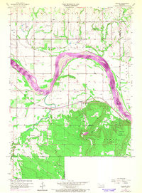
 1955 Broken Arrow1956 Print · USGSCovers Broken Arrow, including Tulsa, Bixby, and other nearby areas5 unique versions available
 - 1957 Map of Leonard, 1968 Print
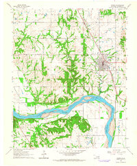
 1957 Leonard1968 Print · USGSCovers Broken Arrow, including Bixby, Coweta, and other nearby areas3 unique versions available
 - 1958 Map of Tulsa, 1968 Print
 1958 Tulsa1968 Print · USGSCovers Broken Arrow, including Tulsa, Fayetteville, and other nearby areas3 unique versions available
 - 1963 Map of Tulsa
 1963 Tulsa1963 Print · USGSCovers Broken Arrow, including Tulsa, Fayetteville, and other nearby areas
 - 1963 Map of Coweta, 1964 Print
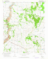
 1963 Coweta1964 Print · USGSCovers Broken Arrow, including Coweta, Stonebluff, and other nearby areas2 unique versions available
 - 1963 Map of Oneta, 1964 Print
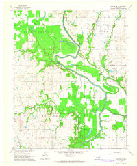
 1963 Oneta1964 Print · USGSCovers Broken Arrow, including Tulsa, Coweta, and other nearby areas3 unique versions available
 - 1963 Map of Catoosa SE, 1964 Print
 1963 Catoosa SE1964 Print · USGSCovers Broken Arrow, including Inola, Rogers County, and other nearby areas4 unique versions available
 - 1965 Map of Fort Smith
 1965 Fort Smith1965 Print · USGSCovers Broken Arrow, including Tulsa, Fayetteville, and other nearby areas
 - 1967 Map of Fort Smith
 1967 Fort Smith1967 Print · USGSCovers Broken Arrow, including Tulsa, Fayetteville, and other nearby areas
 - 1978 Map of Muskogee, 1979 Print
 1978 Muskogee1979 Print · USGSCovers Broken Arrow, including Tulsa, Muskogee, and other nearby areas
 - 1978 Map of Fort Smith, 1979 Print
 1978 Fort Smith1979 Print · USGSCovers Broken Arrow, including Tulsa, Fayetteville, and other nearby areas2 unique versions available
 - 1985 Map of Tulsa
 1985 Tulsa1985 Print · USGSCovers Broken Arrow, including Tulsa, Owasso, and other nearby areas2 unique versions available
End of results
Showing maps 1-19 of 19
Frequently asked questions
- What are the different types of historical maps available for Broken Arrow?
- What is the oldest map of Broken Arrow?
- Where can I purchase historical maps of Broken Arrow for my home or office?
- Where can I download high-res historical maps of Broken Arrow?
- Are there historical topographic maps available for Broken Arrow?
- Is there historical aerial imagery available for Broken Arrow?
- Where are historical maps of Broken Arrow sourced from?