Old Maps of Washita, Oklahoma for Academic Research
Study the evolution of Washita with 10 high-resolution historic maps. Whether you're teaching, researching, or modeling changes in land use, these maps provide essential visual documentation of urban, environmental, and geographic change.
- Analyze long-term change: Track patterns in development, transportation, and natural features.
- Ideal for environmental or urban studies: Support academic projects with primary historical map data.
- Use in the classroom or lab: Educators and researchers rely on these maps to bring historical context to life.
These maps are a powerful tool for teaching, research, and visualizing how Washita has changed over the decades.
Washita, OK maps
(10)- 1951 Map of Fort Cobb, 1952 Print
 1951 Fort Cobb1952 Print · USGSCaddo County's agricultural and rail-driven landscape is captured here in the early fifties, centered on the Washita River valley. Genealogists and historians can trace the foundations of local life through rural landmarks like St Patricks Indian Mission, Oak Grove Cem, and the Riverside Indian Sch.5 unique versions available
 - 1955 Map of Clinton, 1964 Print
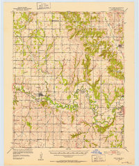
 1955 Clinton1964 Print · USGSWestern Oklahoma during the mid-century transition shows a landscape of growing reservoirs and active military flight lines. Genealogists and historians can locate rural landmarks such as Mountain View Church, Berlin School, and the Riverside Indian School Reserve.3 unique versions available
 - 1957 Map of Clinton
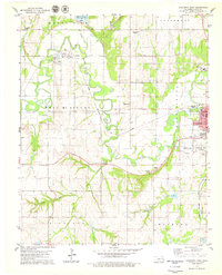
 1957 Clinton1957 Print · USGSWestern Oklahoma in the mid-fifties is captured here as a landscape of river-valley settlements and emerging energy fields. Genealogists can trace family roots through numerous rural landmarks like the Swapping Back Indian School, Hebron Church, and the Riverside Indian School Reserve.
 - 1979 Map of Anadarko West
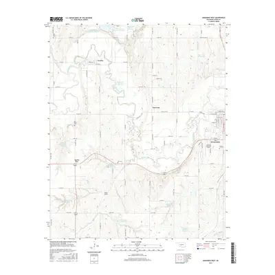
 1979 Anadarko West1979 Print · USGSCaddo County during the late seventies shows a landscape defined by the winding Washita River and the expanding western outskirts of Anadarko. Genealogists and local historians can trace rural roots through Red Stone Ch, the Riverside Indian Sch, and Ware Cem.2 unique versions available
 - 1986 Map of Anadarko
 1986 Anadarko1986 Print · USGSThe Oklahoma plains around Anadarko are captured in the mid-1980s, showing the intersection of rail history and tribal heritage. Genealogists and historians can trace the Indian Treaty Boundary or locate old rail stops along the Burlington Northern Railroad and Atchison, Topeka and Santa Fe Railway.2 unique versions available
 - 2009 Map of Anadarko West, 2009 Print
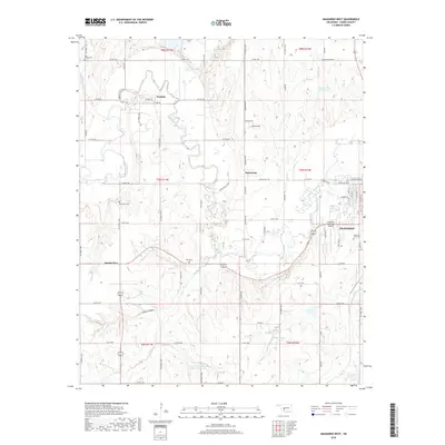
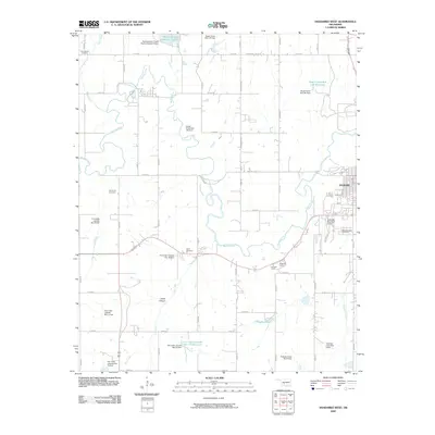 2009 Anadarko West2009 Print · USGSCovers Washita, including Anadarko, Apache Wye, and other nearby areas
 - 2012 Map of Anadarko West, 2012 Print
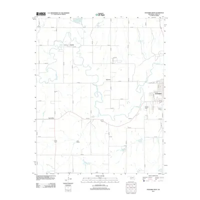 2012 Anadarko West2012 Print · USGSCovers Washita, including Anadarko, Apache Wye, and other nearby areas
 - 2016 Map of Anadarko West, 2016 Print
 2016 Anadarko West2016 Print · USGSCovers Washita, including Anadarko, Apache Wye, and other nearby areas
 - 2018 Map of Anadarko West, 2018 Print
 2018 Anadarko West2018 Print · USGSCovers Washita, including Anadarko, Apache Wye, and other nearby areas
 - 2022 Map of Anadarko West, 2022 Print
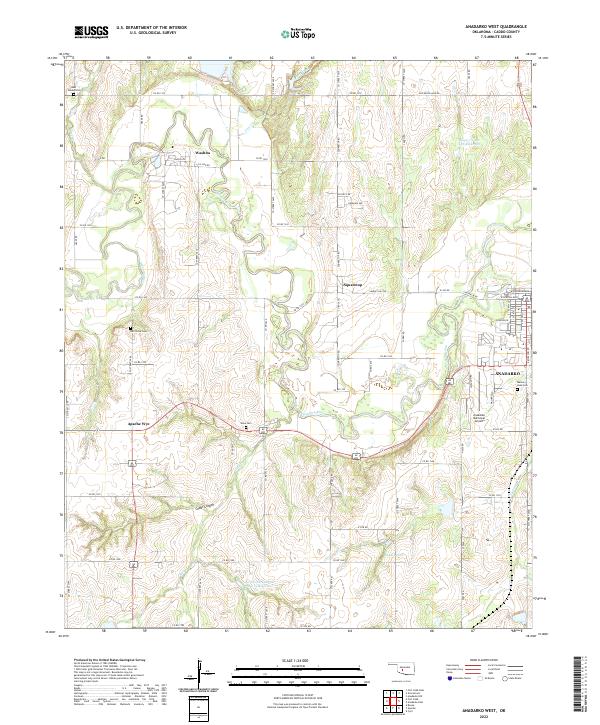 2022 Anadarko West2022 Print · USGSCaddo County in the early twenty-first century reveals a landscape defined by the winding Washita River and its rural outposts. Genealogists can trace family connections at Red Stone Cem or Ware Cem and locate landmarks like Apache Wye.
End of results
Showing maps 1-10 of 10
Top cities near Washita
- Anadarko historical maps
- Carnegie historical maps
- Apache historical maps
- Cyril historical maps
- Fort Cobb historical maps
- Cement historical maps
See more
Frequently asked questions
- What are the different types of historical maps available for Washita?
- What is the oldest map of Washita?
- Where can I purchase historical maps of Washita for my home or office?
- Where can I download high-res historical maps of Washita?
- Are there historical topographic maps available for Washita?
- Is there historical aerial imagery available for Washita?
- Where are historical maps of Washita sourced from?