2020s Maps of El Reno, Oklahoma
Explore 7 historic maps of El Reno from the 2020s. These maps offer a rare glimpse into what life looked like during the 2020s — showing old roads, neighborhoods, homes, and landmarks that have changed or disappeared over time.
Whether you're researching your family's past, planning a metal detecting trip, or studying how El Reno's landscape evolved across the 2020s, these high-resolution maps are a powerful tool for exploring the history of this region.
- Focus on a specific era: All maps on this page are from the 2020s, giving you a focused view of this time period.
- See what’s changed: Compare century-old streets, trails, and buildings to today's modern landscape using overlays and satellite layers.
- Research with precision: Use these maps for genealogy, historical research, land use analysis, or educational projects.
- View, download, or print: Maps are fully viewable online in high resolution, and can be downloaded or printed for your own records.
Start exploring El Reno's history through authentic maps from the 2020s. This is your window into the past.
El Reno, OK maps
(7)- 2022 Map of Richland, 2022 Print
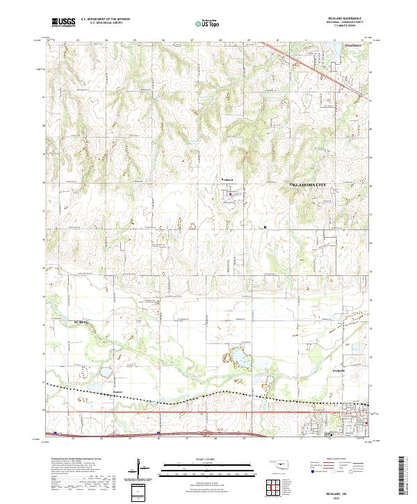 2022 Richland2022 Print · USGSCanadian County at the dawn of the 2020s shows a landscape of steady growth where quiet farming towns meet expanding city limits. Researchers can trace the rural roots of Richland and Banner, or locate historic sites like Frisco Cem and Yukon Cem.
 - 2022 Map of Union City, 2022 Print
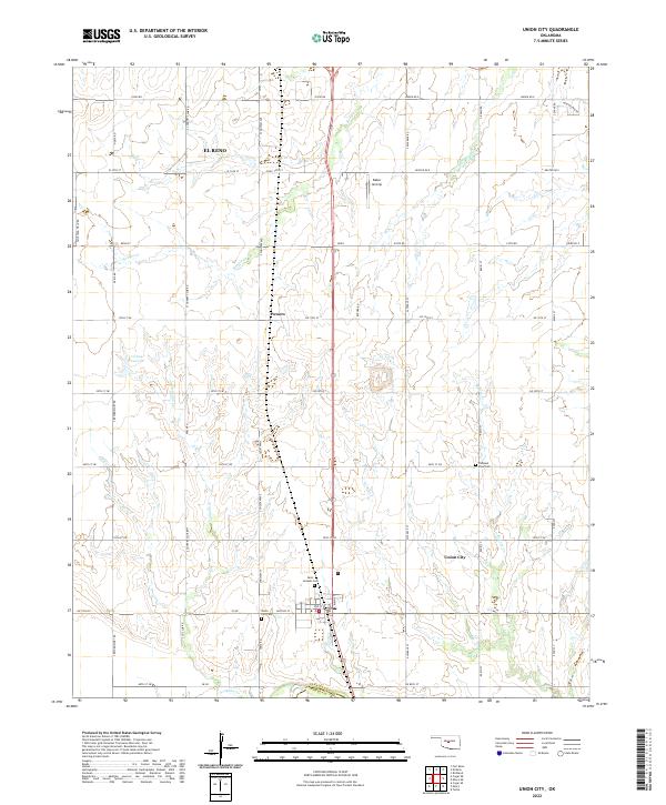 2022 Union City2022 Print · USGSUnion City and its surrounding Canadian County ranchlands are captured here in the early twenty-twenties. Researchers can trace family history at the Union City Cem, Saint Josephs Cem, and the small settlement of Powers.
 - 2022 Map of Okarche, 2022 Print
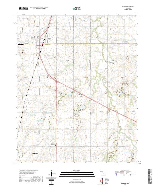 2022 Okarche2022 Print · USGSOkarche sits on the county line in the early 2020s, anchoring a landscape of family-named cemeteries and modern water management. Genealogists can trace sites like Holy Trinity Cem and Beecham Cem while following the path of Uncle Johns Cr.
 - 2022 Map of Fort Reno NE, 2022 Print
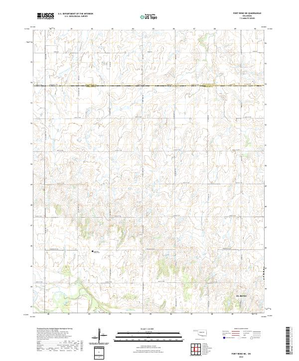 2022 Fort Reno NE2022 Print · USGSThe rural agricultural border between Canadian and Kingfisher counties is captured here just north of the N Canadian River. Researchers can locate the Canadian Valley Cem and follow the path of Winter Camp Cr through the rolling prairie.
 - 2022 Map of El Reno, 2022 Print
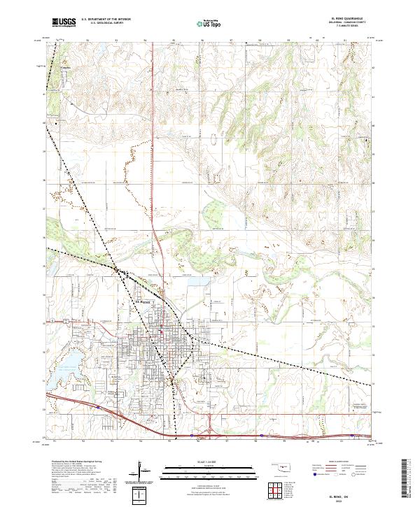 2022 El Reno2022 Print · USGSEl Reno and the surrounding Canadian County landscape are shown in the early 2020s, highlighting the intersection of rail history and modern infrastructure. Researchers can locate family plots at El Reno Cem or trace the path of the N Canadian River near Concho.
 - 2022 Map of Fort Reno, 2022 Print
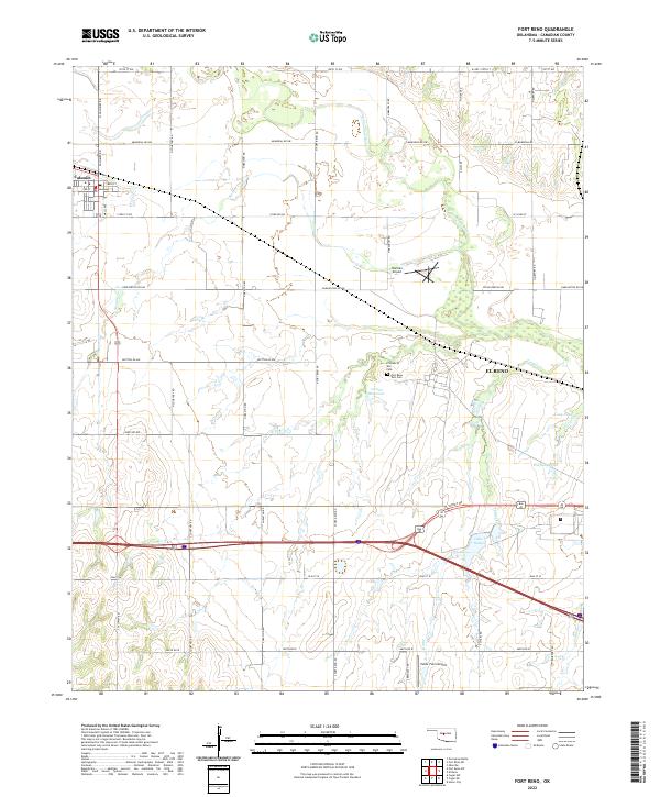 2022 Fort Reno2022 Print · USGSCanadian County's transition from historic military outpost to modern agricultural hub is visible in this contemporary Oklahoma survey. Researchers can trace the legacy of Fort Reno through the Prisoner of War Cemetery and Fort Reno Post Cemetery near El Reno.
 - 2022 Map of Cogar NE, 2022 Print
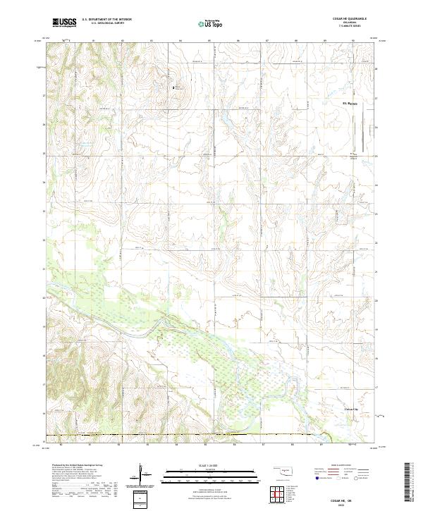 2022 Cogar NE2022 Print · USGSCanadian County at the start of the 2020s shows a landscape of deep river bottoms and prairie section lines. Genealogists and local historians can trace family roots near Buena Vista Cem or follow the banks of the Canadian River toward Union City.
End of results
Showing maps 1-7 of 7
Top cities near El Reno
- Oklahoma City historical maps
- Yukon historical maps
- Mustang historical maps
- Piedmont historical maps
- Tuttle historical maps
- Minco historical maps
See more
Top neighborhoods of El Reno
Frequently asked questions
- What are the different types of historical maps available for El Reno?
- What is the oldest map of El Reno?
- Where can I purchase historical maps of El Reno for my home or office?
- Where can I download high-res historical maps of El Reno?
- Are there historical topographic maps available for El Reno?
- Is there historical aerial imagery available for El Reno?
- Where are historical maps of El Reno sourced from?